 MapUrbex
Learn how to choose an urbex map with GPS coordinates by comparing accuracy, verification, coverage, filters, safety notes, and free vs paid options.
Urbex Map with GPS Coordinates: How to Choose the Right One
Choosing an urbex map with GPS coordinates is not just about finding more places. It is about finding information that is precise, recent, and usable in the real world.
A good map saves research time, improves route planning, and helps you avoid outdated or low-value spots. A bad map does the opposite: it creates confusion, wastes travel time, and can push users toward unsafe decisions.
This guide explains how to compare a carte-like urbex database, what GPS accuracy really means, and which features matter most if you want a reliable urbex map.
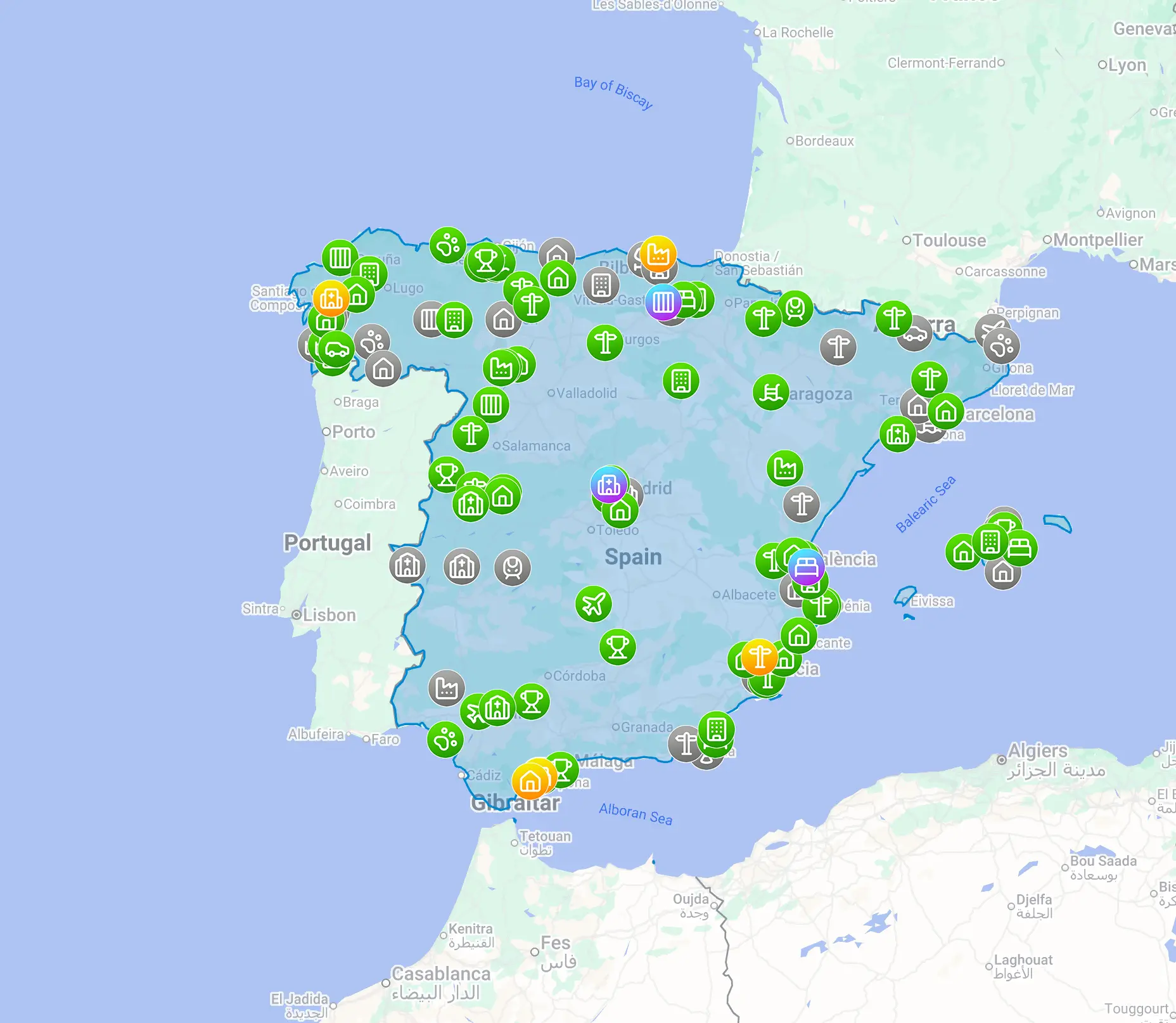
What is the best urbex map with GPS coordinates?
The best urbex map with GPS coordinates is a curated map that combines precise location data, recent verification, clear filtering, and responsible safety context. In practice, accuracy alone is not enough. The right map should help you identify relevant spots quickly, understand whether information is current, and plan visits without encouraging trespassing or risky behavior.
Quick summary
- Choose a map that shows verified and recently updated locations, not just a large number of pins.
- Good urbex GPS coordinates should be precise enough for planning, but paired with status notes and context.
- Filters by place type, region, and condition make an urbex map more useful than raw coordinate lists.
- Coverage quality matters more than volume. A smaller curated map is often better than a messy global directory.
- Free maps are useful for testing workflow, but paid maps may offer stronger curation and better updates.
- Responsible urbex always comes first: check local law, respect property, and never force entry.
Quick facts
- Primary use case: planning and comparing abandoned places efficiently
- Most important trust signal: recent verification date or update history
- Most useful feature for beginners: filters plus concise notes on access context
- Biggest mistake: choosing a map only because it has many spots
- Best long-term value: curated coverage with clear GPS spots and regular maintenance
- Safety rule: coordinates never replace legal checks or on-site judgment
Why does an urbex map with GPS coordinates matter?
An urbex map with GPS coordinates matters because exploration planning depends on precision. If a location is vague, duplicated, or outdated, the map becomes little more than inspiration.
Reliable coordinates reduce search friction. They help you compare travel distance, cluster nearby spots, and decide whether a trip is realistic. That is especially useful when you are planning in unfamiliar regions.
The map is also part of risk management. Clear notes on status, location type, and update quality help users avoid abandoned listings that are demolished, converted, or no longer relevant.
Which criteria show that an urbex map is reliable?
A reliable urbex map shows three things clearly: where the spot is, how recently it was checked, and why the listing is worth keeping. If one of those elements is missing, trust drops quickly.
The table below shows the main criteria to compare when you choose an urbex map.
| Criterion | What to check | Why it matters |
|---|---|---|
| GPS precision | Exact or near-exact coordinates, not vague area markers | Saves time and reduces navigation guesswork |
| Verification | Recent review, community confirmation, or editorial curation | Reduces outdated listings |
| Spot status | Notes on closure, demolition, reuse, or condition | Helps you avoid wasted trips |
| Filters | Country, region, category, popularity, difficulty, condition | Makes large databases usable |
| Map design | Clear interface on desktop and mobile | Improves planning in the field |
| Safety context | Warnings, legal reminders, preservation-first guidance | Supports responsible urbex |
| Update frequency | Evidence that new data is added and old data is maintained | Keeps the map relevant over time |
A trustworthy map does not just collect places. It explains why those places are still worth attention.
How accurate should urbex GPS coordinates be?
Urbex GPS coordinates should be accurate enough to identify the correct site without creating confusion between neighboring buildings, lots, or entrances. For most users, practical accuracy matters more than technical perfection.
In other words, a map can show exact coordinates and still be low quality if the site description is old. The opposite is also true: a slightly generalized point may remain useful if the listing is well explained and recently checked.
Look for these signs of usable coordinate quality:
- the point matches the actual structure, not just the district
- the listing distinguishes multi-building complexes from single sites
- nearby landmarks or short notes support orientation
- duplicate pins are removed or merged
- changes in site condition are noted
If you are comparing several products, the best test is simple: open ten random spots and see whether the coordinates, category, and notes feel internally consistent.
Which features make an urbex map easier to use?
The most useful features are filters, fast search, concise notes, and a clean interface. These save more time than an oversized list of locations.
A strong map urbex experience usually includes:
- filtering by country, city, or region
- categories such as factory, hospital, villa, military, transport, or religious site
- concise descriptions instead of long, vague storytelling
- visual clustering so dense areas remain readable
- mobile-friendly navigation for trip preparation
- clear distinction between free preview content and full listings
For many users, curation is the hidden feature that matters most. When a map removes duplicates and low-value pins, every search becomes faster.
How should you compare free and paid urbex maps?
You should compare free and paid urbex maps by looking at data quality, not only price. A free urbex map is useful if it lets you test geographic coverage, interface quality, and the general reliability of the listings.
Paid access starts to make sense when it adds one or more of the following:
- deeper regional coverage
- more frequent updates
- stronger editorial verification
- better filtering and discovery tools
- a cleaner, less noisy dataset
A practical approach is to start with Access the free urbex map. Then compare it with Browse all urbex maps to see whether broader or more specialized coverage matches your needs.
Why do coverage and curation matter more than raw volume?
Coverage and curation matter more than raw volume because a map is only useful when the right spots can be found quickly. Ten thousand weak listings are less valuable than one thousand verified ones.
Large databases often suffer from three problems: duplicates, obsolete spots, and inconsistent categories. Curated maps reduce those issues by keeping a tighter standard for inclusion.
That is why serious users often prefer maps that are selective. Good coverage is not just geographic reach. It is the combination of reach, consistency, and maintenance.
How can you use GPS spots responsibly and legally?
Use GPS spots as planning references, not as permission to enter anywhere. Coordinates do not override property law, posted restrictions, or site-specific risks.
Responsible urbex means:
- checking local laws before a visit
- respecting private property and no-entry signage
- never climbing fences, breaking locks, or forcing access
- avoiding vandalism, theft, or removal of objects
- leaving the location unchanged
- reconsidering visits when structural damage, water, chemicals, or security hazards are obvious
MapUrbex follows a preservation-first approach. The goal is to document and organize information, not to encourage illegal entry or destructive behavior.
Where can you compare maps and keep learning?
If you want to compare formats and discover how curated databases work, start with Browse all urbex maps. If you are still learning research methods, read How to Find Abandoned Places Near You.
For city-based examples of how local exploration guides are structured, see Urbex in Lille: Guide to Abandoned Places in and Around the City and Saint-Étienne Urbex Guide: Abandoned Places and Urban Exploration Around the City.
FAQ
What is the difference between an urbex map and a generic map app?
An urbex map is specialized. It groups abandoned or disused locations, adds categorization, and often includes notes, verification signals, or community curation. A generic map app only helps you navigate once you already know where to go.
Are precise coordinates always better?
Not always. Precise coordinates are useful, but they need context. A recently updated listing with clear notes is often more valuable than an exact pin attached to outdated information.
Should beginners rely only on social media for urbex GPS spots?
No. Social media is useful for inspiration, but it is inconsistent as a reference source. Posts are often old, incomplete, or intentionally vague. A curated urbex map is usually better for structured planning.
Can a free urbex map be enough?
Yes, for many users it can. A free map is enough when coverage matches your region and the data quality is solid. The key question is not whether it is free, but whether it is maintained and usable.
How often should an urbex map be updated?
There is no universal schedule, but frequent maintenance matters. The best sign is visible evidence that old spots are reviewed, status changes are reflected, and new listings are added carefully.
Conclusion
Choosing the right urbex map with GPS coordinates is mainly a question of trust. Precision matters, but curation, update quality, and responsible use matter more.
A strong map helps you plan faster, compare regions better, and avoid low-quality listings. Look for verified locations, clear filters, recent maintenance, and a preservation-first approach.
Access the free urbex map
