A practical Saint-Étienne urbex guide covering abandoned places, industrial heritage, key areas around the city, and how to explore responsibly with verified maps.
Saint-Étienne Urbex Guide: Abandoned Places and Urban Exploration Around the City
Saint-Étienne urbex is closely tied to the city's industrial history. Coal mining, metalworking, textiles, logistics, and later closures created a wide range of abandoned buildings across the urban area and the nearby valleys.
For that reason, people searching for abandoned places in Saint-Étienne usually mean more than the city center. They often include former industrial zones around Firminy, Le Chambon-Feugerolles, La Ricamarie, Saint-Chamond, and parts of the wider Loire area.
Where can you do urbex in Saint-Étienne?
You can find Saint-Étienne urbex opportunities mainly in former industrial belts, mining-related buildings, disused warehouses, and scattered abandoned houses around the city and nearby valleys. Exact access changes often, many sites are private or unsafe, and the most reliable approach is to use recent, curated location data rather than outdated forum posts.
Quick summary
- Saint-Étienne is one of the strongest urbex landscapes in central-eastern France because of its mining and industrial legacy.
- The most common abandoned places are factories, workshops, mining structures, warehouses, closed public buildings, and isolated houses.
- The richest surroundings are usually the Ondaine valley, the Gier valley, and the outer ring of the Saint-Étienne urban area.
- Many well-known local names are industrial heritage references, not necessarily active abandoned spots.
- A responsible approach matters here because ownership, structural decay, and surveillance vary widely.
- Verified mapping saves time and reduces the risk of relying on obsolete information.
Quick facts
- Location: Saint-Étienne, Loire department, Auvergne-Rhône-Alpes, France
- Urban profile: former coal, steel, textile, arms, and manufacturing city
- Typical urbex categories: industrial ruins, mining-related buildings, villas, warehouses, rail structures, closed institutions
- Nearby search areas: Firminy, La Ricamarie, Le Chambon-Feugerolles, Saint-Chamond, Rive-de-Gier, Andrézieux-Bouthéon
- Main risks: asbestos, unstable floors, falls, broken glass, private property, active surveillance
- Best method: recent verification, legal caution, and curated maps
Why does Saint-Étienne attract so much urbex interest?
Saint-Étienne attracts so much urbex interest because its economy was built on heavy industry and then reorganized over several decades. That long transition left behind a dense layer of industrial traces, from large workshops to smaller support buildings.
This matters for urban exploration because abandoned places in Saint-Étienne are not limited to one iconic ruin. The city and its surroundings contain many different scales of dereliction: huge production halls, neglected service buildings, mining infrastructure, workers' housing, and rural-edge properties.
The local geography also helps. Saint-Étienne sits within a network of valleys and satellite towns where former industrial functions were spread across multiple communes. As a result, people searching for urbex spots around Saint-Étienne usually explore a wider basin rather than a single neighborhood.
If you want a broader overview, you can Browse all urbex maps or start with the Free Urbex Map 2026.
What kinds of abandoned places can you find in Saint-Étienne and the Loire area?
You can find several recurring categories of abandoned places in Saint-Étienne and the Loire area, with industrial sites clearly dominating. The local urbex landscape is defined less by one famous ruin and more by a repeated pattern of former production, storage, transport, and residential sites.
| Type of place | Why it is common around Saint-Étienne | What explorers usually note |
|---|---|---|
| Former factories and workshops | The city grew through mining, steel, weapons, mechanics, and textiles | Large volumes, machinery remnants, brick or concrete shells |
| Mining-related buildings | The Loire coal basin shaped the whole region | Headframes, technical buildings, baths, offices, ancillary structures |
| Warehouses and logistics sites | Industrial supply chains left many secondary buildings | Loading docks, depots, rail-adjacent structures |
| Villas and small châteaux | Some owners' houses and edge-of-city residences were left vacant | Decorative interiors, staircases, gardens, decay from neglect |
| Closed public buildings | Schools, clinics, offices, and care sites sometimes fell out of use | Partitioned interiors, archives, institutional layouts |
1. Former factories and metalworking workshops
Former factories are the core of Saint-Étienne urbex. This is the most visible legacy of the city's industrial past, especially in the wider urban belt and valley towns connected to metalworking and mechanical production.
These sites vary a lot in scale. Some are vast shells stripped to their structure. Others are smaller workshops, garages, or fragmented industrial courtyards. In practical terms, this means a search for abandoned places in Saint-Étienne often turns into a search for old production landscapes rather than single landmark buildings.
2. Mining ruins and technical service buildings
Mining ruins are a defining part of the Loire urbex identity. Saint-Étienne developed on a coal basin, so even when extraction structures are gone or protected, the territory still contains related buildings such as baths, compressor rooms, offices, stores, and maintenance spaces.
These places are historically important, but they can also be among the most dangerous. Old shafts, unstable ground, hidden voids, and contamination risks make mining-related exploration especially sensitive. Responsible urbex means treating former mining sites as high-risk environments and avoiding any unsafe or restricted entry.
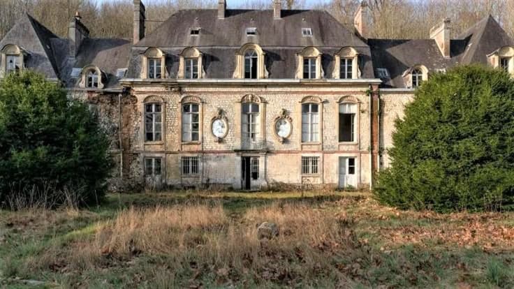
3. Caretakers' houses, managers' villas, and small abandoned châteaux
Not all Saint-Étienne urbex is industrial in appearance. Around the city, especially on the slopes and outer communes, explorers sometimes look for abandoned residences such as caretakers' houses, old bourgeois homes, and small neglected châteaux.
These locations are popular because they preserve domestic traces more clearly than stripped factories. However, they are also often private, visible from the road, and vulnerable to damage. That makes discretion, legality, and preservation especially important.
4. Warehouses, depots, and secondary rail buildings
Warehouses and depots are common around Saint-Étienne because industrial regions require storage, transfer, and transport infrastructure. When production systems shrink or move, these support buildings often become empty before they are demolished or repurposed.
For researchers and photographers, these sites are useful because they reveal how the regional economy worked beyond the main factories. They also tend to be less famous than big industrial ruins, which is why they are frequently under-documented in public searches.
5. Closed schools, clinics, offices, and public facilities
Closed institutional buildings are another recurring category in urban exploration around Saint-Étienne. They include former schools, administrative sites, care buildings, and occasional medical facilities that became obsolete or were moved elsewhere.
These places often attract attention because interiors can remain readable for longer. Corridors, filing systems, signs, and room layouts make them highly legible. At the same time, they usually involve legal sensitivity, remaining ownership, and significant safety issues.
Which areas around Saint-Étienne have the highest density of abandoned sites?
The areas around Saint-Étienne with the highest density of abandoned sites are usually the former industrial corridors rather than the historic center itself. In practice, the most talked-about zones are the Ondaine valley, the Gier valley, and the outer industrial edges of the metropolitan area.
The Ondaine valley is regularly cited because towns such as Firminy, La Ricamarie, and Le Chambon-Feugerolles share a strong industrial and mining inheritance. This creates a broader landscape of disused workshops, storage buildings, worker-related structures, and scattered residential abandonment.
The Gier valley, especially toward Saint-Chamond and Rive-de-Gier, is another key search area. It combines former industry, transport history, and fragmented brownfield zones. For many people, urbex spots around Saint-Étienne actually begin in this corridor.
The outer ring of Saint-Étienne also matters. Peripheral roads, business remnants, hillside properties, and former service buildings can produce smaller but frequent finds. Toward the wider Loire plain, places near logistics routes or old industrial parcels may also appear, though turnover is often fast.
What names are most often associated with urbex in Saint-Étienne?
The names most often associated with urbex in Saint-Étienne are usually industrial heritage references rather than guaranteed abandoned entries. They help people understand the local landscape, but they should not be confused with current-access site lists.
1. Couriot and the mining memory of Saint-Étienne
Couriot is one of the best-known names in the city because it symbolizes Saint-Étienne's mining identity. It appears constantly in discussions about local heritage and abandoned landscapes.
That does not mean it is an abandoned urbex spot. Instead, it shows how strongly mining shapes the local imagination. Many search queries about abandoned places in Saint-Étienne are really rooted in that memory.
2. Firminy and the industrial edges of the Ondaine valley
Firminy often comes up in Saint-Étienne urbex searches because the town sits within a major industrial corridor. People associate it with factories, worker housing, redevelopment zones, and nearby derelict structures.
The same applies to neighboring communes such as Le Chambon-Feugerolles and La Ricamarie. Together, they form one of the best-known abandoned-industrial belts near Saint-Étienne.
3. Saint-Chamond and the Gier valley
Saint-Chamond is frequently mentioned because the Gier valley preserves a strong industrial footprint. Logistics sites, workshops, and disused buildings have long contributed to its urbex reputation.
For search intent, this matters because many users looking for Saint-Étienne urban exploration actually want the wider metropolitan basin. Saint-Chamond is part of that reality.
4. The former arms and manufacturing landscape
Saint-Étienne is also linked to a long manufacturing tradition, especially arms production and mechanical industries. That history explains why the local abandoned landscape often includes robust industrial architecture.
Some landmark names are heritage sites, active buildings, or redevelopment projects rather than abandoned targets. Responsible guidance always separates historical importance from current access reality.
How can you find urbex spots around Saint-Étienne without wasting time?
You can find urbex spots around Saint-Étienne more efficiently by using curated maps, recent verification, and area-based research instead of chasing old social media posts. The biggest time loss usually comes from outdated coordinates and places that were demolished, secured, or converted.
Start by identifying the right geography. In Saint-Étienne, that means thinking in corridors: the city itself, the Ondaine valley, the Gier valley, and the wider Loire edges. A map-first method is more reliable than searching random keywords one by one.
MapUrbex is designed for that type of research. You can Browse all urbex maps, compare with the Free Urbex Map 2026, and read How to Get the Best Free Urbex Map in 2026?? to understand the difference between raw lists and curated mapping.
If you already work with custom files, How to Import Your .KML File into Google Maps explains a simple workflow for organizing your regional searches.
Access the free urbex map
How should you explore Saint-Étienne responsibly and legally?
You should explore Saint-Étienne responsibly by prioritizing legality, safety, and preservation over access at all costs. In a dense post-industrial region, the main rule is simple: abandoned does not mean accessible.
Private ownership is common. Structural decay is common. Hazards such as asbestos, unstable floors, vertical drops, exposed metal, and active surveillance are also common. A location can look empty and still be dangerous or legally protected.
MapUrbex supports responsible urbex only: no forced entry, no trespassing, no theft, no vandalism, and no publishing of sensitive details that increase damage or illegal access.
A practical checklist helps:
- verify whether the building is publicly accessible or clearly private
- avoid any sign of forced access or security breach
- never enter alone in unstable industrial structures
- treat mining-related environments as high-risk
- leave interiors untouched and avoid geotagging fragile places publicly
- prefer verified, curated references over rumors
FAQ
Where are the best abandoned places in Saint-Étienne?
The most searched abandoned places in Saint-Étienne are usually in former industrial belts rather than the city center. The Ondaine valley, the Gier valley, and the outer urban ring are the areas most often discussed. Exact site relevance changes quickly because closures, demolition, and redevelopment are common.
Is Saint-Étienne a good city for urban exploration?
Yes, Saint-Étienne is one of the more significant urban exploration areas in France because of its industrial and mining history. Its strength is variety rather than one single iconic ruin. The wider basin matters as much as the city itself.
What kinds of urbex sites are most common around Saint-Étienne?
Former factories, workshops, warehouses, mining-related buildings, villas, and closed institutions are the most common types. Industrial architecture dominates the local landscape. Smaller residential or service buildings are also frequent in outer communes.
Are famous local heritage names the same as active urbex spots?
No. In Saint-Étienne, well-known names often refer to industrial heritage, memory, or redeveloped sites rather than accessible abandoned places. That distinction is important for both accuracy and responsible behavior.
How can you organize a Loire urbex search more effectively?
The best method is to work by territory, not by rumor. Build a shortlist by sector, use recent map data, and compare historical industrial corridors. Curated mapping is usually more reliable than scattered posts.
Conclusion
Saint-Étienne urbex stands out because the city sits inside a large post-industrial landscape shaped by mining, manufacturing, transport, and long-term economic change. The result is a broad mix of abandoned places, especially across the valleys and surrounding communes rather than only within the center.
If your goal is to understand where abandoned places in Saint-Étienne are most likely to be found, focus on industrial geography, recent verification, and responsible exploration. That approach is more accurate, safer, and more useful than chasing vague spot lists.
Access the free urbex map