 MapUrbex
Learn the 10 clearest signs of an outdated urbex map, how to verify a spot, and what makes a reliable urbex map worth trusting.
Outdated Urbex Map: 10 Signs the Information Is No Longer Reliable
An outdated urbex map is more than an inconvenience. It can send you to a demolished site, a sealed building, or a place whose legal and safety conditions have changed completely.
In urbex, old information becomes risky information very quickly. A reliable urbex map should show recent verification, clear status labels, and a preservation-first approach rather than hype.
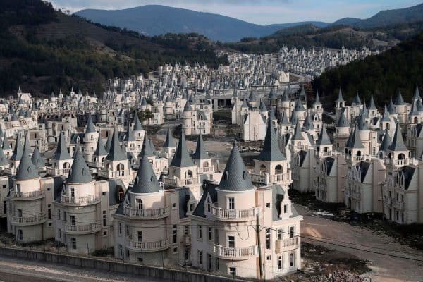
How can you tell an urbex map is outdated?
An outdated urbex map usually shows spots with no recent update date, incorrect status notes, old photos, broken coordinates, or comments reporting demolition, reuse, or sealing. If the map owner does not explain how locations are checked or remove invalid listings, the information should not be treated as reliable.
Quick summary
- A missing update history is one of the strongest signs that a map is outdated.
- Reused, demolished, or sealed places make old urbex data obsolete fast.
- Coordinates, photos, and access notes should match recent reality, not old lore.
- Reliable maps explain verification methods and remove invalid spots.
- You should verify an urbex spot before any trip, and always respect local law and private property.
- Curated maps are usually safer and more useful than scraped directories.
Quick facts
- Main risk: wasted travel, bad coordinates, legal problems, and unsafe assumptions.
- Fastest check: look for a visible last update date and recent status changes.
- Best supporting evidence: current imagery, recent reports, and local news.
- Common status changes: demolition, redevelopment, sealing, security upgrades, and ownership change.
- Trusted map feature: transparent verification and regular cleanup of invalid pins.
What are the 10 clearest signs of an outdated urbex map?
The clearest signs are easy to spot once you know what to check. A map becomes unreliable when the data is old, unverified, or disconnected from current conditions on the ground.
-
There is no visible update date. If you cannot see when a pin, note, or map layer was last reviewed, you cannot judge whether the information is still usable.
-
Comments mention demolition, sealing, or reuse. User reports saying a place is now fenced, converted, occupied, or gone entirely are strong evidence that the listing needs review.
-
Photos no longer match the site. If vegetation, façades, windows, roofs, or surrounding roads look different from current imagery, the listing may be years behind reality.
-
Access notes are vague or copy-pasted. A reliable map should not rely on rumors such as "easy access" or "still open" with no date, no source, and no context.
-
Several pins have inaccurate coordinates. Wrong addresses, misplaced pins, or vague area markers usually indicate weak verification and poor maintenance.
-
The map lists famous places but gives no proof of review. Viral spots change status quickly. If a map still presents them as active without recent checks, treat the entry cautiously.
-
There are no clear status labels. A trustworthy map should distinguish between abandoned, sealed, demolished, reused, visible from public space, and unknown status.
-
Sources are broken or missing. Dead references, deleted posts, or no source trail at all make it hard to confirm whether the information was ever reliable.
-
Safety warnings are generic or absent. Good urbex information should mention obvious hazards and legal limits. No warning at all is often a sign of low editorial quality.
-
Invalid spots never get removed. If a map keeps old listings long after they are known to be gone or inaccessible, the database is not being maintained responsibly.
Why do urbex listings become obsolete so quickly?
Urbex listings become obsolete quickly because abandoned places change fast. Demolition, redevelopment, security upgrades, weather damage, fires, theft, and ownership changes can all alter a location within weeks or months.
This is why old screenshots and recycled lists age badly. A place that was photographable last year may now be sealed, occupied, structurally unsafe, or legally sensitive. The pattern is visible in fast-changing examples such as Abandoned Places That Disappeared in 2025: Demolished, Reused, or Sealed.
How should you verify an urbex spot before planning a visit?
You should verify an urbex spot by checking the latest update date, confirming that the coordinates match current imagery, and looking for recent evidence that the site still exists in the described condition. Verification should reduce uncertainty, not help anyone bypass restrictions.
| Check | What to look for | Why it matters |
|---|---|---|
| Update date | Recent review on the pin or listing | Shows the data was not abandoned years ago |
| Coordinates | Exact match with current satellite view | Prevents travel to the wrong place |
| Current status | Sealed, reused, demolished, unknown | Changes the relevance of the listing |
| Recent reports | Credible recent observations | Helps confirm whether the place still matches the description |
| Legal context | Private property, restricted area, public viewpoint only | Avoids unsafe or unlawful assumptions |
| Safety notes | Structural issues, flooding, collapse risk | Supports responsible planning |
A practical rule is simple: if two or three checks disagree, assume the listing is stale. Do not rely on one old photo set or one forum post. And never use map data as a reason to trespass, force entry, or ignore posted restrictions.
What makes a reliable urbex map more trustworthy?
A reliable urbex map is more trustworthy when it is curated, reviewed, and transparent about uncertainty. Trust comes from process, not from the number of pins.
Look for these features:
- visible update history
- status labels that reflect reality
- removal of invalid or demolished spots
- notes that avoid sensational claims
- preservation-first language
- clear distinction between verified information and unconfirmed reports
MapUrbex is built around verified locations, curated mapping, and responsible urbex practices. If you want a cleaner starting point than random social posts or scraped directories, you can Browse all urbex maps.
For examples of responsible editorial coverage, see Urbex Castles and Abandoned Manors: 12 Places Worth Visiting Responsibly or Urbex Canada: Top 10 Abandoned Places to Explore in Montreal, Quebec, and Beyond.
Frequently asked questions
Can an old urbex pin still be useful?
Yes, but only as a lead, not as proof. An old pin can suggest that a place once existed, but it does not confirm current access, current status, or current safety conditions.
How often should an urbex map be updated?
High-turnover locations should be reviewed often because conditions can change quickly. At minimum, reliable maps should show when a listing was last checked and update or remove invalid spots as changes become known.
Are user comments enough to verify a spot?
No. User comments help, but they are not enough on their own. The best approach combines recent comments with imagery, status notes, and active editorial review.
What is the safest way to check a location?
The safest way is to verify public information, recent status, and legal context before you go. If the status is unclear, treat the spot as uncertain and avoid assumptions.
Should a good urbex map remove demolished places?
Usually yes, or at least mark them clearly as demolished or reused. Leaving dead listings active makes the entire map less reliable.
Conclusion
A stale urbex map usually reveals itself through missing updates, inconsistent coordinates, old imagery, vague notes, and listings that were never cleaned up after major changes. Those are not minor quality issues. They are direct signs that the information may no longer be reliable.
If you want a better standard, choose curated maps that document updates, clarify uncertainty, and support responsible exploration. Good urbex information should help you make informed decisions while respecting law, safety, and preservation.
Access the free urbex map
