 MapUrbex
A practical guide to finding abandoned places with Google Maps faster, verifying real urbex leads, and avoiding outdated or misleading map pins.
How to Find Abandoned Places with Google Maps Without Wasting Hours
Finding abandoned places with Google Maps is possible, but only if you know what signals to look for. Random scrolling rarely works. A faster method is to combine map clues, satellite view, business status, and cross-checking.
For urbex research, Google Maps works best as a filtering tool, not as final proof. It helps you narrow a wide area, spot visual anomalies, and build a shortlist before you verify ownership context, current use, and safety.
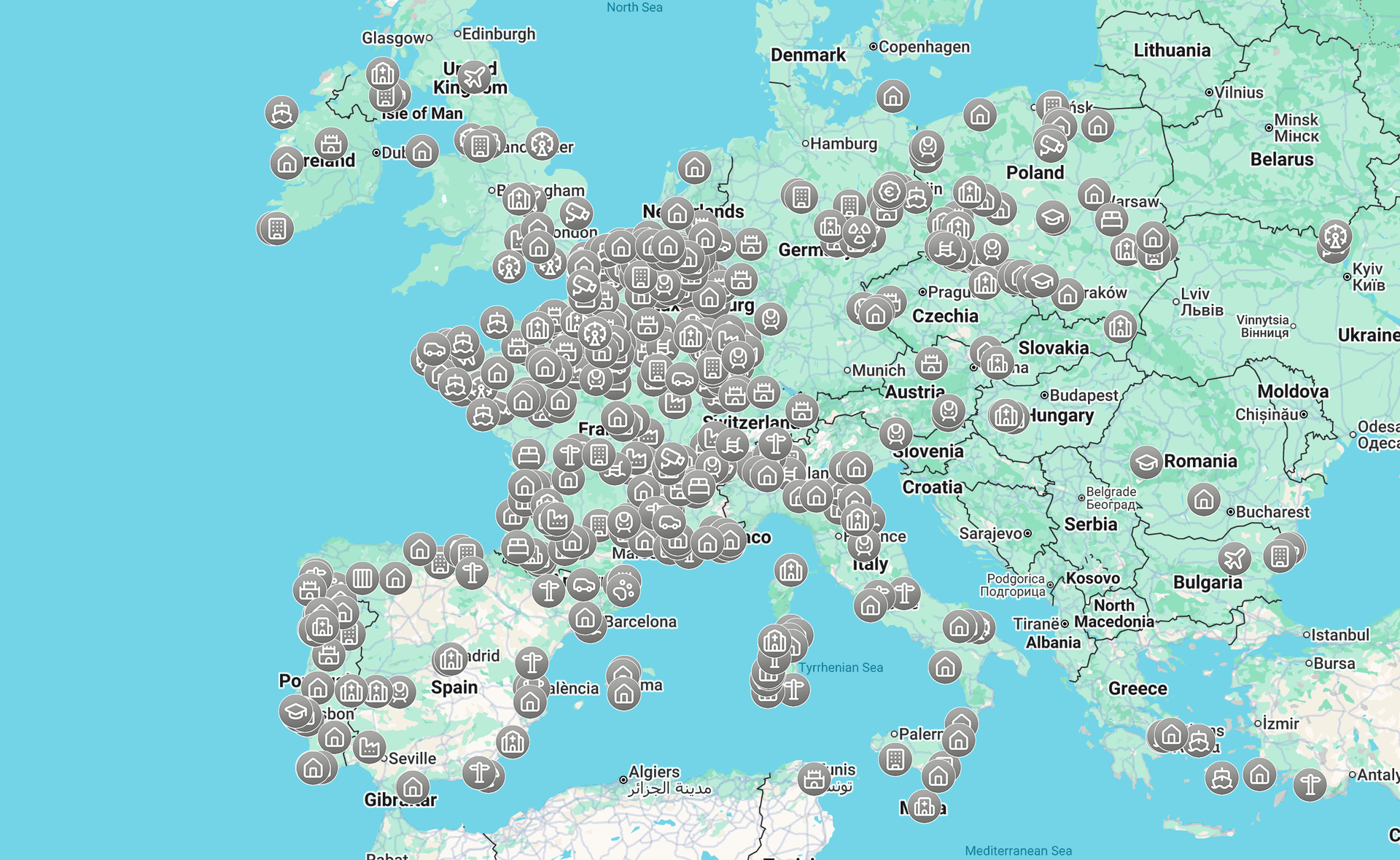
What is the fastest way to find abandoned places with Google Maps?
The fastest way to find abandoned places with Google Maps is to search by likely site category, switch immediately to satellite view, scan for visible neglect, and then verify each candidate with Street View, reviews, and recent web traces. This prevents you from wasting time on buildings that only look unusual from above.
Quick summary
- Start with likely categories such as factories, hospitals, schools, hotels, warehouses, and rail sites.
- Use satellite view first. It reveals roof damage, empty compounds, overgrown roads, and unused parking areas faster than standard map view.
- Treat labels like "permanently closed" as clues, not proof.
- Verify every candidate with Street View, business listings, recent mentions, and local context.
- Use curated resources when you need speed, because many abandoned places are demolished, reused, or sealed over time.
- Always respect local law, private property, and site safety.
Quick facts
- Best use of Google Maps: early-stage filtering
- Weakest signal: one abandoned-looking building with no supporting evidence
- Strongest signal cluster: visible decay + inactive listing + no recent activity
- Best complement to manual research: a verified Browse all urbex maps
- Common time-waster: scanning city centers without target categories
- Legal reminder: finding a place online does not create permission to enter
Which Google Maps clues actually reveal an abandoned place?
The most useful Google Maps clues are visible neglect, inactivity, and contradiction. In practice, an abandoned site often looks physically deteriorated, digitally outdated, and operationally silent at the same time.
Look for these recurring signs:
- Collapsed, patched, or discolored roofs
- Large parking lots that stay empty
- Vegetation taking over service roads, courtyards, or rail spurs
- Former industrial footprints next to inactive infrastructure
- "Permanently closed" labels with no clear reuse
- Street View scenes showing boarded windows, stripped facades, or sealed entrances
A single clue is weak. Several clues that point in the same direction are much more reliable.
| Signal on Google Maps | What it may indicate | Reliability | How to verify |
|---|---|---|---|
| Overgrown access roads | Long-term inactivity | Medium | Check Street View and nearby reviews |
| Empty parking lots | Low or no activity | Medium | Compare with site type and local traffic |
| Roof damage or missing panels | Structural decline | High | Zoom in with satellite view |
| Permanently closed listing | Former business use | Low to medium | Search for recent reuse or ownership updates |
| No recent photos or reviews | Reduced public presence | Low | Cross-check with web mentions |
| Boarded entrances in Street View | Restricted or inactive building | High | Confirm whether the site is sealed, reused, or demolished |
How do you verify a spot before adding it to your urbex shortlist?
You should verify a candidate before saving it because Google Maps often lags behind reality. A place can look abandoned on satellite view and still be reused, guarded, under renovation, or already demolished.
A practical verification checklist looks like this:
- Check satellite view for physical decline.
- Open Street View, if available, and inspect entrances, signage, and fencing.
- Read reviews and public photos in date order.
- Search the place name plus terms like "closed", "demolition", "redevelopment", or local equivalents.
- Check whether the surrounding area is residential, active industrial land, or secured infrastructure.
- Save only spots that show multiple matching signals.
This step matters because abandoned places change fast. Abandoned Places That Disappeared in 2025: Demolished, Reused, or Sealed is a useful reminder that old coordinates should never be treated as permanent truth.
How can you use satellite view to find better urbex spots?
Satellite view is usually the most efficient part of Google Maps urbex research because it lets you scan large areas for neglect patterns that standard labels do not show.
Focus on zones where abandonment is more plausible:
- Former industrial belts
- Railway edges and freight yards
- Rural hospital campuses
- Closed resorts or roadside motels
- Outdated commercial strips
- Port-side warehouses
- Large institutional complexes outside dense centers
Then zoom out and scan for shapes that stand out. Large roofs, empty compounds, cracked service roads, and weed-filled lots are faster to detect from above than by reading labels one by one.
A useful rule is simple: if the surrounding land is active but one property looks frozen in time, it deserves closer review.
What search queries work best for Google Maps urbex research?
The best search queries are category-based, not fantasy-based. Google Maps understands business types and place names better than vague terms like "secret abandoned building."
Try combinations such as:
- abandoned factory
- closed hospital
- former school
- disused railway depot
- old hotel
- industrial site
- mill
- quarry
- airfield
- warehouse district
Search quality improves when you add a region, suburb, town, or road. It also improves when you search in the local language. Terms like "former", "closed", "disused", or local historical labels often surface better results than the word "abandoned" alone.
This is why online urbex research works best as layered research. Search, scan, shortlist, and verify.
When should you stop relying on Google Maps alone?
You should stop relying on Google Maps alone as soon as a spot looks promising. At that point, the main risk is no longer missing a site. The main risk is believing outdated information.
Google Maps does not specialize in urbex verification. It does not tell you whether a site is still documentable from public space, whether it is actively monitored, or whether it has recently been sealed.
That is where curated tools save time. Instead of manually checking hundreds of candidates, you can compare with a verified Access the free urbex map or Browse all urbex maps to narrow your list faster.
Why is a curated urbex map usually faster than manual online research?
A curated urbex map is usually faster because it reduces false positives. You spend less time chasing buildings that are active, demolished, residential, or impossible to document responsibly.
MapUrbex is built for preservation-first research. The goal is not to push reckless exploration. The goal is to help users find real locations more efficiently, with clearer context and better filtering.
That matters if you compare themes and regions. For example, you may want country-specific inspiration such as Urbex Canada: Top 10 Abandoned Places to Explore in Montreal, Quebec, and Beyond or architectural themes such as Urbex Castles and Abandoned Manors: 12 Places Worth Visiting Responsibly.
Access the free urbex map
How do you search for urbex spots responsibly and legally?
Responsible urbex research starts long before any visit. A map pin is not permission. A quiet building is not a safe building. And a public road view does not mean public access beyond that point.
Follow these principles:
- Respect private property and local law.
- Never force entry, bypass barriers, or damage a site.
- Avoid sharing sensitive coordinates publicly.
- Prefer places that can be documented from lawful public access when possible.
- Leave no trace and preserve the site as found.
- Assume conditions may have changed since the last photo or listing.
Good research should reduce wasted time, but it should also reduce harm.
FAQ
Is Google Maps enough to find abandoned places reliably?
No. Google Maps is a strong discovery tool, but not a complete verification tool. It helps you identify candidates, yet you still need to confirm current status, ownership context, and safety signals.
Can I trust a "permanently closed" label?
Not by itself. "Permanently closed" may mean abandoned, relocated, rebranded, under renovation, or simply outdated. Treat it as one clue among several.
Do reviews and user photos help with Google Maps urbex research?
Yes, especially when they are recent. Reviews, dates, and public photos can reveal whether a place is active, fenced, repurposed, or already gone.
Should I share exact coordinates of abandoned places publicly?
Usually no. Public sharing can increase vandalism, theft, and site sealing. Responsible communities prefer selective sharing, verification, and preservation-first behavior.
What types of abandoned places are easiest to find on Google Maps?
Large former industrial sites, hotels, schools, hospitals, and rail properties are usually easier to detect because they leave bigger visual and digital traces than small houses or isolated ruins.
Conclusion
If you want to find abandoned places with Google Maps without losing hours, use it as a screening tool. Search by category, switch quickly to satellite view, look for clusters of neglect, and verify before you save anything.
The biggest time saver is not faster scrolling. It is better filtering. And when you want verified locations instead of endless false leads, a curated urbex map is usually the smarter next step.
Access the free urbex map
