 MapUrbex
A practical guide to using a Brittany urbex map to locate abandoned places, plan routes, and explore with a verified, preservation-first approach.
Brittany Urbex Map: How to Find Abandoned Places in Brittany Responsibly
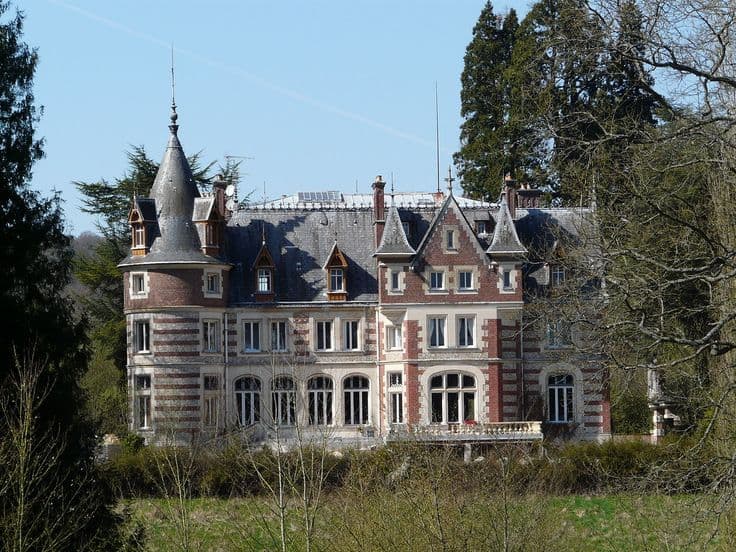
A Brittany urbex map helps you organize abandoned places by area, type, and trip logic. Used well, it saves time and reduces the noise created by outdated pins and vague coordinates.
In Brittany, that matters. The region mixes coastal zones, inland estates, old farm buildings, industrial remnants, and scattered religious or military heritage. Distances can be longer than they look on a phone map, and weather can change quickly.
MapUrbex approaches the topic with a verification-first, preservation-first method. The goal is not reckless access. The goal is to help users identify places, prepare routes, and make better decisions before any visit.
What does a Brittany urbex map show?
A Brittany urbex map shows where abandoned places are distributed across the region and helps users sort them by department, site type, and trip relevance. A good map is not just a cluster of pins. It gives context, reduces duplicate or dead leads, and supports more responsible planning for Brittany urbex spots and abandoned places in Brittany.
Quick summary
- A curated Brittany urbex map is useful for planning, not just browsing.
- Brittany includes very different urbex environments, from rural ruins to coastal structures.
- Verified locations are more reliable than random social media pins or copied coordinates.
- A map pin never means legal access, public entry, or structural safety.
- Weather, tides, travel time, and local visibility all matter in Brittany.
- MapUrbex focuses on verified locations, responsible urbex, and preservation-first mapping.
Quick facts
| Topic | What to know |
|---|---|
| Region covered | Brittany, including Finistère, Cotes-d'Armor, Morbihan, and Ille-et-Vilaine |
| Main use | Finding and organizing abandoned places by area and trip route |
| Common site types | Manor houses, farm ruins, industrial remains, coastal structures, schools, chapels |
| Main planning factors | Distance, weather, tides, daylight, ownership, safety |
| Best practice | Use verified maps, respect property, and never force entry |
| Helpful resources | Browse all urbex maps, Brittany Urbex Map: Hidden Abandoned Places Across Brittany |
Why use a curated Brittany urbex map instead of random pins?
A curated Brittany urbex map is better because it filters noise. Random pins often come from reposted content, outdated coordinates, or places that have already been demolished, secured, or misidentified.
That matters even more in a large region. Brittany has both dense pockets of interest and wide rural gaps. If you rely only on scattered screenshots or social posts, you can waste hours on duplicate leads or inaccessible sites.
A curated map also improves trip structure. Instead of chasing one isolated point, you can group nearby spots, compare departments, and choose a route that makes sense for daylight, parking, and weather.
For a wider national overview, start with Browse all urbex maps. If you want a region-specific overview first, Brittany Urbex Map: Hidden Abandoned Places Across Brittany gives useful context.
Which kinds of abandoned places can you find in Brittany?
Brittany contains a wide range of abandoned place types, but they are unevenly distributed. Rural heritage is common, while industrial and coastal sites tend to be more localized.
Typical categories include:
- abandoned manor houses and estates
- farm buildings and rural ruins
- former schools or institutional buildings
- industrial workshops or depots
- chapels, presbyteries, and religious heritage
- coastal bunkers or maritime-related structures
This variety is one reason why the phrase abandoned places in Brittany covers very different realities. Some sites are isolated and overgrown. Others are visible from roads but highly exposed. Some are structurally fragile even if they look intact from outside.
If you want examples organized as a reading list, Top 50 Abandoned Places in Brittany: Verified Urbex Guide is a strong next step.
How should you plan an urbex trip across Brittany?
You should plan a Brittany urbex trip around geography first, then access conditions. The region is broad, roads can slow down in rural areas, and coastal microclimates can change your day fast.
A practical approach is to build a route by department. Finistère, Cotes-d'Armor, Morbihan, and Ille-et-Vilaine each create different travel patterns. Coastal sectors can look close on the map but take much longer in reality because of road shape, stops, and detours.
Good planning usually includes:
- a primary route and a backup route
- realistic driving times between points
- daylight margins for arrival and exit
- weather checks, especially wind and rain
- local sensitivity around villages, farms, and visible roadside sites
For more targeted reading on two heavily searched departments, see Brittany Urbex Map: 15 Mysterious Places to Spot in Cotes-d'Armor and Finistere.
What should you verify before visiting any spot on a map of abandoned places in Brittany?
Before visiting any pin on a map of abandoned places in Brittany, verify legal status, visible barriers, local conditions, and basic safety. Verification is not optional. Conditions can change between one update and the next.
Use this checklist:
- confirm whether the place still exists
- check whether access appears blocked or clearly restricted
- note whether the site is on private land
- assess exposure from nearby houses or roads
- review weather and ground conditions
- avoid sites with obvious collapse risk
- prepare to leave without entering if conditions are wrong
Reminder: a map pin is not permission to enter. Never trespass, force access, damage property, or ignore signs and barriers.
In Brittany, local conditions matter. Mud, vegetation, sea air damage, roof decay, and storm exposure can make a site more dangerous than old photos suggest.
Which areas of Brittany are most searched on urbex maps?
The most searched areas on Brittany urbex maps are usually Finistère, Cotes-d'Armor, Morbihan, and parts of Ille-et-Vilaine. Searches often concentrate on places that combine heritage architecture, rural isolation, and repeat photographic interest.
Finistère and Cotes-d'Armor often attract attention because they combine inland ruins with coastal atmosphere. Morbihan is also searched for estates, military traces, and semi-rural sites. Ille-et-Vilaine tends to attract users looking for accessible routes from larger towns.
That said, search volume is not the same as site quality or legal accessibility. High-interest areas can also be the most exposed, the most watched, or the most degraded.
How does MapUrbex verify locations in Brittany?
MapUrbex verifies locations in Brittany by focusing on curation and practical relevance rather than raw quantity. The aim is to reduce false leads and keep the map useful for real route planning.
In practice, a verified location usually means the place has been identified with enough confidence to categorize it, position it meaningfully on a map, and distinguish it from duplicate or invented entries. When possible, status is reviewed over time, but no map can guarantee that a site is unchanged on the day you check it.
That distinction is important. Verification improves reliability. It does not replace on-site judgment, legal compliance, or safety awareness.
FAQ
Is using a Brittany urbex map legal?
Using a map is legal in itself, but a pin does not create a right to enter a property. Access depends on ownership, restrictions, and local conditions. Always respect private property and posted rules.
Are all abandoned places in Brittany free to access?
No. Many abandoned places in Brittany are on private land, secured, unsafe, or locally sensitive. Some can be viewed only from public space. Others should simply be avoided.
When is the best season to use a Brittany urbex map?
Spring and autumn are often practical because visibility, weather, and daylight can be balanced more easily than in peak summer or heavy winter conditions. Still, each site depends on terrain, vegetation, and weather exposure.
Can a verified pin guarantee that a place still exists?
No. A verified pin improves confidence, but sites can be demolished, renovated, fenced, or damaged between updates. Always treat map data as a planning tool, not a guarantee.
What should beginners bring on a Brittany urbex day trip?
Beginners should keep it simple: charged phone, offline navigation, weather-appropriate clothing, water, flashlight for non-entry assessment, and a conservative route plan. Do not bring tools for entry or anything that suggests forced access.
Conclusion
A Brittany urbex map is most useful when it helps you make fewer bad decisions. The best map does not just show abandoned places in Brittany. It helps you understand the region, sort priorities, and avoid unreliable leads.
That is where a curated, verified, preservation-first approach matters. For Brittany urbex spots, reliability and context are more useful than hype.
Access the free urbex map
