Use a Belgium urbex map to find verified abandoned places, understand the main regional clusters, and plan safer, responsible exploration.
Belgium Urbex Map: Best Abandoned Places and Responsible Exploration Guide
Belgium is one of the most compact and varied urbex countries in Western Europe. Old coal basins, industrial towns, rural estates, hospitals, and transport relics are often only a short drive apart.
That density makes a Belgium urbex map genuinely useful. Locations in Belgium change fast because of redevelopment, security upgrades, vandalism, and demolition. A verified map is more reliable than recycled coordinate lists.
If you want a wider starting point before focusing on Belgium, Browse all urbex maps.
What is the best way to use a Belgium urbex map?
The best way to use a Belgium urbex map is to treat it as a planning and verification tool, not as a checklist of coordinates. In Belgium, the strongest abandoned place clusters are usually in Wallonia's industrial belt, rural castle zones, and selected institutional or transport sites. A good map helps you compare region, site type, and current context while reducing legal and safety uncertainty.
Quick summary
- Belgium has a high concentration of abandoned places relative to its size.
- Wallonia usually offers the densest industrial heritage and the widest choice of large ruins.
- Rural Wallonia and the Ardennes are stronger for castles, manor houses, and estate buildings.
- Famous Belgian urbex sites can become sealed, demolished, or redeveloped quickly.
- A responsible guide should prioritize verified context, ownership awareness, and preservation-first behavior.
- MapUrbex is most useful when Belgium-specific research is combined with broader European route planning.
Quick facts
- Country covered: Belgium
- Main intent: finding abandoned places in Belgium through a curated map
- Common site types: factories, castles, hospitals, schools, farms, bunkers, rail depots
- Strong regional patterns: Wallonia, the Ardennes, former industrial valleys, port and border infrastructure
- Best use case: planning a responsible photo trip or multi-stop route
- Key reminder: an abandoned place is not automatically legal to enter
Why is Belgium such a strong country for urbex?
Belgium is a strong urbex country because it combines dense history, short travel distances, and several different abandonment patterns in a small territory. Few countries offer industrial ruins, country houses, medical institutions, and military remains within such a compact road network.
Belgium's importance comes from its industrial past, especially in Wallonia, but that is only part of the picture. The country also has old noble estates, changing agricultural zones, former border infrastructure, and towns shaped by deindustrialization or long property disputes.
This variety is why Belgium is often discussed alongside wider European exploration research. For a broader method, see Urbex Map Europe: How to Find Verified Abandoned Places Safely.
Which regions of Belgium contain the most interesting abandoned places?
The most interesting abandoned places in Belgium are usually concentrated in Wallonia, the Ardennes and rural southern estates, selected medical or institutional sites, transport and military corridors, and a smaller set of fringe urban locations in Flanders. Each cluster has a different history, visual character, and update cycle.
1. Former industrial valleys in Wallonia
Wallonia is the first region most people should study on a Belgium urbex map. The former industrial belt around Liège, Charleroi, Mons, and the Sambre-Meuse axis has long produced the country's best-known factories, workshops, mines, depots, and heavy-industry ruins.
These locations matter because they document Belgium's coal, steel, glass, and manufacturing history in a direct way. Even when individual sites disappear, the regional pattern stays strong. If one plant is demolished or secured, a map still shows the wider network of industrial heritage nearby.
Wallonia also illustrates why verification matters. Many industrial spots sit on private property, near active business zones, or inside redevelopment areas. A responsible map helps separate historic context from outdated rumors.
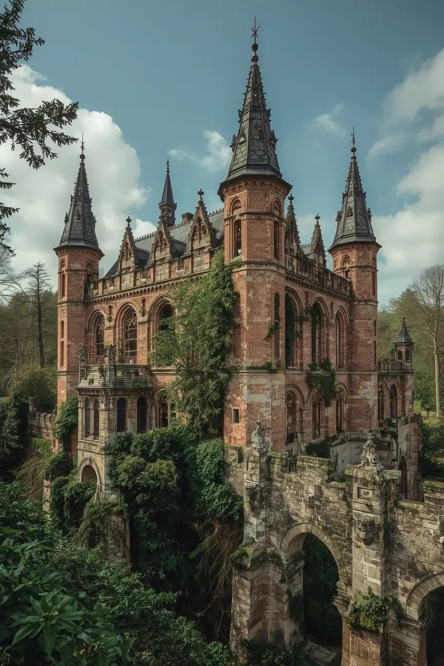
2. Castles and manor houses in rural Wallonia and the Ardennes
Rural Wallonia and the Ardennes are the best areas to look for abandoned castles, manor houses, and estate buildings. These sites attract photographers because they combine architectural decay with landscape setting, especially in wooded valleys and isolated villages.
Former icons such as Château Miranda helped create Belgium's international urbex reputation, but they also show how fast information becomes obsolete. Some famous château sites are gone, heavily secured, or no longer relevant as current exploration targets.
This is where a curated map is more useful than social media memory. Instead of chasing demolished legends, you can focus on verified regional clusters and current context.
3. Abandoned hospitals, sanatoriums, and care institutions
Abandoned hospitals and care institutions are among Belgium's most compelling urbex categories because they combine medical history, social history, and highly specific interior traces. Former clinics, schools, retirement homes, and sanatorium-style buildings often tell a clearer human story than industrial shells.
Belgium has several well-known institutional sites, but these locations are also the most sensitive from an ethical and preservation standpoint. Personal documents, medical material, and unsafe interiors can make them unsuitable for careless visits.
A good starting point for context is Rayon de soleil Abandoned Hospital in Belgium: History, Context, and Urbex Facts. It shows how a single Belgian hospital site can be explained through history, condition, and responsible urbex framing.
4. Military, transport, and infrastructure remnants
Military and transport remnants are another important layer on a Belgium urbex map. Former barracks, bunkers, rail depots, signal cabins, port structures, and water infrastructure often survive in overlooked zones near borders, industrial towns, or logistics corridors.
These places are not always the most dramatic visually, but they are often historically rich. Belgium's position in European transport and conflict history means infrastructure ruins can reveal strategic uses that factory sites do not.
They also require caution. Some structures are unstable, hidden by vegetation, or close to active rail and port operations. Map context matters more here than viral photographs.
5. Semi-abandoned villages and fringe urban sites in Flanders
Flanders usually has fewer classic large ruins than Wallonia, but it still matters on a map of abandoned places in Belgium. The best Flemish leads often include fringe urban warehouses, agricultural properties, schools, smaller institutional buildings, and publicized cases such as Doel, whose status has changed repeatedly over time.
These places are useful because they show a different Belgian abandonment pattern. Instead of giant industrial shells, you often find smaller sites shaped by urban pressure, infrastructure projects, or long redevelopment delays.
Public visibility does not equal free access. Highly known places can be the most monitored, the most damaged, or the least rewarding once condition and legality are considered.
How should you read a Belgium urbex map before planning a route?
You should read a Belgium urbex map by filtering for region, site type, freshness of information, and legal context before you think about photography. In Belgium, short travel distances make it easy to combine stops, but that only works if the underlying data is current.
| Map filter | Why it matters in Belgium | What to verify |
|---|---|---|
| Region | Belgium changes quickly from industrial valleys to rural estates | Travel time, local density, nearby alternatives |
| Site type | Factories, castles, hospitals, and bunkers have different risks | Structural condition, likely visibility, ethical sensitivity |
| Status freshness | Demolition and sealing can happen fast | Recent notes, updates, redevelopment signals |
| Access context | A site can be abandoned and still restricted | Ownership, fencing, signs, active security |
| Route clustering | Belgium is ideal for multi-stop days | Parking, daylight, backup spots, border proximity |
If you are building a multi-day trip, the best method is to combine Belgian research with a larger European route. How to Plan an Urbex Road Trip in Europe explains that process clearly.
Access the free urbex map
What makes an abandoned place in Belgium worth prioritizing?
The best abandoned places in Belgium are usually the ones that combine historical value, distinct architecture, current photographic interest, and clear situational context. Fame alone is not a reliable quality signal.
A strong Belgian spot often has at least four qualities:
- a readable backstory, such as industrial decline or institutional closure
- a visual identity, such as monumental machinery or preserved interiors
- a regional link, meaning it fits into a larger cluster on the map
- recent verification that helps avoid wasted travel
In practice, this favors curated mapping over viral lists of Belgium urbex spots shared without updates. The goal is not to collect names. The goal is to understand which sites still matter, which sites are sensitive, and which routes make sense.
What rules and safety points matter most for urbex in Belgium?
The most important rule for urbex in Belgium is simple: never treat abandonment as permission. Many Belgian sites are private property, actively monitored, structurally unsound, or in transition toward demolition or redevelopment.
A responsible Belgium urbex guide should always follow these basics:
- check ownership and posted restrictions
- do not force entry or bypass security
- avoid dangerous floors, roofs, shafts, and asbestos-heavy interiors
- leave objects, documents, and rooms exactly as found
- avoid publishing details that increase vandalism or theft
MapUrbex is preservation-first. Verified information should reduce harm, not increase pressure on fragile sites.
Which MapUrbex resources are most useful after this guide?
The most useful next step is to move from a single-country overview to verified map browsing and route planning. These resources help you do that without relying on outdated spot lists.
- Browse all urbex maps
- Access the free urbex map
- Urbex Map Europe: How to Find Verified Abandoned Places Safely
- How to Plan an Urbex Road Trip in Europe
- Rayon de soleil Abandoned Hospital in Belgium: History, Context, and Urbex Facts
FAQ
Is urbex legal in Belgium?
Urbex in Belgium is not automatically legal just because a place looks abandoned. Many sites are private property or fall under active security, redevelopment, or municipal control. If access is restricted, do not enter. Always verify the legal context before visiting an area.
What types of abandoned places are most common in Belgium?
The most common abandoned places in Belgium are industrial sites, rural estates, hospitals, schools, agricultural properties, and military or transport remnants. Wallonia is usually stronger for heavy industry and large ruins. Rural southern areas are often better for castles and manor houses. Flanders tends to offer more fragmented urban-edge sites.
Are famous Belgian urbex spots still accessible?
Some are, but many famous Belgian sites are sealed, demolished, repurposed, or heavily monitored. Viral fame usually makes a place less reliable, not more. This is why a Belgium urbex map should be based on current verification rather than old forum lists.
How often should a Belgium urbex map be updated?
A Belgium urbex map should be updated as often as possible because Belgian site status can change quickly. Security, ownership, vandalism, and redevelopment all move faster than most published guides. Fresh notes are especially important for hospitals, industrial plants, and highly publicized spots.
Is Belgium a good destination for a first urbex road trip?
Belgium can be a very good first urbex road trip destination because travel distances are short and site types are varied. It is best suited to people who plan carefully and respect access limits. A curated map and a conservative route are more useful than trying to chase famous ruins at any cost.
Conclusion
A Belgium urbex map is most valuable when it helps you understand patterns, not just pin locations. Belgium stands out because industrial valleys, rural estates, medical sites, and infrastructure remnants all exist within a small travel area, but those opportunities only make sense when information is current and responsibly handled.
If you want verified context instead of outdated spot lists, start with curated mapping, cross-check each area, and keep preservation first.
Access the free urbex map