 MapUrbex
Use a curated abandoned places map to find verified lost places, compare regions, and plan responsible urbex research with clearer, safer data.
Abandoned Places Map: Find Verified Lost Places Responsibly
An abandoned places map is useful when you want real locations without wasting time on dead pins, vague forum threads, or outdated lists.
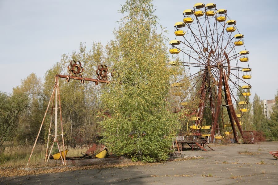
The best map does more than show a point on a screen. It gives context: whether a place is still standing, what type of site it is, how current the information is, and whether the location is suitable for research or a future trip.
MapUrbex is built around verified locations, responsible urbex, and preservation-first mapping. The goal is not illegal entry. The goal is better research, better filtering, and better decisions.
What is an abandoned places map?
An abandoned places map is a curated tool that helps users locate and compare abandoned sites, often called lost places, by region, type, and verification status. A good map supports research and responsible trip planning with clearer data than random social media posts or scattered coordinates.
Quick summary
- A strong abandoned places map saves time by filtering out duplicate, closed, or doubtful locations.
- The most useful lost places maps include verification, categories, update status, and practical context.
- A curated urbex map is more reliable than random pins shared in forums or short-form videos.
- Responsible urban exploration starts with legality, safety, and preservation of each site.
- MapUrbex focuses on verified locations and structured map browsing rather than hype.
- Beginners can start with a free map, then move to more targeted regional maps if needed.
Quick facts
| Topic | Answer |
|---|---|
| Main use | Find and compare abandoned places more efficiently |
| Best format | Curated map with filters and verification context |
| Common names | Abandoned places map, lost places map, urbex map, urban exploration map |
| Ideal for | Research, trip planning, regional discovery |
| Important limit | A map never replaces legal checks or on-site judgment |
| Fast starting point | Access the free urbex map |
Why use a curated abandoned places map instead of random pins?
A curated abandoned places map is better because it reduces uncertainty. Random pins often lead to demolished buildings, empty fields, duplicates, or places that were never viable in the first place.
This matters for both beginners and experienced explorers. Poor location data wastes travel time and increases the chance of unsafe decisions. A structured map makes comparison easier because you can sort locations by region, type, and usefulness.
It also improves research quality. A proper map lost places workflow is less about collecting coordinates and more about understanding what each site actually is.
How does MapUrbex verify abandoned places?
MapUrbex verifies places by prioritizing consistency, recent information, and curation over quantity. In practice, that means a smaller set of stronger entries is more useful than a huge list of doubtful points.
Useful verification signals typically include:
- recent visual confirmation
- cross-checking of location identity
- category clarity such as factory, hospital, mansion, or military site
- removal of obvious duplicates or dead entries
- updates when a place changes status
That approach supports a preservation-first model. A responsible urbex map should help people research abandoned places without turning sensitive sites into disposable content.
What should a good lost places map include?
A good lost places map should include more than names and pins. It should help you judge whether a location is relevant, current, and worth further research.
Look for these core elements:
- clear map filtering by country, region, or site type
- verified or reviewed entries
- practical notes about status and reliability
- enough detail to distinguish similar sites
- a format that is easy to browse on desktop and mobile
A strong urban exploration map also avoids false precision. Exact coordinates alone are not quality. Quality comes from context and curation.
How can you use an urbex map responsibly?
Use an urbex map responsibly by treating it as a research tool, not as permission to enter a site. Legal access, ownership, and safety conditions vary from place to place and can change quickly.
Always check local law, ownership, and current conditions. Never force entry, bypass barriers, vandalize a site, or publish details that could increase damage.
Responsible use also means preserving the site itself. That includes leaving no trace, avoiding fragile structures, and understanding that some locations should remain documented rather than visited.
This is one reason curated maps matter. They help users move away from reckless location sharing and toward informed, lower-impact exploration.
Where should beginners start when choosing a map?
Beginners should start with a curated map that is easy to browse and simple to verify. The best first step is to compare available regions and understand what kind of abandoned places you actually want to research.
To explore the full catalog, Browse all urbex maps. If you want a free starting point, use the free map before moving to more specific regional options.
If your current focus is France, these guides are useful references:
- How to Find Abandoned Places in France
- France Urbex Map: Find Verified Abandoned Places Across France
- Top 10 Abandoned Places Around Paris for Urbex in Île-de-France
Frequently asked questions
Below are short answers to the most common questions about using an abandoned places map.
Is it legal to visit abandoned places?
Not always. Legality depends on ownership, local law, access restrictions, and the current status of the site. A map helps with research, but it does not grant permission.
Are all places on a lost places map publicly accessible?
No. Many abandoned places are on private land or have changing conditions. Public visibility on a map is not the same as lawful access.
What is the difference between a free urbex map and a paid map?
A free urbex map is usually a starting layer with limited scope. A paid or premium map often adds more verified entries, stronger filtering, and deeper regional coverage.
How often should abandoned places data be updated?
As often as possible. Abandoned sites change fast because of demolition, redevelopment, fires, closures, or increased security.
Can beginners use an urban exploration map safely?
Yes, if they use it for planning and research, follow the law, avoid risky structures, and do not treat every listed place as visit-ready.
Conclusion
A reliable abandoned places map is not just a collection of coordinates. It is a decision tool. The best maps help you find stronger leads, avoid bad data, and approach urbex with more care.
For that reason, verified and curated mapping is usually better than chasing random location drops online. It supports research, reduces waste, and fits a preservation-first mindset.
Ready to start with a verified map?
Start with the free option, compare regions, and use better data before planning your next trip.
Access the free urbex map
