 MapUrbex
A practical urbex Nantes guide to abandoned places, industrial wastelands in Loire-Atlantique, safety, legality, and verified maps.
Urbex Nantes Guide: How to Explore Loire-Atlantique's Abandoned Spaces Responsibly
If you are researching urbex Nantes, the main challenge is not finding rumors. It is finding current, usable information about abandoned places in Nantes and the wider Loire-Atlantique area.
Nantes has a strong industrial, port, rail, and peri-urban history. That creates a steady interest in friches, disused buildings, and transitional sites. It also means locations change fast, redevelopment is common, and legal access must always come before curiosity.
MapUrbex approaches the area with a preservation-first method: verified locations, curated maps, and responsible exploration habits.
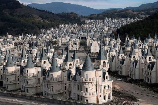
Where can you do urbex in Nantes responsibly?
Responsible urbex in Nantes usually means focusing on documented, low-impact opportunities on the city's edges and across Loire-Atlantique rather than chasing risky central sites. The safest method is to use verified map data, confirm a place is still inactive, avoid forced entry, and choose locations where your visit does not damage the building, endanger you, or disturb owners, workers, or neighbors.
Nantes is often more useful as a base than as a promise of easy city-center access. Many of the most interesting abandoned spaces are short-lived, partly secured, or located in industrial transition zones.
Quick summary
- Urbex Nantes is best approached as a city-and-department search, not only a city-center search.
- Friches in Nantes change quickly because redevelopment pressure is high.
- Typical targets include industrial remnants, warehouse zones, rail-edge structures, and peri-urban abandoned buildings.
- A verified map is more useful than old lists, screenshots, or recycled coordinates.
- Legal caution matters: no trespassing, no forced access, and no public exposure of fragile locations.
- MapUrbex is built for responsible discovery, not reckless entry.
Quick facts
- Primary area: Nantes and the wider Loire-Atlantique department
- Best fit for explorers: photographers, architecture enthusiasts, responsible beginners with preparation
- Common site turnover: high, especially in redevelopment corridors
- Most useful research style: verified maps plus recent status checks
- Main risks: unstable floors, broken glass, active security, water infiltration, and changing access conditions
- MapUrbex position: curated maps, verified locations, and preservation-first guidance
Why is Nantes a strong base for urbex in Loire-Atlantique?
Nantes is a strong base for urbex in Loire-Atlantique because the city sits between industrial heritage, logistics infrastructure, river-port activity, and suburban expansion. That mix tends to produce varied abandoned spaces, even if individual sites do not remain accessible for long.
In practice, this means you may encounter very different types of locations within a relatively compact search radius. One area may hold disused workshops or depots. Another may feature agricultural outbuildings, institutional leftovers, or half-forgotten structures on the urban fringe.
The other reason Nantes matters is turnover. Sites appear, close, change ownership, or get demolished quickly. For transactional search intent, that matters a lot. People searching for a Nantes urbex guide usually want a tool they can use now, not a nostalgic list from three years ago.
If you want a broader overview before narrowing your route, start with Browse all urbex maps and then compare Nantes against nearby parts of Loire-Atlantique.
Which abandoned places can you expect around Nantes?
Around Nantes, you can generally expect industrial wastelands, warehouse shells, edge-of-network transport structures, abandoned houses outside the dense core, and occasional institutional remnants. Exact addresses and live access conditions change fast, so the useful question is the type of site, not only the name.
The table below shows the kinds of places urbex researchers commonly look for in the Nantes area.
| Site type | What it usually offers | Main limitation | Best use |
|---|---|---|---|
| Industrial friches | Large volumes, machinery traces, graffiti layers, metal textures | Fast redevelopment and security changes | Wide-angle photography and atmosphere |
| Warehouses and depots | Repetition, empty bays, loading architecture | Often partially active nearby | Composition practice and detail shots |
| Rail-edge structures | Strong lines, rust, utility spaces | Operational risk if still connected to active lines | Exterior observation only unless clearly inactive and lawful |
| Peri-urban houses or farms | Domestic decay, smaller rooms, personal traces | Ownership is often clearer and more sensitive | Careful documentary photography |
| Institutional remnants | Corridors, signage, layered interiors | Access may be highly restricted or hazardous | Research value more than easy entry |
This is why responsible urbex Nantes planning should begin with status verification. A dramatic-looking place may be active, occupied, monitored, or already sealed. A less famous place may be safer, quieter, and more respectful to explore.
For a more visual city-specific overview, see Urbex Nantes: Top 10 Abandoned Places, Photos and GPS Tips.
How should you plan an urbex Nantes outing safely and legally?
A safe and legal urbex outing in Nantes starts before you leave home. You should verify the current status of the site, avoid any location that requires trespassing or forced entry, plan a daylight visit, and keep a clear exit strategy.
A good preparation checklist is simple:
- Check whether the place is clearly abandoned rather than active, occupied, or under works.
- Do not climb fences, break locks, move barriers, or enter through damaged openings you did not create.
- Tell someone where you are going and when you expect to return.
- Wear solid shoes, gloves if needed, and carry a charged phone and light.
- Avoid going alone if the building condition is unknown.
- Leave objects exactly where they are and never remove artifacts.
- Do not publish vulnerable locations in a way that encourages vandalism.
Nantes weather also matters. Moisture, moss, coastal wind, and water infiltration can make concrete, stairs, and metal surfaces more dangerous than they look in photos.
If you are new to the hobby, read How to Start Urbex: The Complete Beginner's Guide before planning a first visit.
Which tools help you find friches in Nantes without guessing?
The best tools for finding friches in Nantes are verified maps, recent status notes, and research methods that reduce guesswork. A curated database saves time because it filters out demolished sites, obvious dead leads, and outdated rumors.
This matters especially in Nantes because redevelopment can be rapid. A popular abandoned place may be empty in one season and sealed, cleaned, or rebuilt in the next.
Useful research signals include:
- recent confirmation that a site still exists
- notes on surrounding activity and visibility
- general site category and difficulty
- signs of demolition or reactivation
- safety context and preservation sensitivity
MapUrbex is designed around that logic. Instead of pushing reckless exploration, it helps you compare verified options and plan lower-impact visits. You can start with Access the free urbex map or read How to Find Secret Urbex Spots Responsibly for a method that does not rely on leaked coordinates.
When is the best time to photograph abandoned places in Nantes?
The best time to photograph abandoned places in Nantes is usually early morning or late afternoon in stable weather, with winter and early spring often giving clearer sightlines around overgrown sites. Soft light improves textures, while dry conditions reduce slip risk.
For urban exteriors, overcast skies often work well because they control contrast and reveal concrete, rust, and broken surfaces evenly. For interiors, stable daylight is more important than dramatic weather.
Season also changes access around vegetation. Dense summer growth can hide hazards, conceal drops, or make navigation harder. Winter can open views but also expose wet floors and colder interiors.
If your goal is documentation rather than social media spectacle, favor visibility, time, and safety over dramatic conditions.
FAQ
Is urbex legal in Nantes?
Urbex itself is not a special legal category. What matters is property law, access rights, and safety. In Nantes, as elsewhere, entering private property without permission can be illegal. That is why MapUrbex emphasizes verification, caution, and no forced access.
Are there still many friches in Nantes?
Yes, but the number that remain both visible and relevant changes constantly. Nantes and Loire-Atlantique still attract interest because of industrial history and ongoing urban change, yet individual abandoned sites can disappear quickly.
Should beginners focus on Nantes itself or the wider Loire-Atlantique area?
Beginners usually benefit from looking beyond the dense center. The wider department often provides more varied, lower-pressure options and a better chance of finding places that are easier to assess responsibly.
Why do verified maps matter so much in Nantes?
Verified maps matter in Nantes because old coordinates age badly. A curated map helps you avoid demolished sites, active workplaces, and locations that have become risky or irrelevant.
What should you never do during an urbex visit?
Never force entry, vandalize, steal, light fires, move objects for content, or ignore structural danger signs. Responsible urbex is based on minimal impact, lawful choices, and preservation.
Conclusion
Urbex Nantes is most rewarding when treated as a practical research project, not a hunt for sensational coordinates. The city and the wider Loire-Atlantique area can offer industrial friches, abandoned buildings, and strong photographic atmospheres, but conditions change fast.
That is exactly why verified locations matter. A curated map helps you spend less time chasing dead leads and more time planning responsible visits with better safety and better respect for places.
If you want to explore Nantes with a preservation-first method, use the free map first and expand only after checking current status carefully.
Access the free urbex map
