Learn how a UK urbex map helps you find verified abandoned places in Britain, compare location types, and plan responsible research.
UK Urbex Map: Best Abandoned Locations Explained
A UK urbex map is useful because it turns scattered research into a structured view of abandoned places in Britain. Instead of relying on old forum threads or vague social posts, you can compare location types, regions, and verification signals in one place.
For most people, the best abandoned locations in the UK are not simply the most dramatic ruins. They are the places with clear historical interest, current research value, and a realistic way to assess legality and safety before any visit.
What does a UK urbex map help you find?
A UK urbex map helps you find verified abandoned places in Britain by sorting locations by type, region, and research value. The best map is not just a list of coordinates. It helps you compare manor houses, hospitals, mills, military relics, and transport sites while keeping legality, safety, and preservation in view.
Quick summary
- A good UK urbex map helps filter abandoned places in the UK by region and category.
- The most searched sites are usually manor houses, hospitals, factories, military remains, and transport relics.
- Verification matters because the status of abandoned buildings can change quickly.
- A curated map is usually more reliable than scattered posts on social media.
- Responsible urbex starts with permission, lawful access, and preservation-first behavior.
Quick facts
- Geographic scope: England, Scotland, Wales, and Northern Ireland.
- Main use: comparing abandoned places in the UK before planning research.
- Common categories: country estates, institutions, mills, coastal defenses, rail sites.
- Main risk: sites may be sealed, demolished, occupied, or structurally unstable.
- Best practice: confirm current status and never force entry.
Which abandoned places in the UK are usually the most sought after?
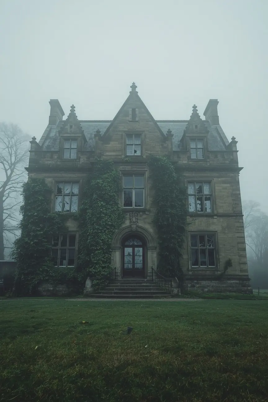
The best urbex spots in the UK are usually locations with strong historical character and clear visual identity. In practice, explorers most often search for abandoned manor houses, Victorian institutions, industrial buildings, military remains, and railway or transport sites.
| Location type | Why people look for it | What to verify first |
|---|---|---|
| Manor houses and country estates | Architectural detail, strong exterior photography, local history | Ownership, active security, roof collapse risk |
| Hospitals and institutions | Large scale, layered interiors, social history | Current closure status, asbestos risk, fencing |
| Mills and factories | Industrial heritage, machinery remnants, wide spaces | Structural stability, redevelopment work, contamination |
| Military and coastal sites | Historic function, unusual layouts, remote settings | Restricted land, surveillance, exposure to hazards |
| Rail and transport sites | Strong atmosphere, transport history, easy regional comparison | Live infrastructure nearby, restricted access, demolition status |
A map of abandoned places in the UK is most useful when it shows these categories clearly. Category-level research often matters more than hype around a single site.
Which regions of the United Kingdom tend to have the widest range of abandoned locations?
The widest variety of abandoned places in the UK is usually found where industrial history, institutional history, and changing land use overlap. That often means former mill districts, post-industrial towns, old transport corridors, coastal defense zones, and rural estate areas.
In broad terms, northern England is often associated with mills, factories, hospitals, and civic buildings. The Midlands frequently combine industrial and institutional sites. Wales is known for mining and quarry heritage, alongside remote ruins. Scotland often attracts interest for estates, hospitals, and isolated rural structures. Southern and coastal areas can include forts, defense infrastructure, resorts, and transport remnants.
These are patterns, not guarantees. A reliable UK urbex map is valuable because it helps you compare those patterns without assuming that every historically rich area still contains accessible or safely viewable sites.
How should you judge whether a location belongs on a reliable UK urbex map?
A reliable UK urbex map should include more than a pin. It should indicate that a location has been checked, categorized, and reviewed for current relevance rather than copied from an old list.
Look for five signals:
- Recent verification: the site was checked recently enough to reduce the chance of stale information.
- Clear category: manor, hospital, factory, military site, transport site, or similar.
- Status context: abandoned, partially redeveloped, sealed, or uncertain.
- Safety and legal note: reminders about property rights, instability, or restricted land.
- Curated presentation: locations are selected for research value, not dumped in bulk.
This is where MapUrbex stands out. The goal is not to encourage risky entry. The goal is to help users research verified locations and make better, more responsible decisions.
Safety reminder: a mapped location is not permission to enter. Ownership, access conditions, and hazards can change without notice.
Why do verified locations matter more than long unverified lists?
Verified locations matter more because abandoned places have short information lifecycles. A building that was open to exterior viewing last year may now be fenced, occupied, renovated, demolished, or under active monitoring.
Long unverified lists often create three problems. First, they waste time. Second, they increase the chance of unsafe planning. Third, they push attention toward locations that may no longer be appropriate to share widely.
A curated map reduces that noise. It gives users a smaller but more trustworthy set of options. For transactional search intent, that is exactly what most people want: fewer guesses, better filters, and clearer research value.
How can you plan a responsible day using a map of abandoned places in the UK?
A responsible day plan starts with lawful research, not with entry. The map should help you shortlist areas, compare categories, and decide whether a location is suitable for external viewing, historical study, or a permission-based visit.
A simple planning process looks like this:
- Start with a region rather than one famous site.
- Filter by type, such as manor houses or industrial buildings.
- Check whether the site status is still current.
- Review transport, weather, daylight, and fallback options.
- Prefer places that can be appreciated from public rights of way or with explicit permission.
- Leave immediately if the situation on the ground is unsafe or clearly private.
This approach is more sustainable than chasing viral coordinates. It also fits MapUrbex's preservation-first position.
What are the legal and safety limits for urbex in the United Kingdom?
In the United Kingdom, legality depends on the place, the land, and what you do there. Forced entry, damage, theft, interference with infrastructure, and access to restricted sites can lead to serious legal consequences. The safest rule is simple: only go where you have permission or where viewing is lawful from public access points.
Safety limits matter just as much. Abandoned sites can contain unstable floors, broken glass, hidden shafts, contaminated materials, water hazards, and live utilities. Remote military or industrial sites can add exposure, poor phone signal, or hidden drops.
For that reason, a responsible urbex map is a research tool, not an invitation to take risks. Preservation-first behavior means leaving no trace, taking nothing, and never breaking access barriers.
Which map is best if you want verified abandoned locations in Britain?
The best option is a curated map that focuses on verification, clear categories, and responsible exploration guidance. If your goal is to compare the best abandoned locations in the UK efficiently, a verified map is usually more useful than a generic abandoned places list.
If you want to compare broader coverage, start with Browse all urbex maps. You can also read UK Urbex Map: Find Verified Abandoned Places in Britain and Urbex Map Europe: How to Find Verified Abandoned Places Safely. For wider trip planning, Best Countries in Europe for Urbex: 7 Strong Choices for Urban Exploration adds useful context.
FAQ
What is the difference between a UK urbex map and a general abandoned places list?
A UK urbex map is usually more structured. It helps you filter by region, category, and verification status instead of scrolling through random names with no current context.
Are the best urbex spots in the UK always inside buildings?
No. Many of the most interesting sites can be studied from exteriors, surrounding landscapes, public viewpoints, or legal access routes. Interior access is never the only source of historical value.
How often do abandoned locations change status?
They can change quickly. Redevelopment, demolition, security changes, temporary occupation, and weather damage can alter a site's status within weeks or months.
Is a free map enough for beginners?
A free map can be a good starting point if it is curated and current. Beginners should still verify details, keep expectations realistic, and avoid treating any pin as guaranteed access.
Can social media coordinates replace a verified map?
Usually not. Social posts are often incomplete, outdated, or designed for attention rather than accuracy. A verified map is better for research and safer decision-making.
Conclusion
A strong UK urbex map does three things well: it helps you compare location types, it reduces reliance on stale information, and it supports responsible research. That matters whether you are looking for manor houses, industrial ruins, military sites, or a broader map of abandoned places in the UK.
The best results come from verified locations, realistic planning, and preservation-first behavior. Use a map as a research tool, not as a shortcut around safety or property rights.
Access the free urbex map