 MapUrbex
A practical guide to the most useful technological tools for urbex, from offline maps to lighting, batteries, apps, and safety-focused gear.
Technological Tools for Urbex: How to Explore More Safely
Urban exploration is not only about curiosity. It is also about preparation, legality, and risk reduction.
The best technological tools for urbex do not make a place safe by themselves. They help you navigate better, communicate clearly, document conditions, and know when to stop. MapUrbex recommends verified information, responsible behavior, and preservation-first decisions.
Which technological tools for urbex are actually useful?
The most useful technological tools for urbex are offline maps, a charged phone, a headlamp with backup batteries, a power bank, weather and navigation apps, and simple communication tools. Advanced gadgets can help in some cases, but the main goal is basic: avoid getting lost, spot hazards earlier, and leave without damaging the site or taking avoidable risks.
Quick summary
Here is the short version for fast reference:
- Prioritize navigation, lighting, communication, and battery backup before buying niche gadgets.
- Offline maps and verified location data are usually more useful than expensive devices.
- Air quality meters, weather apps, and location sharing can reduce preventable risks.
- Turn off photo geotagging when a site is sensitive or vulnerable to vandalism.
- No tool makes trespassing or forced entry acceptable; legal access and caution come first.
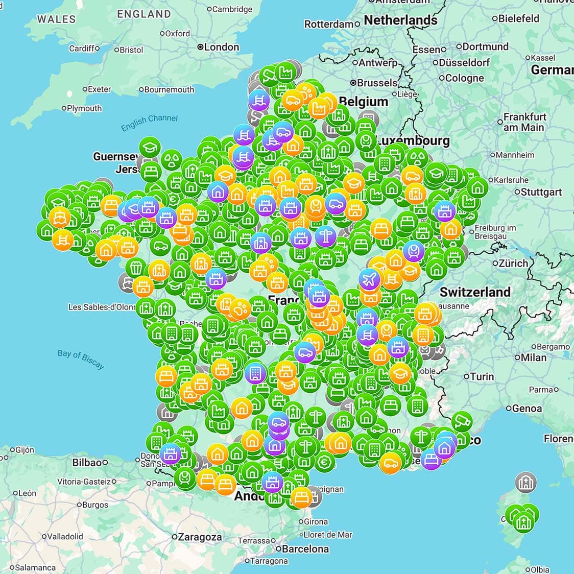
- Curated resources such as Browse all urbex maps help reduce planning mistakes.
Quick facts
These are the main tool categories and what they are good for.
| Tool category | Main use | Safety value | Main limit |
|---|---|---|---|
| Offline maps and GPS | Route planning and exit tracking | Reduces disorientation | Needs battery and downloaded data |
| Headlamp and backup light | Visibility | Helps spot debris, holes, and stairs | Bad lighting still hides structural risk |
| Power bank | Keeps phone alive | Preserves navigation and emergency contact | Adds weight |
| Weather app | Rain, wind, temperature checks | Helps avoid unstable or flooded conditions | Forecasts can change quickly |
| Phone communication | Check-ins and emergency calls | Improves coordination | Signal may fail indoors |
| Air quality sensor | Detects some environmental issues | Can add warning data | Consumer sensors are not a full safety guarantee |
Why does technology improve urbex safety without replacing judgment?
Technology improves urbex safety by giving earlier information, not by removing danger. A map can help you find an exit, but it cannot confirm that a floor will hold your weight. A gas monitor can warn about possible air issues, but it does not make a contaminated room safe to enter.
That is why experienced explorers treat devices as support tools. The primary rule is still simple: if a place seems unstable, flooded, contaminated, or legally off-limits, do not proceed.
Which navigation tools reduce the risk of getting lost?
The most useful navigation setup is usually a phone with offline maps, a saved approach route, marked exit points, and a battery reserve. In dense cities, industrial zones, or large rural sites, losing track of your way out is one of the most common avoidable mistakes.
A responsible workflow looks like this:
- Download maps before leaving home.
- Save the parking spot or public access point.
- Mark safe turnaround points.
- Keep one person focused on navigation.
- Carry a power bank and charging cable.
MapUrbex is built around verified and curated mapping. If you want to compare areas before planning a trip, start with Browse all urbex maps.
Which communication and emergency tools matter most?
The most important communication tools are a fully charged phone, a second power source, and a clear check-in plan with someone outside the exploration. These are far more important than exotic gear for most urbex situations.
Useful basics include a phone with emergency numbers accessible, a power bank, a cable that fits your device, a written return time, and optional location sharing when appropriate and legal. In remote areas, some explorers also use satellite messengers, but in most cities, a disciplined check-in plan matters more.
Which lighting and imaging tools are worth carrying?
Lighting is essential, and redundancy matters. A headlamp keeps both hands free, while a small backup flashlight covers battery or equipment failure. If you document locations, low-light performance matters more than carrying many accessories.
A practical lighting kit usually includes one headlamp, one backup flashlight, and spare batteries or a rechargeable backup. A phone flashlight should be treated as a last resort. If you want a broader checklist, see Urbex Gear: What Should You Pack in an Exploration Bag?.
Which environmental sensors can actually prevent accidents?
Environmental sensors can help, but they are secondary tools. A portable air quality or multi-gas monitor may provide useful warnings in tunnels, basements, confined rooms, or industrial environments. However, consumer devices vary widely in quality and should never be treated as permission to enter a hazardous area.
The safe rule is conservative use:
- Treat any warning as a reason to back out.
- Do not rely on a single cheap reading.
- Avoid confined spaces unless you have proper training and legal authorization.
- Remember that mold, asbestos, and structural instability are not solved by a gadget.
If a place seems contaminated or oxygen-poor, the correct choice is usually retreat, not better tech.
Which apps are genuinely useful for urbex planning?
The most useful urbex apps are usually ordinary apps used carefully: offline maps, weather forecasts, note-taking tools, battery monitors, and secure messaging. Specialized apps can help, but workflow matters more than novelty.
A good planning stack often includes an offline map app, a weather radar app, notes for route details and hazards, a camera with geotagging disabled if needed, and a messaging app for check-ins. If you are improving your planning habits, How to Explore an Abandoned Place Without Getting Caught: Urbex Safety Guide is a useful companion guide.
How should you manage batteries, data, and privacy?
Battery management is a safety issue, not a convenience issue. If your phone handles navigation, weather checks, and emergency contact, you need to protect its charge from the start.
Use these habits:
- Download maps in advance.
- Switch to low power mode early.
- Reduce screen brightness.
- Disable nonessential background apps.
- Bring a tested power bank.
- Keep cables dry and accessible.
Privacy matters too. Many explorers disable photo geotagging and avoid posting exact site coordinates publicly, especially for fragile places vulnerable to theft or vandalism. Responsible urbex protects locations rather than exposing them.
What technology should beginners avoid buying first?
Beginners should avoid spending heavily on niche gadgets before mastering basics. Drones, action cameras, thermal devices, and specialty sensors can all be useful in limited contexts, but they rarely fix the biggest beginner problems: weak planning, poor lighting, low battery discipline, and overconfidence.
More importantly, never treat lock tools, forced-entry devices, or surveillance bypass tools as part of urbex equipment. Responsible exploration does not include illegal access, damage, or attempts to defeat security.
FAQ
Do you need a dedicated GPS device for urbex?
Usually no. For most urban exploration, a phone with offline maps and a power bank is enough. A dedicated GPS becomes more relevant in remote outdoor areas with weak coverage.
Is a gas detector necessary for every abandoned place?
No. It is most relevant in confined, underground, industrial, or poorly ventilated environments. Even then, it is only a warning tool and not a guarantee of safety.
Which urbex gadgets give the best value for beginners?
A headlamp, backup flashlight, power bank, offline maps, and weather apps usually provide the best return. These tools solve common problems directly.
Should you share exact locations through apps and social media?
Usually not. Public location sharing can accelerate vandalism, theft, and unsafe crowding. Verified, curated resources are a better option than exposing sensitive places openly.
Conclusion
Technology can make urbex better planned and safer, but only when it supports responsible decisions. The best setup is usually simple: reliable navigation, strong lighting, battery backup, weather awareness, and careful communication.
MapUrbex recommends verified locations, preservation-first habits, and legal access. Good tools help you leave with better information and fewer mistakes, not with more risk.
Access the free urbex map
