 MapUrbex
Learn what an interactive urbex map is, how MapUrbex verifies locations, and how to use a curated map of abandoned places responsibly.
Interactive Urbex Map: How to Find Verified Abandoned Places Responsibly
An interactive urbex map helps explorers find abandoned places with more context than a simple list. Instead of scrolling through random posts, you can use filters, categories, and verified location data to plan better.
For MapUrbex, the goal is not to push risky behavior. The goal is to provide curated maps, reduce guesswork, and support responsible urbex with a preservation-first approach.
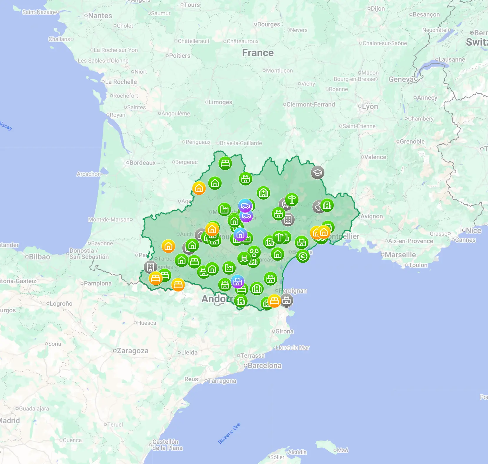
What is an interactive urbex map?
An interactive urbex map is a searchable digital map of abandoned places that lets users view locations, organize them by area or type, and access practical notes in one interface. A good map urbex tool is curated, regularly updated, and designed to help users research locations responsibly rather than rely on scattered, unreliable sources.
Quick summary
- An interactive urbex map is faster to use than a static document or unstructured list.
- The best maps combine verification, filtering, and practical trip planning.
- A map of abandoned places is useful only if the data is updated and curated.
- MapUrbex focuses on verified locations, responsible exploration, and preservation.
- A map is not permission: always respect ownership, local law, and site safety.
Quick facts
- Primary use: find and organize abandoned places more efficiently
- Best format: interactive map with categories and updates
- Main benefit: better trip planning with less noise
- Key risk to avoid: trespassing or unsafe entry based on incomplete data
- MapUrbex position: curated maps, verified locations, preservation-first
Why use an interactive urbex map instead of a static list?
An interactive urbex map is usually better than a static list because it is easier to search, compare, and update. It turns raw location data into a practical planning tool.
A static PDF can still be useful, especially offline. But an interactive map of abandoned places is stronger for filtering by region, checking relevance, and building routes. That matters when you want a clear overview instead of hundreds of disconnected entries.
If you want to compare formats, see Free Urbex Map: Download the Updated PDF and Google Maps Version.
How does MapUrbex verify locations?
MapUrbex verifies locations through curation, consistency checks, and ongoing review. The point is to reduce false leads and low-quality entries.
Verification does not mean a place is safe, legal to enter, or permanently accessible. It means the location data is reviewed more carefully than random crowd-sourced lists. That distinction matters for users who want a trustworthy map of urbex spots without depending on rumors.
MapUrbex also follows a preservation-first logic. The platform is built to help people research sites, not damage them, expose them recklessly, or encourage forced access.
Which features matter most in a map of abandoned places?
The most useful features are clear categorization, location accuracy, regular updates, and practical navigation. Without those elements, a carte interactive des lieux abandonnés becomes difficult to trust.
| Feature | Why it matters | Practical benefit |
|---|---|---|
| Verified entries | Reduces outdated or fake spots | Saves time and avoids wasted trips |
| Interactive filters | Helps sort by region or site type | Makes planning faster |
| Curated structure | Improves consistency across listings | Easier comparison between places |
| Regular updates | Keeps the map relevant | Fewer dead leads |
| Mobile-friendly access | Useful in the field | Better route planning |
A strong urbex map should also be easy to read quickly. In practice, the best tools do not overwhelm users with noise. They surface the right information at the right moment.
How should you use a map of urbex spots responsibly?
You should use a map of urbex spots as a research aid, not as an excuse to ignore property rights or safety rules. Responsible urbex starts before any trip begins.
Follow a few basic principles:
- Never force entry.
- Never trespass where access is prohibited.
- Never vandalize, steal, or publish sensitive details recklessly.
- Prioritize personal safety and structural caution.
- Leave places exactly as you found them.
This is especially important with abandoned sites. Conditions change fast. A spot that existed in one state a few months ago may now be sealed, demolished, occupied, or dangerous.
What should you check before visiting a location?
Before visiting a location, you should check legality, current status, access conditions, and basic safety factors. A good interactive urbex map helps with planning, but it does not replace judgment.
Use this checklist:
- Confirm whether the place is still standing and relevant.
- Review the surrounding environment and access routes.
- Check weather and daylight conditions.
- Avoid solo visits in high-risk areas.
- Tell someone your plan if you are going into remote terrain.
- Respect local regulations and private property.
The most important reminder is simple: a location on a map is not permission to enter.
Where can you access a free urbex map?
You can start with the free resources offered by MapUrbex, then move to broader curated collections if you need more coverage. That approach is useful for beginners and for experienced users testing a new region.
Useful starting points:
- Access the free urbex map
- Browse all urbex maps
- Free Urbex Map: Download the 500+ Hidden Places List [PDF]
- Free Urbex Map: Download the 500+ Hidden Places List [PDF]
FAQ
Is an interactive urbex map the same as permission to enter?
No. A map shows location data, not legal authorization. You must still respect ownership, local law, closures, and safety restrictions.
Are the locations on MapUrbex random user submissions?
No. MapUrbex is positioned around curated and verified locations, which helps reduce the noise found in unstructured public lists.
Can a free urbex map be enough for trip planning?
Yes, for basic discovery. A free urbex map can help you understand coverage and format. For broader research, curated map collections usually provide more depth and organization.
Is an interactive map better than a PDF list?
Usually yes for filtering and live planning. A PDF is still useful for quick reference or offline reading, but an interactive map is more flexible.
Why does responsible urbex matter when using a map?
Because maps can amplify impact. Publishing or using location data carelessly can lead to vandalism, theft, unsafe visits, or legal problems. Preservation-first behavior protects sites and people.
Conclusion
A good interactive urbex map is more than a list of abandoned places. It is a structured research tool that helps users filter locations, plan more efficiently, and avoid unreliable information.
The value of MapUrbex is not just access to spots. It is the combination of verified locations, curated maps, and a responsible approach to exploration. Use the data carefully, respect the law, and treat every site with restraint.
Access the free urbex map
