 MapUrbex
Learn how to use an urbex map on Android to find verified locations, apply filters, plan routes, and explore abandoned places responsibly.
How to Use an Urbex Map on Android: A Responsible Step-by-Step Guide
Using an urbex map on Android is one of the simplest ways to organize location research, compare verified spots, and prepare a safer outing. The key is not just finding pins on a screen. The key is using the map responsibly.
A good Android workflow helps you check verification status, review notes, save useful places, and navigate efficiently without encouraging trespassing or risky access. That matters because a map is only useful when paired with legal awareness and preservation-first habits.
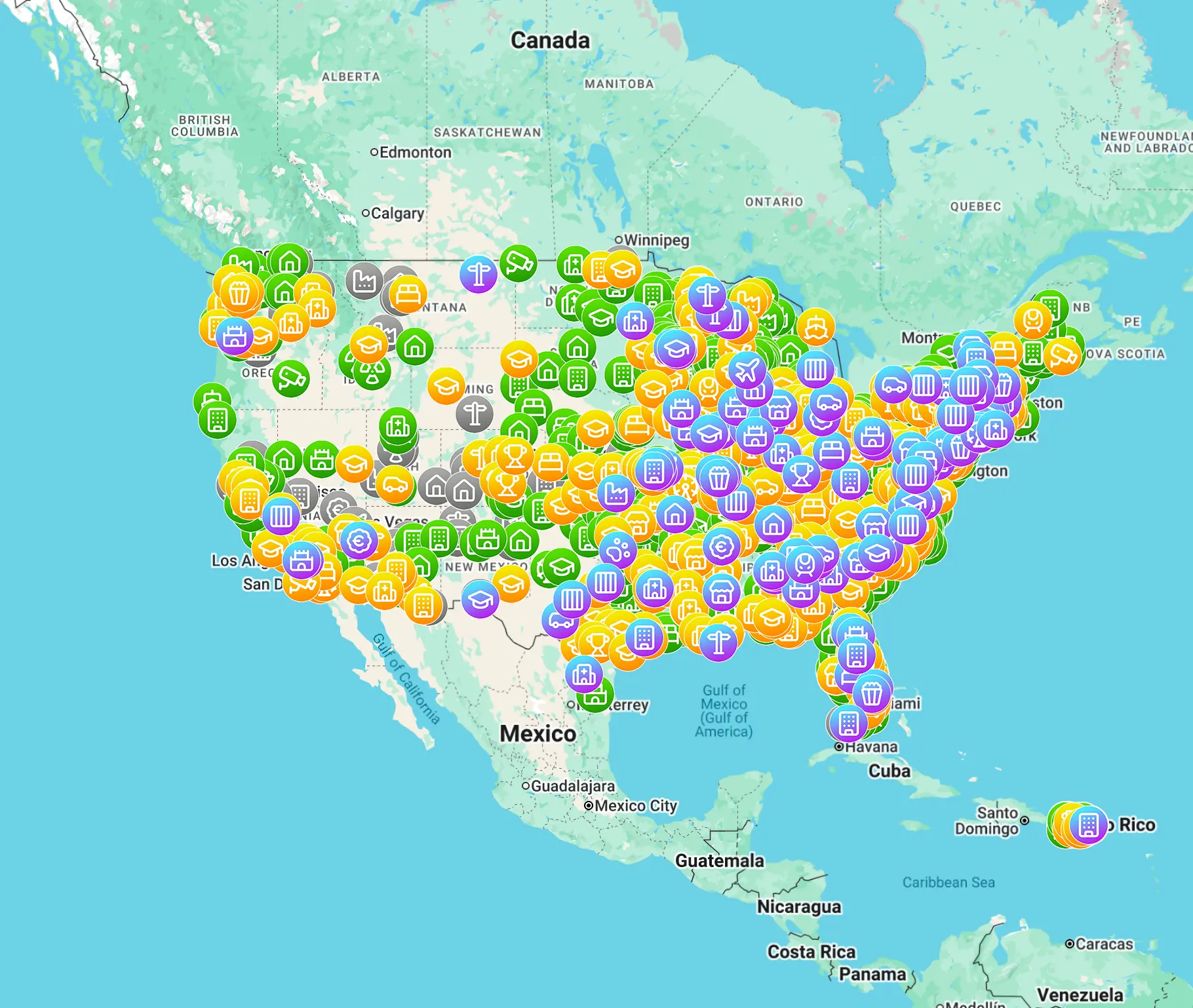
How do you use an urbex map on Android?
To use an urbex map on Android, open the map on your phone, enable location services, search by area or keyword, apply filters for verified or relevant spots, read each listing carefully, and save locations for later review. Use the map to plan research and travel, not to force entry or bypass property rules.
Quick summary
- Android is well suited for urbex mapping because it combines GPS, mobile data, screenshots, offline tools, and route planning in one device.
- A reliable urbex map should show verified locations, recent updates, and useful notes rather than random unconfirmed pins.
- Always read listing details before visiting. A location pin alone does not explain legal status, hazards, or site changes.
- Use filters to narrow results by region, category, or verification level so you waste less time in the field.
- Plan navigation to public surroundings or legal viewpoints, not to entry points or restricted access areas.
- An urbex map supports responsible research. It does not grant permission to enter private property.
Quick facts
| Element | Best practice on Android |
|---|---|
| Location services | Turn on GPS before searching nearby spots |
| Data connection | Check mobile data or Wi-Fi before loading map layers |
| Verification | Prioritize verified locations and recent updates |
| Saved places | Bookmark promising spots for later research |
| Route planning | Use normal navigation to legal public access areas |
| Safety | Check battery, weather, and local rules before leaving |
Why is Android useful for an interactive urbex map?
Android is useful for an interactive urbex map because it lets you search, filter, save, and navigate from one device. For most users, that is faster than switching between a desktop map, notes app, and separate GPS tool.
Android phones also give you practical field advantages. You can enable precise location, save screenshots, keep reference notes, and switch quickly between mapping tools and messaging. If you explore with a partner, Android makes it easy to share a general meeting point without oversharing sensitive access details.
Another advantage is flexibility. Some users prefer a browser-based map, while others use dedicated tools or bookmarks on the home screen. In both cases, the goal stays the same: reduce confusion and keep planning structured.
What should you check before opening an urbex map on Android?
Before opening an urbex map on Android, check four basics: battery level, internet access, GPS permissions, and your reason for searching. If any of these are unclear, the map becomes less useful immediately.
Start with battery. Mapping, screen brightness, and location services can drain power quickly. If you expect a long day, a power bank is practical.
Next, check permissions. If Android blocks location access, nearby results will be less accurate. You do not always need live GPS, but it helps when comparing your position to saved areas.
Then confirm your connection. Some interactive maps load slowly with weak coverage. It is smart to review key spots before leaving home.
Finally, be clear about intent. Are you building a future list, checking a trip area, or reviewing one verified place in detail? Clear intent helps you avoid impulsive decisions.
How do you search and filter verified locations on Android?
The best way to search and filter verified locations on Android is to begin broad, then narrow results with clear criteria. This produces better results than zooming randomly and tapping every marker.
A simple process works well:
- Search by city, region, or trip corridor.
- Zoom out once to understand the wider area.
- Apply filters for verified spots, categories, or recent updates.
- Open individual listings and read the notes.
- Save only the locations that still look relevant after review.
This matters because not every abandoned place is useful for the same goal. Some people want industrial sites. Others prefer hospitals, schools, transport infrastructure, or military remains where legal viewing from public land may exist. Filtering helps you match the map to the trip.
Map quality matters too. A curated source is more useful than a crowd dump of outdated pins. If you want a broader overview of location databases, see Best Urbex Maps in the World: Where to Find Verified Locations.
How should you read a location listing before going anywhere?
You should read a location listing as a research note, not as an invitation. The first job of the listing is to help you decide whether further review is worthwhile.
Look for these details:
- Whether the location is marked as verified
- How recent the information is
- Whether the place appears active, demolished, renovated, or monitored
- Notes about visibility from public space
- Broad hazard warnings such as unstable structures or water exposure
If a listing is vague, old, or contradictory, do not treat it as reliable. An Android urbex app or map interface can only surface information that exists. It cannot guarantee that a place is safe, legal, or unchanged.
A useful rule is simple: if the description does not support a calm, informed decision, skip the spot and keep researching.
How do you plan a route on Android without encouraging risky access?
You plan a route responsibly by navigating to legal public surroundings, transport links, or general nearby areas rather than to breach points or private entrances. The route should support observation and research, not forced access.
On Android, that usually means checking:
- Public parking or transit options
- Walking distance from legitimate public space
- Daylight timing
- Weather conditions
- Battery level before departure
If you are looking for nearby ideas, Abandoned Places Near Me: How to Find Nearby Urbex Spots Responsibly explains a responsible discovery workflow in more detail.
You can also compare several saved spots and rank them by practicality. A less dramatic site with clear public visibility is often a better choice than a famous place surrounded by legal or physical risk.
Which Android settings improve urbex map use in the field?
A few Android settings make urbex map use much smoother in the field. The most useful ones are location accuracy, screen management, battery planning, and saved references.
| Setting | Why it helps |
|---|---|
| High-accuracy location | Improves nearby positioning when comparing map markers |
| Adaptive brightness or manual brightness | Keeps the screen readable outdoors |
| Battery optimization review | Prevents some apps from being closed too aggressively |
| Saved screenshots or notes | Gives you backup information when coverage drops |
| Downloaded surrounding maps | Helps with travel even if the urbex layer loads slowly |
Do not rely on one app alone. Many users pair an interactive urbex map with a standard navigation app and a notes app. That combination is often more reliable than trying to do everything inside one interface.
What mistakes should you avoid when using an urbex map on Android?
The biggest mistakes are overtrusting the pin, rushing the trip, and treating a map like permission. Android makes information easy to access, but it can also create false confidence.
Avoid these common errors:
- Visiting a location based on one old pin with no recent confirmation
- Ignoring signs that a site has been repurposed or secured
- Sharing sensitive details publicly in ways that increase damage or trespass pressure
- Leaving with low battery or no backup plan
- Focusing on viral locations instead of realistic, low-impact options
Preservation-first urbex is slower by design. It values verification, context, and restraint.
How does MapUrbex fit into a responsible Android workflow?
MapUrbex fits into a responsible Android workflow by giving users curated maps, verified locations, and a preservation-first approach to discovery. That makes the map more useful as a research tool and less likely to reward careless behavior.
A sensible workflow looks like this:
- Review the map at home.
- Save a short list of relevant places.
- Check public access context and local rules.
- Compare timing, weather, and travel distance.
- Go only if the plan remains legal and reasonable.
If you want to explore the broader catalog, you can Browse all urbex maps. If your interest includes region-specific culture, Urbex Tokyo: A Responsible Guide to Haikyo and Abandoned Places in Japan is a useful example of how local context changes responsible exploration.
FAQ
Do I need a special Android urbex app to use an urbex map?
No. Many users access an urbex map through a mobile browser. Others prefer a saved shortcut or a dedicated Android urbex app. What matters most is the quality of the map data, not the packaging.
Can I use Google Maps together with an interactive urbex map?
Yes. That is often the most practical setup. Use the urbex map for research and verification, then use standard navigation for travel to legal public surroundings.
Does a verified pin mean I can enter the place legally?
No. Verification usually means the location itself has been checked or documented, not that entry is lawful. Property rights, local rules, closures, and safety conditions still apply.
What should I do if signal is weak on Android?
Review important listings before departure, save screenshots or notes, and use standard offline navigation where possible. Weak signal is a reason to simplify your plan, not to take bigger risks.
Is Android enough for responsible urbex planning by itself?
Android is enough for organizing research, but not enough for legal judgment. You still need common sense, local knowledge, and a preservation-first mindset.
Conclusion
Using an urbex map on Android is straightforward when the process is disciplined. Search broadly, filter carefully, read each listing critically, and plan around legal public access rather than risky shortcuts.
The best Android urbex workflow is simple: verified information, calm preparation, and respect for places. That approach protects both explorers and locations.
Access the free urbex map
