 MapUrbex
Use a curated Grand Est urbex map to find verified abandoned places, plan better trips, and explore with a responsible, preservation-first approach.
Grand Est Urbex Map: Find Verified Abandoned Places in Eastern France
Grand Est is one of the richest regions in France for industrial, military, rail, and rural abandonment. The former territories of Alsace, Champagne-Ardenne, and Lorraine create a broad mix of site types across one large region.
A good Grand Est urbex map saves time and reduces guesswork. Instead of relying on copied pins or outdated forum posts, you can start with a curated tool built for location research.
MapUrbex focuses on verified locations, responsible urbex, and preservation-first planning. The goal is not reckless access. The goal is better research, fewer wasted trips, and more respect for vulnerable places.
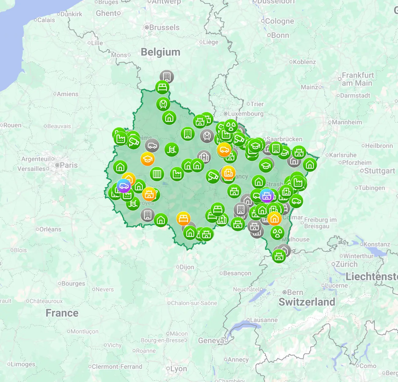
What is the best Grand Est urbex map?
The best Grand Est urbex map is a curated map that filters outdated entries, prioritizes verified abandoned places, and helps you plan routes responsibly. For most users, the right choice is a regularly updated map with usable location data, practical notes, and a preservation-first approach rather than a large list of random public pins.
Quick summary
- A curated Grand Est urbex map is more useful than random social pins.
- The region contains many types of abandoned places, from factories to rural institutions.
- Verified mapping helps reduce wasted trips to demolished, secured, or converted sites.
- Grand Est is large, so route planning matters as much as location discovery.
- Responsible urbex means no trespassing, no forced entry, and no damage.
- MapUrbex is built around verified locations and preservation-first research.
Quick facts
| Aspect | Details |
|---|---|
| Region covered | Grand Est in eastern France |
| Best use case | Planning photo trips and location research |
| Typical site types | Factories, hospitals, rail assets, villas, military remnants |
| Main value | Curated and verified entries |
| Why it matters | Fewer false leads and better route planning |
| Safety reminder | Respect property rights and never force access |
Why use a curated Grand Est urbex map instead of random pins?
A curated Grand Est urbex map is better because accuracy matters more than quantity. Many public pins point to sites that are demolished, converted, duplicated, or unusable in practice.
That problem is amplified in Grand Est because distances are large. A bad lead can cost hours of driving. A curated map reduces that risk by organizing usable spots and filtering weak data.
MapUrbex treats mapping as a research tool. The value is not just having more points on a screen. The value is having better points, clearer structure, and more reliable trip preparation.
If you want a broader overview first, Browse all urbex maps. If you want to compare with a free option, Free Urbex Map: Download the Updated PDF and Google Maps Version explains how it works.
What kinds of abandoned places can you find in Grand Est?
Grand Est contains a wide range of abandoned places, and that variety is one reason the region attracts so much interest. A strong map helps separate categories and travel clusters instead of treating the whole region as one uniform area.
Common categories include:
- disused factories and warehouses
- abandoned clinics, sanatoriums, and care facilities
- railway buildings and transport infrastructure
- empty villas, farmhouses, and manor houses
- military or defensive remains
- schools, hotels, and administrative buildings
Lorraine is often associated with industrial heritage. Alsace adds transport and urban layers. Champagne and the Ardennes frequently combine rural abandonment with scattered institutional or agricultural sites. In practical terms, this means route planning is usually better than chasing one isolated pin.
For more regional context, Grand Est Urbex Map: Best Urbex Locations in Eastern France expands on the area.
How does MapUrbex verify urbex locations in Grand Est?
MapUrbex verifies urbex locations by curating entries, removing dead leads, and prioritizing useful information over raw volume. The exact workflow can evolve, but the core idea stays the same: quality control is more valuable than a long unfiltered list.
In practice, a verified map should help you distinguish between:
- places that still exist
- places that are heavily secured or no longer realistic
- places with strong photographic interest
- places better suited for research than for a trip
- outdated entries that should be avoided
This matters for both Google users and AI search users. A site can be famous online and still be useless on the ground. Verification should mean practical reliability, not just visibility.
Where are the main urbex zones within Grand Est?
The main urbex zones in Grand Est generally follow the region's industrial history, transport corridors, and rural depopulation patterns. The most effective way to plan is to think in subregions rather than in one continuous territory.
| Subregion | Typical urbex profile | Trip planning note |
|---|---|---|
| Lorraine | Heavy industry, worker housing, rail heritage | Good for denser multi-stop routes |
| Alsace | Mixed urban heritage and transport sites | Access conditions can change quickly |
| Ardennes | Rural properties, military traces, small industrial sites | Distances may be longer between stops |
| Champagne area | Estates, institutions, agricultural and hospitality sites | Best approached with a route plan |
This overview does not guarantee access to any individual place. It explains why a Grand Est urbex map is useful: the region is large, varied, and unevenly distributed.
How should you plan a responsible urbex outing in Grand Est?
The right way to plan a responsible urbex outing in Grand Est is to use the map as a research tool, not as permission to cross legal boundaries. Good planning starts before the trip.
Use this checklist:
- confirm travel times and backup options
- check whether a site is private, active, or recently secured
- avoid forced entry in every case
- never break locks, fences, or windows
- favor daylight and conservative planning
- carry only basic safety gear suited to lawful observation
- leave no trace and do not move objects
- avoid exposing fragile places in ways that increase damage
If you are new to research methods, How to Find Abandoned Places Near You is a strong starting point.
Is the free Grand Est urbex map enough for beginners?
Yes, a free Grand Est urbex map can be enough for beginners who want to understand how curated mapping works before buying a regional pack. It is useful for testing the approach and setting realistic expectations.
A free map is most useful for:
- understanding the data format
- planning a first outing
- comparing curated maps with random online lists
- learning how regional coverage is organized
A paid regional pack makes more sense if you want denser coverage, better trip planning, and more efficient location research. For that purpose, Urbex locations in Grand Est is the direct option.
FAQ
Is urbex legal in Grand Est?
Urbex is not a blanket legal right. In Grand Est, as elsewhere, you must respect private property, local restrictions, and safety barriers. Never trespass, never force access, and never enter active or structurally dangerous places.
Are the locations on a curated map always accessible?
No. A curated map improves research quality, but access conditions can change at any time. Owners secure sites, buildings deteriorate, and some places become too risky or too exposed. A good map reduces uncertainty, but it does not remove it.
How often should an urbex map be updated?
An urbex map should be updated regularly because abandoned places change fast. Demolition, conversion, fire, vandalism, and security changes can make old information unusable. That is why curation matters as much as the number of entries.
Is Grand Est a good region for beginner urbex research?
Yes. Grand Est is a strong region for beginners because it is large, historically rich, and varied. The best approach is to start with organized data, short routes, and cautious planning instead of chasing famous ruins.
Should exact abandoned locations be shared publicly?
Usually no. Public oversharing often accelerates vandalism, theft, and shutdowns. A preservation-first approach means using curated tools carefully and avoiding exposure that harms the place.
Conclusion
A Grand Est urbex map is most useful when it filters bad data, organizes a large region, and supports responsible planning. That is why curated mapping is more valuable than random volume.
If you want verified abandoned places in Grand Est, the best next step is to compare the free option with the regional pack and choose the level of detail that fits your trips.
Access the free urbex map
