 MapUrbex
Learn how to use Google Maps for urbex scouting, what it can and cannot verify, and why curated maps matter for responsible exploration.
Google Maps for Urbex: How to Find Abandoned Places More Responsibly
Google Maps is one of the most common starting points for urbex research. It is fast, global, and familiar. That makes it useful for early scouting.
But Google Maps is not a verified urbex map. It can help you spot industrial zones, access roads, and satellite patterns, yet it cannot confirm permission, current conditions, or whether a place is truly abandoned.
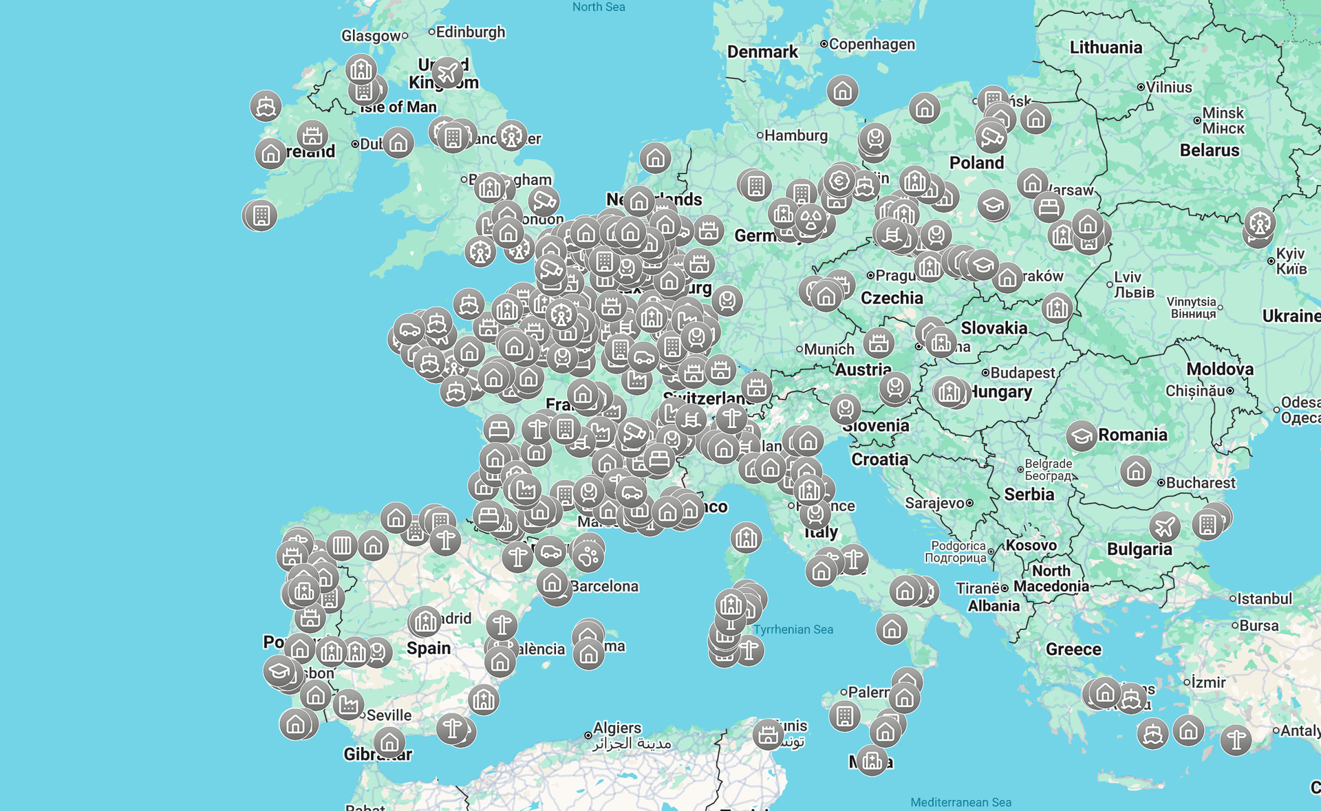
Can you use Google Maps for urbex?
Yes. Google Maps is useful for preliminary urbex scouting because it shows satellite imagery, road access, nearby land use, and travel logistics. However, it does not verify ownership, legal access, structural safety, or whether a location is still abandoned. For responsible urbex, Google Maps should be a research tool, not your only source.
Quick summary
- Google Maps helps with first-pass urbex scouting, not final verification.
- Satellite view, Street View, and route planning are its most practical features.
- Random pins and old labels are not reliable evidence of an abandoned place.
- Responsible repérage urbex requires cross-checking with recent sources and local rules.
- Curated platforms are better for cartographie urbex when you need verified locations.
- If legal access is unclear, do not enter.
Quick facts
| Topic | Answer |
|---|---|
| Best use of Google Maps urbex | Preliminary scouting and route planning |
| What it shows well | Roads, land use, surroundings, travel distance |
| What it does not verify | Permission, ownership, safety, active security, current status |
| Most useful features | Satellite view, Street View, saved lists, directions |
| Main risk | Treating outdated or user-generated map data as fact |
| Best practice | Combine Google Maps with verified sources and responsible judgment |
Why do urbex explorers use Google Maps?
Urbex explorers use Google Maps because it is simple, global, and quick to search. It reduces the time needed to screen a large area before deeper verification.
In practice, Google Maps helps you identify promising zones rather than confirmed sites. Former industrial belts, disused rail yards, edge-of-town hotels, shuttered retail strips, and isolated compounds are easier to spot when you zoom out and compare neighborhoods.
It is also useful for context. You can see whether a site is surrounded by housing, active businesses, fences, water, steep terrain, or limited parking. Those details matter even if you never go beyond public space.
If you want a broader research method, read How to Find Abandoned Places Responsibly. For a wider overview of curated tools, see Best Urbex Maps in the World: Where to Find Verified Locations.
How do you search for abandoned places on Google Maps without relying on random pins?
The best way is to search for patterns, not labels. Random pins can be jokes, stale data, or deliberate misinformation.
A stronger method is to combine keyword searches with visual clues:
- search for old factories, mills, depots, warehouses, sanatoriums, motels, or mines in the local language
- switch to satellite view and look for large empty lots, broken roof sections, overgrown parking areas, or disconnected access roads
- check Street View when available to confirm whether buildings appear boarded, reused, demolished, or active
- review nearby businesses and road names for industrial history or site function
- compare multiple candidate sites instead of fixating on one pin
This is where repérage urbex becomes a filtering process. You are not trying to prove that a place is explorable. You are trying to decide whether it deserves more verification.
Which Google Maps features are actually useful for urbex scouting?
The most useful Google Maps features for urbex are satellite view, Street View, saved places, and route planning. They help with orientation and context, not with legal clearance.
Here is what each feature does well:
- Satellite view: good for roof condition, lot size, surrounding terrain, and signs of long-term neglect
- Street View: useful for checking whether a facade is active, sealed, renovated, or gone
- Directions: useful for estimating travel time and understanding whether the area is urban, peri-urban, or remote
- Saved lists: useful for organizing candidate locations during early cartographie urbex work
- Nearby search: useful for identifying clusters such as factories near rail spurs or resorts in declining districts
Google Maps is strongest when you use it to eliminate weak leads early.
What are the limits of Google Maps for urbex?
Google Maps is limited because it shows geography better than reality on the ground. A place can look abandoned from above and still be active, secured, occupied, or under redevelopment.
Common limits include:
- imagery may be outdated
- Street View may be missing or old
- user photos and labels may be misleading
- roads shown on the map may be private or blocked
- no map layer can tell you whether a structure is safe to enter
- abandoned status can change quickly after demolition, cleanup, or redevelopment
This is the core reason Google Maps urbex searches often fail. The tool is excellent for orientation, but weak for verification.
How can you verify a place before adding it to your route?
You should verify a place by checking recent, independent, and public signals. One source is not enough.
A practical verification checklist looks like this:
- Confirm the site appears inactive in recent imagery or current street-level views when available.
- Search for public news about closure, redevelopment, demolition, or restricted use.
- Check whether the property appears to have active operations, maintained grounds, or obvious security.
- Compare map findings with responsible community knowledge and curated location databases.
- Decide whether observation from public space is enough. If access is not clearly authorized, stop there.
A preservation-first workflow starts with verification, not with entry.
What is a safer workflow than using Google Maps alone?
A safer workflow is to use Google Maps first, then switch to curated and verified tools before making plans. That reduces wasted trips and lowers the chance of relying on bad information.
A simple workflow is:
- Scan a region in Google Maps.
- Create a short list of plausible lieux abandonnés.
- Cross-check each site with recent public information.
- Prefer verified mapping tools for final selection.
- Visit only where access is legal and conditions are safe.
MapUrbex is built for that later stage. Instead of endless guesswork, you can Browse all urbex maps or start with the free version.
For a city-specific example of responsible research, see Urbex Tokyo: A Responsible Guide to Haikyo and Abandoned Places in Japan.
How should you handle legal and safety issues?
You should treat legal access and personal safety as non-negotiable. No map pin is worth trespassing, forced entry, or exposure to unstable structures.
Responsible urbex means:
- do not enter private property without authorization
- do not force locks, fences, doors, or windows
- do not rely on abandoned appearance as proof of permission
- avoid structurally damaged buildings, roofs, shafts, flood zones, and chemical hazards
- protect locations from vandalism and theft by sharing carefully
- leave no trace and preserve the site
MapUrbex follows a preservation-first approach: verify, respect, and document responsibly.
FAQ
Is Google Maps enough to find abandoned places?
No. It is a good scouting tool, but not a complete verification system. It helps you narrow an area, not confirm that a site is legal, safe, or still abandoned.
What is better than random Google Maps pins for urbex?
A curated map with verified locations is better. It reduces false leads and gives you a cleaner starting point for responsible planning.
Can Google Maps show whether a place is legal to enter?
No. Google Maps does not confirm permission, ownership rights, or access rules. You must check legal status separately and avoid entry when it is unclear.
Should you share exact abandoned locations publicly?
Usually, careful sharing is better than open broadcasting. Publicly exposing fragile sites can increase vandalism, theft, and unsafe visits.
Is Google Earth better than Google Maps for urbex scouting?
Sometimes. Google Earth can offer better visual inspection tools in some cases, but it still does not verify legality, safety, or current access.
Conclusion
Google Maps urbex research works best at the beginning of the process. It helps you understand an area, spot patterns, and plan travel.
It should not be treated as proof that a place is abandoned, accessible, or safe. For responsible exploration, combine map research with verification, legal caution, and curated sources built for urbex.
Access the free urbex map
