Practical guide to using a Germany urbex map to research abandoned places, compare regions, and explore responsibly, legally, and safely.
Germany Urbex Map: Find Abandoned Places Safely and Legally
Germany has one of Europe's broadest abandoned-building landscapes, from Ruhr factories to former military sites in the eastern states. The variety is real, but so are the legal and safety differences from one region to another.
A good Germany urbex map helps you sort scattered information into something usable. That matters in a country where ownership, fencing, redevelopment, and local conditions can change quickly.
MapUrbex focuses on verified locations, responsible exploration, and preservation-first mapping. The goal is not to encourage risky entry, but to make planning more reliable.
What is the best way to use a Germany urbex map safely and legally?
The best way to use a Germany urbex map is to treat it as a planning and verification tool, not as permission to enter any site. A reliable map helps you identify abandoned places, compare regions, avoid outdated spots, and focus on locations that can be approached responsibly, legally, and with clear safety judgment.
Quick summary
- Germany offers diverse abandoned places, including factories, barracks, hospitals, hotels, and rail infrastructure.
- A curated map is safer and more useful than random coordinates shared on social media or forums.
- Legal access in Germany depends on ownership, signs, fencing, and current use, not on whether a place looks abandoned.
- Regions often associated with urbex include the Ruhr area, Berlin-Brandenburg, Saxony, Saarland, and parts of Bavaria.
- Responsible exploration means no trespassing, no forced access, no theft, and no damage.
- MapUrbex is built around verified locations, curated maps, and preservation-first urbex research.
Quick facts
- Country: Germany
- Primary topic: Germany urbex map
- Best use case: Planning abandoned-place research before a trip
- Common site types: Factories, barracks, hospitals, hotels, rail depots
- Main legal issue: Access rights change from site to site
- Key safety risks: Structural instability, broken glass, asbestos, shafts, active security
In Germany, an abandoned appearance does not mean public access. Always confirm access conditions and leave immediately if a place is restricted.
Why use a Germany urbex map instead of random coordinates?
A Germany urbex map is useful because it turns fragmented information into a more reliable research workflow. Random coordinates shared in forums, chats, or short-form videos are often outdated, duplicated, incomplete, or linked to places that are now demolished, secured, or active again.
A curated map also helps you compare regions. That is important in Germany, where industrial decline, post-military vacancy, and rural abandonment created different types of sites in different states.
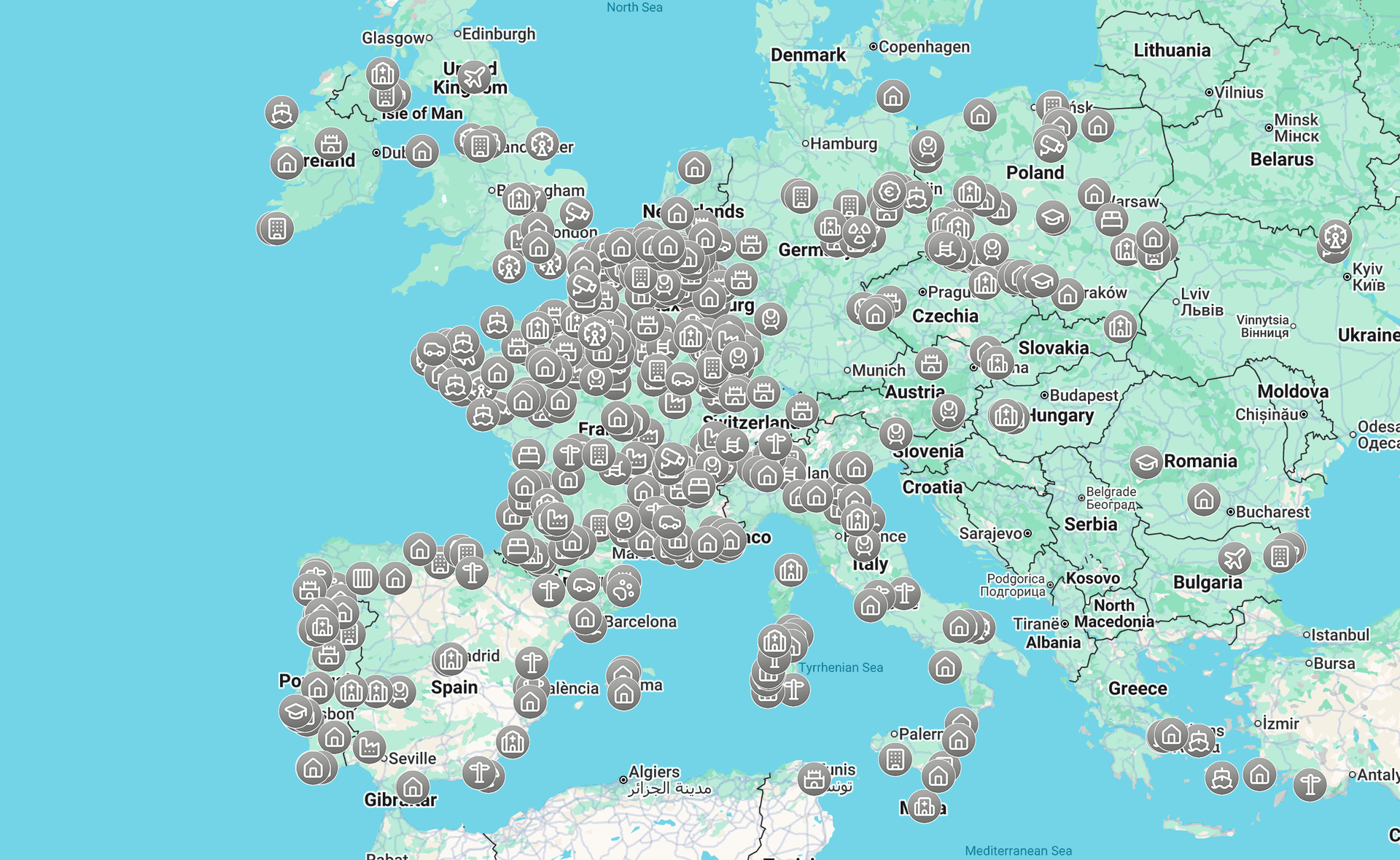
If you want a wider overview, start with Browse all urbex maps. If you want a simple entry point, Access the free urbex map gives you a practical overview before you build a more detailed route.
Access the free urbex map
Which types of abandoned places can you find on a Germany urbex map?
A Germany urbex map usually highlights recurring categories of abandoned places rather than a single style of site. The most common groups are industrial buildings, former military properties, institutional sites, hospitality venues, and transport infrastructure.
These categories matter because each one has different risks. A closed hotel is not assessed the same way as a stripped factory, a former hospital with hazardous materials, or a rail structure near active lines.
| Type of abandoned place | Typical context in Germany | What to check before visiting |
|---|---|---|
| Factories and workshops | Ruhr industry, Saxony textiles, regional manufacturing decline | Fencing, demolition status, unstable floors |
| Barracks and military remains | Former East German and Cold War areas | Ownership changes, security patrols, hidden shafts |
| Hospitals and sanatoriums | Older institutional estates, peri-urban areas | Hazardous materials, sealed wings, broken stairwells |
| Hotels and leisure sites | Mountain, spa, or rural tourism decline | Seasonal activity, private redevelopment, neighbors |
| Rail and transport infrastructure | Freight decline, disused depots, border-era remnants | Operational lines nearby, drops, restricted zones |
MapUrbex favors context over hype. That makes it easier to decide whether a site fits your experience level and whether it is worth researching further.
Where are the main regions for abandoned places in Germany?
The main regions for abandoned places in Germany are the Ruhr area, Berlin-Brandenburg, Saxony, Saarland with nearby Rhineland zones, and selected parts of Bavaria. Each region reflects a different historical pattern, so the map becomes much easier to use when you understand what produced the vacancy in the first place.
1. Ruhr area industrial sites
The Ruhr area is one of Germany's strongest urbex regions because decades of coal, steel, and heavy industry left large industrial footprints. Even after redevelopment, the landscape still includes closed plants, warehouses, workshops, and worker-related structures.
What makes the Ruhr especially useful on a map is density. Multiple industrial municipalities sit close together, so a route can be planned efficiently without relying on a single location. Access conditions vary sharply, however, and many sites are fenced, repurposed, or under surveillance.
2. Berlin and Brandenburg military and institutional remains
Berlin and Brandenburg are known for former military compounds, training grounds, hospitals, and state-era infrastructure. The region reflects both Cold War history and post-reunification property transitions.
This area attracts strong interest, but it also requires caution. Some widely shared spots are overexposed, sealed, or actively monitored. A responsible map is useful here because it helps filter rumor from current reality.
3. Saxony's factory and textile heritage
Saxony offers a different profile: mills, workshops, manufacturing buildings, and dense urban industrial districts. In many towns, nineteenth- and twentieth-century industrial architecture remains visible even when the original production is long gone.
For mapping, Saxony is valuable because site types are varied but often historically coherent. That makes the region appealing to photographers and architecture-focused explorers, provided they verify legal access before any visit.
4. Saarland and Rhineland border-industry landscapes
Saarland and nearby Rhineland areas combine mining history, steel production, transport remnants, and border-influenced infrastructure. Some abandoned places are smaller than the giant sites of the Ruhr, but they can be historically rich and geographically close.
This region works well for short urbex loops. It is also a good example of why curated maps matter: smaller sites disappear faster, get cleared without notice, or shift between abandonment and reuse.
5. Bavaria's hotels, sanatoriums, and rural complexes
Bavaria is less associated with classic heavy-industry urbex, but it still contains abandoned hospitality buildings, former health facilities, rural institutional sites, and isolated complexes. Mountain and spa areas can produce a very different visual style from western industrial regions.
The main challenge in Bavaria is uneven distribution. Good map research saves time because interesting sites are often more scattered, more seasonal, and more affected by tourism or redevelopment.
How can you verify whether an abandoned place in Germany is legal to access?
You verify legal access in Germany by checking ownership, visible restrictions, current use, and permission status before you go. A place is not legal to enter simply because it is derelict, open, or popular online.
Start with visible signals: fences, locked gates, warning signs, cameras, recent vehicle tracks, and maintained paths. Then cross-check whether the property has been redeveloped, sold, or partly reactivated. Many sites change status faster than old urbex posts suggest.
A practical rule is simple: if access is unclear, assume you do not have permission. That approach protects you legally and reduces harm to sites that are already under pressure.
For a deeper legal overview, read Urbex in Germany: How to Find Abandoned Places Legally and Safely. If you are combining several countries on one trip, How to Plan an Urbex Road Trip in Europe helps structure routing, timing, and backup options.
How should you plan a responsible urbex trip across Germany?
A responsible urbex trip across Germany starts with regional research, access checks, daylight timing, and backup destinations. The goal is not to maximize entries. The goal is to reduce legal risk, avoid unsafe sites, and preserve locations for the future.
Use a simple planning sequence:
- Choose one region instead of chasing isolated pins across the whole country.
- Build a short list by site type: industrial, military, medical, or transport.
- Check whether the place is still abandoned and whether access is legal.
- Prefer daylight visits and carry basic safety gear suited to passive observation.
- Leave immediately if the site is secured, occupied, or clearly restricted.
This is where curated mapping is stronger than viral spot-sharing. A good map gives you context, not just coordinates. That makes route decisions smarter and safer.
If you are comparing Germany with nearby destinations, Browse all urbex maps is the best overview page.
FAQ
Is urbex legal in Germany?
Urbex is not automatically legal in Germany. Legality depends on property rights, site status, signage, and whether you have permission to enter. If a place is privately owned or clearly restricted, entry can amount to trespassing. Research and verification are essential.
What are the most common abandoned places in Germany?
The most common types are factories, barracks, hospitals, hotels, and disused rail infrastructure. Their distribution varies by region and history. Western Germany often shows industrial decline, while eastern states may include more military and institutional remains.
Why is a curated Germany urbex map better than social media spot sharing?
A curated map is better because social media spots are often outdated, vague, or overexposed. Overexposure increases damage, theft, and security crackdowns. Curated mapping supports verification, safer planning, and a preservation-first approach.
What safety risks should I expect at abandoned places in Germany?
The main risks are unstable floors, broken glass, falling debris, exposed shafts, water damage, and hazardous materials such as asbestos. Some sites also have active security or partial reuse. Good planning means assessing from outside first and avoiding any doubtful structure.
Can I build a Germany urbex route around public viewpoints only?
Yes. In many cases, the safest and most responsible option is to focus on exterior photography, surrounding public roads, and legal viewpoints. That approach still lets you document architecture and industrial landscapes without entering restricted property.
Conclusion
A Germany urbex map is most useful when it helps you decide where not to go as much as where to research further. The real value is not secret coordinates. It is verified context, safer planning, and a legal, preservation-first way to explore Germany's abandoned landscapes.
Use the map to compare regions, understand site types, and filter unreliable information before you travel. That is the approach MapUrbex is built for.
Access the free urbex map