Use a verified France urbex map to find abandoned places more efficiently, compare regions, and plan responsible low-impact exploration.
France Urbex Map: Find Verified Abandoned Places Responsibly
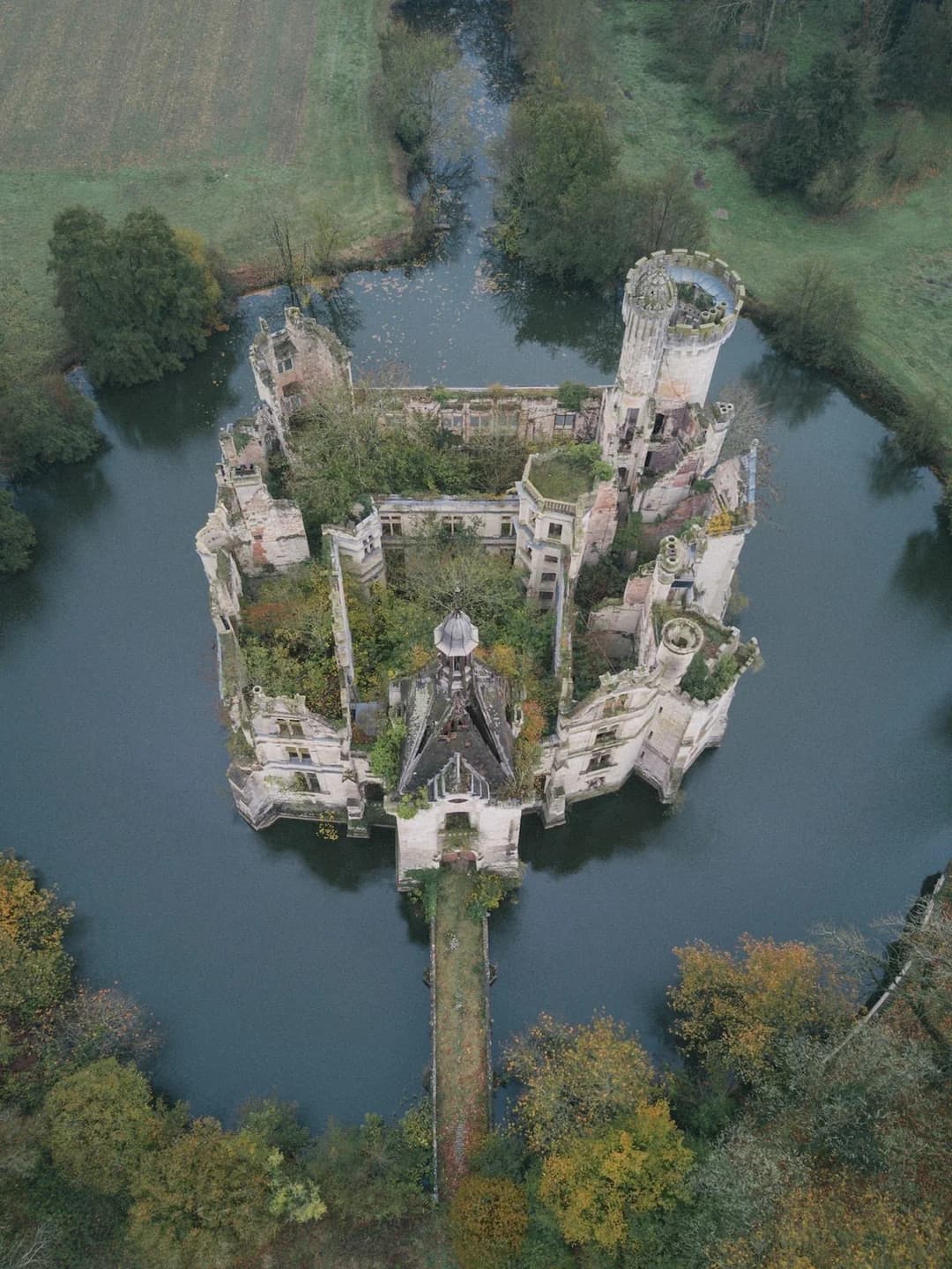
A France urbex map helps you identify abandoned places at national scale instead of searching city by city. For most people, the real problem is not finding rumors. It is finding locations that are still relevant, filtered, and usable for trip planning.
MapUrbex approaches this with verified locations, responsible urbex principles, and curated maps built for preservation-first exploration. The goal is simple: save time, reduce bad leads, and avoid turning abandoned sites into overexposed targets.
What is the best way to use a France urbex map to find verified abandoned places?
The best way to use a France urbex map is to rely on a curated database that filters outdated pins, organizes spots by region, and prioritizes verified abandoned places over random social media tips. A good map helps you compare areas, plan routes, and focus on safer, lower-impact research.
A map does not grant access or permission. It is a planning tool that works best when combined with legal checks, local context, and responsible behavior on the ground.
Quick summary
- A verified France urbex map is more useful than scattered lists because it centralizes locations and reduces outdated information.
- The most valuable maps focus on verified abandoned places, not mass-shared coordinates.
- France has strong urbex interest across industrial, military, rural, and château landscapes.
- Responsible use means checking access rules, avoiding forced entry, and protecting fragile sites.
- MapUrbex is designed for preservation-first trip planning with curated national coverage.
- You can start with Access the free urbex map or compare national options via Browse all urbex maps.
Quick facts
- Country covered: France
- Search intent: transactional and planning-focused
- Best use case: finding and sorting verified abandoned places by region
- Typical spot categories: factories, hospitals, military remains, manors, farms, hotels
- Main benefit: less time wasted on dead leads and duplicate pins
- Important reminder: a map is not permission to trespass or enter restricted property
Why does a verified France urbex map matter?
A verified France urbex map matters because abandoned places change constantly. Sites get demolished, renovated, secured, or heavily exposed. An unfiltered list quickly becomes unreliable.
That is why verified locations are more valuable than raw volume. If you are looking for spots urbex France travelers actually can research today, accuracy matters more than having the biggest pin count.
France is a large and diverse urbex territory. Industrial corridors in the north, rural heritage in the center, military remnants in the east, and abandoned estates in multiple regions create very different search patterns. A national map helps you see that structure clearly.
For a broader comparison of national options, see Top 5 Best Urbex Maps in France in 2026.
How does MapUrbex verify abandoned places in France?
MapUrbex verifies abandoned places in France by curating locations, reviewing relevance, and filtering out many low-quality or overexposed entries before they reach the map. The objective is not to publish every rumor. It is to keep the map useful and credible over time.
Verification is practical rather than sensational. A good urbex map checks whether a location still appears abandoned, whether the information is coherent, and whether the listing is worth a researcher’s time.
| Verification point | Why it matters |
|---|---|
| Recent relevance | Old coordinates often lead to demolition sites or active reuse |
| Category clarity | Users need to know whether a spot is industrial, medical, residential, or military |
| Regional organization | Route planning is easier when locations are grouped logically |
| Duplicate filtering | Repeated entries create noise and waste time |
| Responsible publishing | Preservation-first curation helps reduce harmful exposure |
This approach is especially useful for people who want a practical abandoned places map France-wide rather than endless screenshots and forum fragments.
Access the free urbex map
Which regions in France are most searched for urbex spots?
The most searched regions for urbex in France are usually those with dense industrial history, military heritage, or large stocks of disused rural buildings. Interest is high where access to multiple spot types exists within a reasonable driving radius.
The exact balance changes over time, but several regions consistently attract attention from researchers and photographers.
1. Hauts-de-France
Hauts-de-France is one of the most searched areas because it combines former industry, wartime traces, hospitals, and abandoned civic buildings. The region has density, and density is what makes route planning efficient.
It also has a strong reputation in the French urbex community. If you want a regional starting point, see Hauts-de-France Urbex Map 2026.
2. Île-de-France and the surrounding belt
Île-de-France attracts attention because the population base is large and the demand for nearby spots is constant. Many searchers are not looking for deep-remote exploration. They want day-trip options within reach of Paris and nearby departments.
The challenge here is fast turnover. Sites are often watched, repurposed, or heavily shared, which makes verification especially important.
3. Grand Est
Grand Est is regularly searched because it combines industrial heritage, military remnants, transport infrastructure, and borderland history. The region offers strong thematic variety for photographers and researchers.
It also illustrates why national maps are useful. Without a structured map, valuable regional clusters remain buried across disconnected local sources.
4. Auvergne-Rhône-Alpes
Auvergne-Rhône-Alpes draws attention for its mix of mountain villages, industrial remains, sanatorium history, and rural properties. The geography creates a wide spread of site types rather than one dominant urban concentration.
That spread makes pre-trip planning essential. A map is most helpful here when it helps prioritize areas instead of sending you across long distances for weak leads.
5. Occitanie and Provence areas
Occitanie and Provence-related searches stay popular because users look for abandoned farms, estates, hospitality sites, and scattered institutional buildings. These regions often combine photogenic settings with long travel distances.
This is where curated mapping matters. A pretty rumor is not enough if the site is now active, sealed, or transformed.
How should you evaluate an abandoned places map before you trust it?
You should trust an abandoned places map only if it is curated, regionally organized, and clearly built for current research rather than recycled internet lore. A useful map reduces uncertainty. A weak one adds it.
Use these checks before you rely on any France urbex map:
- Check regional structure. A national map should let you compare zones quickly.
- Look for curation. A smaller verified database is often better than a giant unfiltered list.
- Avoid hype-driven sources. Viral coordinates are often outdated or harmful to sites.
- Prefer context over mystery. Category, condition, and relevance matter more than dramatic branding.
- Use legal judgment. If a site is clearly restricted or occupied, do not treat a pin as an invitation.
If you are comparing offers, start with Browse all urbex maps and then go deeper with Explore abandoned places in France.
What makes a France urbex map useful for trip planning?
A France urbex map is useful for trip planning when it helps you sort by region, reduce pointless travel, and build realistic day routes around verified abandoned places. Efficiency is the real product.
That matters in France because the country is large. A random list may show 20 places, but if they are spread across five regions with no quality control, it does not help you plan anything.
A good planning workflow usually looks like this:
- Start with a national overview.
- Narrow to one region or corridor.
- Check whether the site type matches your goals.
- Verify the legal and practical context before visiting the area.
- Keep a backup plan in case a location is no longer viable.
For a method focused on research, see How to Find Abandoned Places in France.
How can you explore abandoned places in France responsibly?
You can explore abandoned places in France responsibly by treating location data as sensitive, prioritizing preservation, and never assuming a map overrides property rights or safety limits. Responsible urbex protects both people and places.
That means no forced entry, no vandalism, no theft, and no publishing behavior that accelerates damage. If a site is occupied, monitored, or clearly restricted, the correct decision is to leave it alone.
Responsible use also means understanding why verified locations are curated carefully. Overexposure shortens the life of sites. Preservation-first mapping is not about secrecy for its own sake. It is about reducing predictable harm.
Explore abandoned places in France
FAQ
Is using an urbex map legal in France?
Yes, using an urbex map as a research tool is legal in itself. What matters is what you do afterward. A map does not authorize entry onto private, occupied, or restricted property.
Are verified abandoned places always accessible?
No, verification does not mean open access. It usually means the location is relevant and appears to match its abandoned status. Access conditions can still change at any time.
Why not just use social media coordinates?
Social media coordinates are often outdated, duplicated, or posted without context. They also contribute to rapid overexposure. A curated map is more useful for planning and usually more respectful to the site.
What is the difference between a free urbex map and a country bundle?
A free urbex map is a good starting point for discovering the platform and understanding coverage. A country bundle is more suitable when you want focused national research and broader planning depth. The right choice depends on how often you explore and how specific your target region is.
Which French region is best for starting urbex research?
There is no single best region for everyone. Hauts-de-France is often a strong starting point because of density and variety, but the right region depends on your location, interests, and travel radius. A national map helps you compare those options faster.
Conclusion
A France urbex map is most useful when it helps you find verified abandoned places, compare regions, and plan with less noise. In practice, accuracy, curation, and preservation-first publishing matter more than huge unfiltered databases.
If you want a practical starting point, begin with the free map, then move to a country-level product when you need deeper coverage and better trip planning across France.
Access the free urbex map