Use a curated Texas urbex map to find abandoned places across Dallas, Houston, Austin, San Antonio, and rural Texas with verified context.
Texas Urbex Map: Find Abandoned Places Across Texas
Texas is one of the biggest and most fragmented states for urbex research. Distances are long, site types vary widely, and many old leads are outdated. A curated Texas urbex map helps you sort abandoned places by region, building type, and research value.
MapUrbex approaches Texas with a preservation-first method. The goal is to document and organize known places, not to encourage trespassing or risky access. Property status can change quickly, so always verify legality, respect private property, and avoid unsafe structures.
Where can you find a Texas urbex map?
The best way to find abandoned places across Texas is to use a curated Texas urbex map that organizes locations by region, site type, and verification status. That approach saves time, reduces dead leads, and makes it easier to research abandoned places in Dallas, Houston, Austin, San Antonio, and rural corridors without relying on random pins.
Quick summary
- A Texas urbex map is most useful when it is curated, searchable, and regularly reviewed.
- Texas has a wide mix of abandoned schools, industrial sites, motels, farms, hospitals, and roadside buildings.
- The strongest research zones usually cluster around major metro belts, rail corridors, oil infrastructure, and declining small-town districts.
- A good map helps separate promising documentation targets from outdated or duplicate leads.
- Responsible urbex in Texas starts with legal checks, safety planning, and respect for preservation.
- You can start with Access the free urbex map before comparing broader options on Browse all urbex maps.
Quick facts about the Texas urbex map
- Scope: statewide, from large cities to remote counties
- Primary use: finding and filtering abandoned places in Texas
- Best for: photographers, researchers, road trip planners, and responsible urbex users
- Common site categories: factories, schools, motels, hospitals, ranch properties, churches, warehouses, and retail shells
- Research challenge: long driving times and rapidly changing access status
- MapUrbex position: verified locations, curated mapping, and preservation-first research
Why use a curated Texas urbex map instead of random pins?
A curated Texas urbex map is better than random pins because it gives context, removes duplicate leads, and helps you prioritize places that are still relevant. In a state as large as Texas, context matters as much as the point on the map.
Many abandoned places lists on forums and social media age badly. A building may be demolished, redeveloped, sealed, or actively monitored while the old post remains online for years. Random pins also tend to omit the details that make a location useful for planning, such as site type, surrounding density, or whether the lead is recent enough to trust.
That is why many users begin with Access the free urbex map, then compare other regions through Browse all urbex maps. If you want a broader comparison of research value, the article Free vs Paid Urbex Map: Which Abandoned Places Map Is Worth It? explains what extra filtering and curation can change in practice.
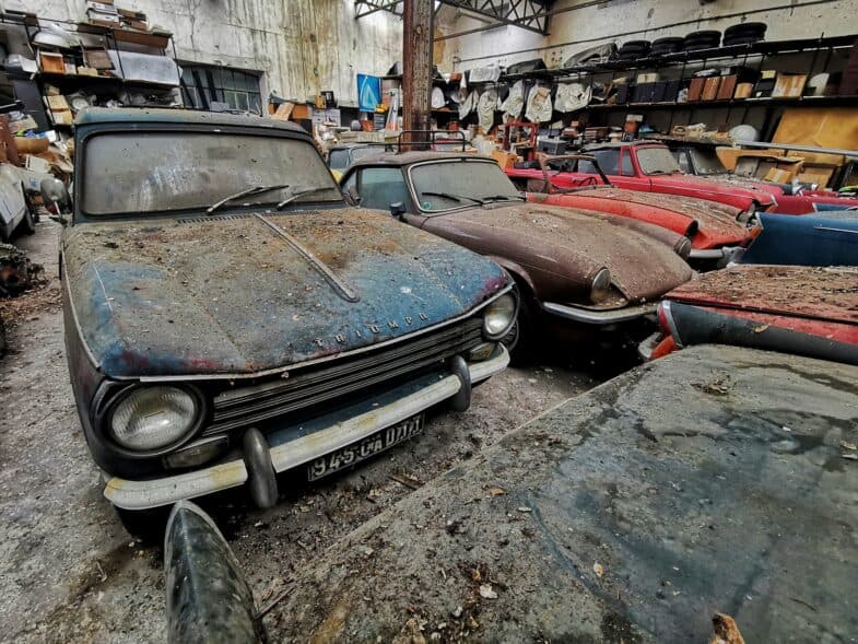
What types of abandoned places can you find in Texas?
Texas contains a wide range of abandoned places, but the most commonly mapped categories are industrial buildings, schools, healthcare sites, motels, rural properties, and commercial structures. The exact mix changes by region because Texas combines major metros, oil infrastructure, agricultural land, and older transport corridors.
Some areas produce dense clusters of small commercial abandonment. Others are better known for warehouses, depots, closed schools, or weathered roadside properties. That is why a statewide abandoned places map works best when it lets users filter by both geography and building type.
| Site type | Where it commonly appears in Texas | Why it matters on a map |
|---|---|---|
| Industrial buildings | Metro fringes, rail zones, refinery belts, old manufacturing districts | Often spread across large districts with uneven documentation |
| Schools and institutions | Small towns, older suburbs, shrinking districts | Useful for architectural research and local history context |
| Hospitals and care facilities | Larger cities and regional service centers | High interest, but also high safety and legal sensitivity |
| Motels and roadside properties | Highway corridors, bypassed towns, edge-of-city routes | Good for road trip research and visual storytelling |
| Farms, ranch buildings, and rural homes | Agricultural counties and remote backroads | Harder to validate without a curated map |
| Retail and office shells | Urban edges and changing commercial zones | Frequently redeveloped, so recent verification matters |
Which areas matter most on a Texas urbex map?
The most useful areas on a Texas urbex map are the regions where older infrastructure, economic transition, and transport routes overlap. In practice, that means major urban belts, industrial corridors, bypassed small towns, and remote service zones all matter for different reasons.
1. Dallas-Fort Worth and the North Texas belt
Dallas-Fort Worth is one of the strongest search zones because scale creates variety. Older industrial parcels, school closures, commercial turnover, and warehouse districts produce more abandoned places leads than a single-city map can show well.
North Texas also changes quickly. Some sites disappear fast through redevelopment, while others remain in semi-industrial edges or older satellite towns. A curated Texas urbex map is especially useful here because it helps distinguish short-lived leads from locations with more stable research value.
2. Houston and the Gulf corridor
Houston and the surrounding Gulf corridor matter because industrial history and constant urban change produce a broad mix of abandonment. Warehouses, service buildings, commercial shells, and infrastructure-related properties appear across a very large metropolitan footprint.
The challenge is sprawl. Distances are substantial, and older online tips can send users to demolished or inaccessible places. Map-based filtering is more practical than browsing scattered lists when you want to compare neighborhoods, corridors, and building types efficiently.
3. Austin-San Antonio and Central Texas
Central Texas is important because it mixes rapid redevelopment with older institutional and roadside sites. That combination makes it a useful research area, even though many leads have a shorter lifespan than in slower-changing regions.
Austin often loses older sites quickly, while the broader corridor toward San Antonio and surrounding towns can retain a wider range of buildings. For users interested in urbex in Texas, this region works best when the map includes context rather than isolated coordinates.
4. East Texas small towns and rail corridors
East Texas matters because small towns and transport routes often preserve the kinds of abandoned places that disappear in major cities. Closed schools, churches, depots, stores, and residential properties are more likely to appear in dispersed clusters rather than dense urban blocks.
These sites are harder to research through generic search results. A statewide map helps connect local leads to a wider pattern, especially when you are comparing county seats, former industrial pockets, and old rail-linked communities.
5. West Texas industrial and roadside zones
West Texas is important for a different reason: distance. The region includes remote service buildings, industrial remnants, motels, roadside structures, and support properties connected to older transport and energy networks.
Because the territory is sparse, random online lists are less reliable. A Texas abandoned places map is useful here not because it creates density, but because it reduces wasted drives and helps users identify where documentation is actually concentrated.
Access the free urbex map
How does MapUrbex verify abandoned places in Texas?
MapUrbex verifies Texas locations by prioritizing documented leads, recent signals, and curated review instead of unfiltered crowd noise. The goal is not to promise access, but to improve research quality.
In practice, verification means checking whether a lead still makes sense geographically and contextually, removing obvious duplicates, and organizing locations in a way that helps users understand what they are looking at. A good map also separates strong research leads from weak or stale entries.
If you are comparing entry-level options, start with Access the free urbex map. Then use Free Urbex Map 2026 as a baseline and How to Get the Best Free Urbex Map in 2026?? for a clearer selection framework.
How should you use a free abandoned places map before paying?
The best way to use a free abandoned places map is to test the workflow first: search by region, compare building types, and see whether the leads match your travel radius. If the structure saves time, then a paid layer may be worth it.
A free map is enough for many beginners. It lets you understand how Texas research works, especially the difference between dense metro zones and long-distance rural searching. It also shows whether you prefer broad discovery or more filtered results.
For that comparison, read Free Urbex Map 2026, then How to Get the Best Free Urbex Map in 2026??. If you want to evaluate value more directly, Free vs Paid Urbex Map: Which Abandoned Places Map Is Worth It? is the most relevant next step.
Browse all urbex maps
What should you check before visiting an abandoned place in Texas?
Before visiting an abandoned place in Texas, you should check legality, structural risk, weather exposure, and current site status. A map is a research tool, not permission to enter.
Use this checklist before any trip:
- Confirm legal status: Never assume an abandoned building is open for entry. Private property laws still apply.
- Review recent context: A site may have been demolished, secured, or repurposed since the last report.
- Plan for Texas conditions: Heat, storms, long distances, and low-service areas increase risk.
- Assess structural hazards: Roof failure, unstable floors, mold, broken glass, and vertical drops are common.
- Protect the site: Do not force entry, move barriers, vandalize, or remove objects.
- Travel responsibly: Tell someone your route and avoid isolated locations without preparation.
Responsible urbex means documentation without damage. Preservation matters more than getting inside a specific building.
FAQ
Is a Texas urbex map useful for beginners?
Yes, a Texas urbex map is useful for beginners because it reduces random searching and helps organize sites by region. Texas is too large for trial-and-error research to be efficient. A curated map makes it easier to learn how abandoned places are distributed across the state.
Are all abandoned places in Texas legal to enter?
No, abandoned does not mean legal to enter. Many sites are still private property, under surveillance, or structurally unsafe. Always verify access rules and never force entry.
Which Texas cities usually have the most abandoned places?
Dallas-Fort Worth and Houston usually generate the broadest mix because of their size, industrial history, and constant redevelopment. Central Texas also produces many leads, but they can disappear faster. Smaller towns matter too, especially along rail lines and older highway corridors.
Should you use a free or paid Texas urbex map?
Start with a free map if you want to test the research workflow. Upgrade only if you need better filtering, wider coverage, or more efficient trip planning. The right choice depends on how often you search and how much time you want to save.
Can a map guarantee that a Texas location is still accessible?
No map can guarantee access because conditions change quickly. Buildings can be sealed, demolished, monitored, or converted to a new use. The value of a curated map is better research quality, not guaranteed entry.
Conclusion
A Texas urbex map is most valuable when it does more than drop pins. It should help you understand where abandoned places cluster, what kinds of sites each region produces, and which leads are worth your time.
For Texas, that matters more than in smaller states because distance, redevelopment, and inconsistent online information create real research friction. Start with a curated tool, verify legality before every visit, and keep preservation at the center of the process.
Access the free urbex map