Explore the North Carolina urbex map with a responsible guide to abandoned mills, schools, coastal sites, and verified research methods.
North Carolina Urbex Map: Hidden Abandoned Locations Explained
North Carolina has one of the most varied abandoned landscapes in the United States. Textile decline, tobacco restructuring, rural depopulation, tourism change, and military history all left different site types across the state.
A North Carolina urbex map helps organize that variety. Instead of chasing random social posts, it lets you compare regions, verify context, and research sites with a preservation-first approach. For broader regional browsing, Browse all urbex maps.
Where can you find a North Carolina urbex map?
A North Carolina urbex map is the most useful way to research abandoned places across the state because it groups verified pins, historical context, and safety notes in one place. The best maps do not encourage trespass. They help you understand where mills, schools, hospitals, farm structures, and coastal remnants appear in North Carolina without exposing fragile sites carelessly.
Quick summary
- North Carolina's abandoned places are tied to textile, tobacco, rail, military, and rural change.
- The most useful map of abandoned places shows context, not just raw coordinates.
- Piedmont mill towns and former industrial corridors are the state's strongest urbex zones.
- Coastal and mountain areas have smaller but distinctive abandoned site clusters.
- Responsible urban exploration in North Carolina means checking ownership, legality, and structural risk before any visit.
- Beginners should use verified research methods instead of chasing social media drops.
Quick facts
- Location: Southeastern United States
- Scope: Statewide guide for North Carolina
- Best-known abandoned categories: Textile mills, warehouses, schools, hospitals, farm structures, roadside businesses, coastal remnants
- Main historical drivers: Deindustrialization, agricultural shifts, rail decline, changing tourism, institutional closure
- Research goal: Build a reliable North Carolina urbex map rather than collect random pins
- Approach: Verified locations, responsible urbex, preservation-first mapping
Why does North Carolina have so many abandoned places?
North Carolina has many abandoned places because several different economic systems changed at the same time. Textile manufacturing contracted, tobacco operations reorganized, rural communities lost population, and older roadside businesses were bypassed by newer transport routes.
The result is an unusually mixed abandoned landscape. In one state, researchers can find former mills in the Piedmont, empty schools in rural counties, disused industrial buildings near rail lines, and scattered coastal or mountain properties tied to older tourism cycles.
This variety is why a statewide map matters. A random list of North Carolina urbex spots is rarely enough. A structured guide helps separate industrial clusters from isolated rural sites and makes it easier to understand why certain counties have more activity than others.
What kinds of abandoned locations appear on a North Carolina urbex map?
A North Carolina urbex map usually includes industrial, institutional, rural, and transport-related sites. The most common entries are former textile facilities, tobacco warehouses, schools, hospitals, motels, farm buildings, and small commercial structures left behind by local economic change.
Some types are widespread, while others are regional. The table below shows the main patterns.
| Type of abandoned place | Where it often appears | Why it is common | Main caution |
|---|---|---|---|
| Textile mills and factories | Piedmont cities and mill towns | Long-term industrial decline and relocation | Heavy structural damage, broken floors, asbestos |
| Warehouses and rail-side buildings | Former freight corridors and tobacco towns | Logistics change and warehouse consolidation | Unstable roofs, active rail property |
| Schools and hospitals | Smaller towns and county seats | Consolidation of public services | Security, hazardous materials, locked utilities |
| Farmhouses and barns | Rural interior counties | Agricultural change and land turnover | Collapse risk, private ownership |
| Motels, gas stations, roadside businesses | Older highways and bypassed corridors | Traffic shifted to interstates | Glass, squatters, environmental hazards |
| Coastal or military remnants | Shoreline zones and former defense areas | Storm damage, erosion, changing use | Exposure, flooding, legal restrictions |
A good map of abandoned places in North Carolina does more than label categories. It should explain age, context, access sensitivity, and whether a site is historically important enough to avoid public overexposure.
Legal and safety reminder: urban exploration in North Carolina is not a right of access. Always respect ownership, posted restrictions, and preservation concerns. Never force entry or publish sensitive details that increase vandalism risk.
Which parts of North Carolina matter most for abandoned-place research?
The most relevant parts of North Carolina for abandoned-place research are the Piedmont industrial belt, former tobacco and rail corridors, mountain tourism zones, coastal military landscapes, and rural interior counties. Each region produces different site types, different risks, and different preservation issues.
1. The Piedmont mill belt
The Piedmont is the strongest area for industrial abandonment in North Carolina. Cities and towns between Charlotte, Gastonia, Greensboro, High Point, Burlington, and smaller manufacturing communities contain the deepest concentration of mill-era buildings.
Many of these sites reflect the long decline of domestic textile production. Large brick complexes, weaving sheds, warehouses, power buildings, and worker-related infrastructure often survive in partial form, even when the original business is gone.
From a mapping perspective, the Piedmont matters because patterns repeat. Once you understand rail access, river power history, and the location of old manufacturing districts, the map becomes much easier to read.
2. Former tobacco and rail corridors
North Carolina's tobacco economy left behind warehouses, processing buildings, storage structures, and distribution sites. These are often tied to towns that once depended on rail movement and regional agricultural trade.
Even where major city cores have been redeveloped, secondary corridors still show traces of older logistics landscapes. Smaller depots, loading buildings, and vacant commercial blocks often tell the more complete story.
These areas are useful for research because they connect economic history with physical geography. A verified map can show how abandoned places in North Carolina often cluster around former transport systems rather than appearing randomly.
3. Mountain resort and roadside decline
Western North Carolina has fewer large industrial ruins, but it has a different kind of abandonment. Closed motels, shuttered camps, seasonal businesses, forgotten attractions, and isolated institutional buildings appear along older mountain travel routes.
These sites often look less dramatic than a giant mill, but they are historically important. They reflect changes in tourism, road design, insurance costs, and the economics of maintaining remote properties.
Researchers should treat mountain sites carefully. Weather exposure, rotten wood, and steep terrain can make a modest-looking building more dangerous than a larger urban shell.
4. Coastal military and maritime remnants
North Carolina's coast includes layers of military history, maritime infrastructure, and storm-related abandonment. Depending on the exact area, researchers may find small defense remnants, disused service structures, weather-damaged facilities, or older waterfront buildings with changing uses.
Coastal abandonment is often fragmented. A site may not be a classic large ruin. Instead, the map may reveal scattered remnants shaped by erosion, redevelopment pressure, or repeated hurricane impact.
This is one reason urban exploration in coastal areas needs restraint. Sensitive shoreline locations can degrade quickly when too many visitors treat them like content backdrops instead of vulnerable historical places.
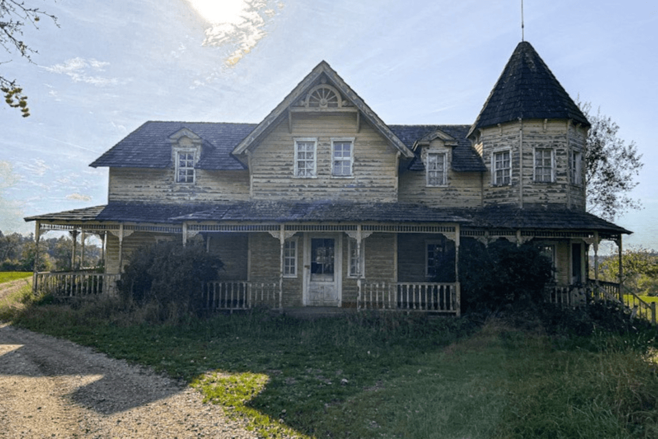
5. Rural schools, churches, and farm structures
Much of North Carolina's hidden abandonment is rural rather than urban. Closed schools, empty churches, tenant houses, barns, and small civic buildings are common in counties that lost population or consolidated services.
These places rarely trend online, but they matter on a curated map. They help explain regional decline, changes in agriculture, and the slow disappearance of small community institutions.
They also require the most caution. Rural sites are almost always on private land, often near occupied homes, and should never be approached casually.
How should you use a map of abandoned places in North Carolina responsibly?
You should use a map of abandoned places in North Carolina as a research and planning tool, not as a shortcut to unlawful entry. The responsible method is to confirm ownership, compare historical context, evaluate hazards, and avoid sharing sensitive access details that can damage a place.
If you are new to the hobby, start with How to Start Urbex: A Beginner's Guide to Urban Exploration. It explains the mindset that matters most: respect the site, leave no trace, and do not treat abandoned buildings like disposable scenery.
For research workflow, How to Find Abandoned Places with Google Maps shows how satellite imagery, parcel boundaries, and surrounding land use can help you filter weak leads. How to Find Abandoned Places Near Me: A Step-by-Step Urbex Method is useful if you want a repeatable process rather than random browsing.
A verified map is most helpful when combined with judgment. If a location is active, occupied, fenced, structurally compromised, or culturally sensitive, the correct decision may be to document it from public space only or skip it entirely.
Access the free urbex map
What makes a verified urbex map more useful than random pins?
A verified urbex map is more useful than random pins because it adds context, filtering, and preservation standards. Raw coordinates can spread quickly, but they do not tell you whether a site is demolished, occupied, misidentified, or too sensitive to publicize widely.
MapUrbex focuses on curated mapping. That means the goal is not maximum exposure. The goal is better research, clearer regional understanding, and lower harm to fragile places.
For travelers comparing states, Browse all urbex maps is the easiest way to see how North Carolina fits into broader US abandonment patterns. State-level variation matters. The industrial logic of North Carolina is not the same as the mining logic of Appalachia or the desert logic of the Southwest.
FAQ
Is urban exploration legal in North Carolina?
Urban exploration is not automatically legal in North Carolina. Legality depends on ownership, access permission, posted restrictions, and site status. An abandoned building can still be private property, and entering without authorization can be trespassing.
What abandoned places are most common in North Carolina?
The most common abandoned places in North Carolina are textile mills, warehouses, schools, rural farm structures, roadside businesses, and smaller institutional buildings. The exact mix changes by region. Industrial sites dominate the Piedmont, while rural and tourism-related sites are more common elsewhere.
Should a North Carolina urbex map include exact entry points?
No. A responsible North Carolina urbex map should prioritize identification, history, and verification over sensitive access details. Publishing entry points often accelerates vandalism, theft, and unsafe behavior.
Can beginners use a North Carolina urbex map safely?
Beginners can use a North Carolina urbex map safely if they treat it as a research tool and follow conservative rules. Stay in legal public areas when uncertain, avoid unstable structures, and never go alone into hazardous properties. Education matters more than collecting a high number of spots.
Why are so many abandoned places in North Carolina tied to industry?
Many abandoned places in North Carolina are tied to industry because textiles, warehousing, rail movement, and agricultural processing once shaped the state's economy. When those systems shrank or moved, large specialized buildings were left behind. That industrial legacy still defines the state's urbex geography.
Conclusion
A strong North Carolina urbex map explains more than where abandoned places are. It shows why they exist, which regions produce the most meaningful patterns, and how to research them without increasing risk to people or sites.
If you want to explore abandoned locations in North Carolina responsibly, focus on verified information, historical context, and preservation-first decisions. That approach produces better research and helps protect the places that still remain.
Access the free urbex map