Use this Missouri urbex map guide to understand the state's main abandoned site types, research areas responsibly, and plan safer, preservation-first exploration.
Missouri Urbex Map: Urbex Locations and Exploration Guide
Missouri has one of the most varied urbex landscapes in the central United States. Large industrial cities, railroad infrastructure, river towns, mines, farms, and closed institutions all shape the state's abandoned geography.
A good Missouri urbex map is useful because the state is geographically diverse. Urban ruins in St. Louis do not require the same research methods as rural agricultural sites in northern Missouri or isolated industrial remains in the Ozarks.
This guide explains what a Missouri urbex map should help you find, how to research Missouri urbex locations responsibly, and how to use curated information without treating a map as permission to enter private property.
What is the best Missouri urbex map?
The best Missouri urbex map is a curated, regularly updated map that helps you identify likely abandoned areas, understand site types, and plan legal, low-impact research across the state. In practice, a useful map does not just show points. It adds context about risk, access uncertainty, regional patterns, and preservation-first exploration.
Quick summary
- Missouri combines industrial ruins, riverfront infrastructure, agricultural decay, and institutional abandonment.
- A strong Missouri urbex map should prioritize verified information, not recycled social posts.
- St. Louis and Kansas City offer the widest concentration of urban and industrial environments.
- Smaller towns and rural corridors often contain mills, schools, depots, silos, and farm structures.
- A map is a research tool, not proof of legal access or permission to enter.
- Responsible exploration in Missouri means respecting property, avoiding damage, and protecting sensitive locations.
Quick facts
- State: Missouri
- Primary urbex environments: Industrial, rail, civic, agricultural, medical, educational, and commercial ruins
- Major urban anchors: St. Louis, Kansas City, Springfield, Joplin, Columbia, and older river towns
- Geographic advantage: Strong mix of dense city fabric and sparsely populated rural territory
- Best research season: Fall through early spring often improves visibility, but weather and safety conditions vary
- Safety reminder: Never force entry, ignore posted restrictions, or enter unstable structures
Access the free urbex map
Why use a Missouri urbex map instead of random social posts?
A Missouri urbex map is more reliable than random social posts because it organizes information by geography, site type, and research value instead of hype. That matters in a state where abandoned places can range from downtown factories to remote grain infrastructure.
Social media lists often repeat old information without checking whether a place has been demolished, renovated, secured, or made dangerous by collapse and fire damage. A curated map reduces that noise. It helps you sort locations by regional patterns and avoid wasting time on dead leads.
If you want a broader overview beyond Missouri, Browse all urbex maps is the best starting point. For method-based research, How to Find Abandoned Places with Google Maps explains how to screen areas before you ever travel.
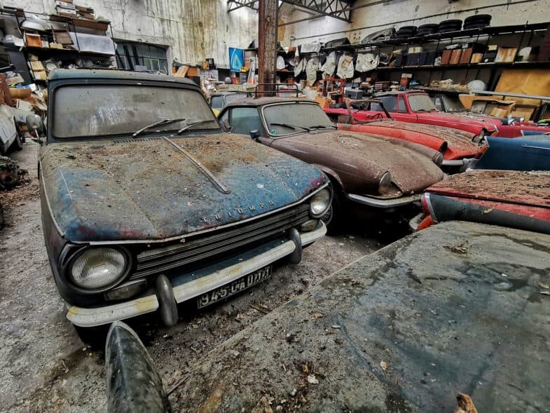
What types of Missouri urbex locations can you expect to find?
Missouri urbex locations usually fall into a few recurring categories: industrial sites, transport infrastructure, institutional buildings, rural agricultural structures, and abandoned commercial properties. The exact mix changes sharply from one region to another.
| Location type | Common Missouri context | What explorers should know |
|---|---|---|
| Factories and warehouses | St. Louis, Kansas City, older manufacturing corridors | Often large, heavily exposed, and structurally inconsistent |
| Rail infrastructure | Freight zones, depots, sidings, river transport corridors | Access is often restricted and active lines remain hazardous |
| Schools and hospitals | Small towns, suburban edges, older districts | Ownership changes are common and conditions deteriorate quickly |
| Farms, silos, and barns | Northern Missouri, central plains, Ozarks outskirts | Remote settings add weather, terrain, and isolation risks |
| Motels, gas stations, retail shells | Highway corridors and bypassed towns | Easy to spot, but not always truly abandoned |
| Civic and riverfront buildings | Historic towns along the Mississippi and Missouri rivers | Preservation concerns are common and some sites are monitored |
The main research lesson is simple: not every empty-looking building is abandoned, and not every abandoned building is worth a visit. Curated mapping is useful because it helps separate visible vacancy from meaningful exploration leads.
Which parts of Missouri offer the broadest range of urbex environments?
The broadest range of urbex environments in Missouri is found in a handful of major regional clusters. St. Louis and Kansas City dominate for scale, but smaller cities, river towns, and rural belts add site diversity that many explorers overlook.
1. St. Louis industrial corridors
St. Louis has the state's deepest concentration of industrial and warehouse environments. Old manufacturing zones, freight infrastructure, vacant commercial blocks, and long-disused service buildings give the city a dense urban exploration profile.
The main advantage of the St. Louis area is variety. You can study how industry, rail, migration, and redevelopment overlap in one metropolitan region. The main limitation is that legal status changes quickly, and many structures are either actively monitored or too unstable to approach closely.
2. Kansas City rail and warehouse districts
Kansas City offers a different but equally important urbex landscape. Its historic freight role created clusters of warehouses, industrial yards, transport buildings, and edge-of-downtown commercial abandonment.
Compared with St. Louis, Kansas City often feels more spread out. A good map matters here because the most useful patterns are corridor-based rather than concentrated in one compact district. Research is more efficient when you group places by transport history and redevelopment pressure.
3. Springfield and the southwest manufacturing belt
Southwest Missouri, including Springfield and nearby industrial towns, contains a mix of commercial vacancy, light manufacturing remains, and bypassed roadside properties. This region is especially useful for explorers interested in mid-scale abandonment rather than massive urban complexes.
The pattern here is often incremental decline rather than sudden collapse. That means you may find more modest but historically readable sites, including workshops, older storefronts, service stations, and small industrial shells.
4. Mississippi River towns and older civic centers
Missouri's eastern river towns often contain some of the state's most photogenic abandoned fabric. Former schools, municipal buildings, river-related industry, and older commercial streetscapes can survive long after economic activity has shifted elsewhere.
These places require extra care. Historic town centers are more likely to have preservation value, visible local ownership, or community sensitivity. Responsible explorers should treat them as cultural landscapes, not just abandoned backdrops.
5. Rural Missouri, the Ozarks, and agricultural infrastructure
Rural Missouri expands the map beyond city ruins. Barns, grain elevators, sheds, mining traces, isolated houses, and forgotten roadside businesses appear across wide areas of the state.
These locations can look simple, but they create different risks: long travel times, poor phone coverage, unstable floors, animals, weather exposure, and uncertain ownership. A curated Missouri urbex map is especially useful in rural zones because distance makes bad leads more costly.
How should you research a site before leaving home?
You should research a Missouri urbex site by confirming whether it appears abandoned, checking current land use, understanding the surrounding area, and preparing a no-entry plan if legality or stability is uncertain. Good research reduces wasted trips and prevents reckless decisions.
Start with map-based pattern reading. Look for disused rail lines, bypassed downtown strips, former industrial parcels, and rural service roads that connect older infrastructure. Then compare satellite imagery, street-level context where available, parcel clues, recent business activity, and signs of redevelopment.
For a step-by-step process, read How to Start Urbex: A Beginner's Guide to Urban Exploration and How to Find Abandoned Places Near Me: A Step-by-Step Urbex Method. Those guides are useful because they treat exploration as research, not impulse travel.
A simple pre-visit checklist helps:
- Confirm whether the site still exists
- Check whether the property looks active, fenced, or posted
- Review access roads, parking realities, and nearby occupied buildings
- Note water, weather, and seasonal ground conditions
- Prepare backup locations so you do not feel pressure to take risks
How can you explore Missouri responsibly and safely?
You can explore Missouri responsibly and safely by treating every location as potentially private, unstable, and culturally significant. The core rule is simple: if access is unclear, do not enter.
MapUrbex is built around verified locations, responsible urbex, and preservation-first research. That means no forced entry, no sharing of sensitive details that increase damage, no theft, and no behavior that turns abandonment into destruction.
Use these baseline rules:
- Respect property rights and posted restrictions
- Avoid roofs, basements, fire-damaged structures, and flood-affected buildings
- Never explore active rail property or equipment
- Do not move objects, break barriers, or open sealed points of entry
- Leave no trace and do not publish details that could accelerate vandalism
- If a site feels unstable or occupied, leave immediately
In Missouri, weather is also part of safety. Ice, summer heat, hidden vegetation, ticks, and storm exposure can be as serious as structural hazards.
When is the best time of year to use a Missouri urbex map?
The best time of year to use a Missouri urbex map is usually fall through early spring, when vegetation is lower and sightlines are clearer. In many parts of the state, summer growth can hide access roads, holes, debris, and water damage.
Winter can improve visibility, but it also increases slip risk and can make roofs, metal stairs, and concrete surfaces dangerous. Spring often reveals flood effects near rivers, while summer creates heat stress and thicker insect activity in rural areas.
The practical answer is to research year-round and visit only when site conditions, weather, and legality align. Good timing is part of responsible exploration.
FAQ
Is urbex legal in Missouri?
Urbex itself is not a special legal category in Missouri. The legal issue is usually trespassing, entry without permission, or access to restricted property. A map can support research, but it does not grant the right to enter any site.
What are the most common abandoned spots in Missouri?
The most common abandoned spots in Missouri are former industrial buildings, warehouses, schools, rural farm structures, roadside businesses, and transport-related sites. The exact mix depends on region. Large cities skew industrial, while rural counties often show agricultural and roadside decay.
Can beginners use a Missouri urbex map effectively?
Yes, beginners can use a Missouri urbex map effectively if they use it as a planning tool rather than a destination list. Start with exterior observation, public viewpoints, and strong pre-visit research. Beginners should prioritize legal, low-risk environments and avoid unstable ruins.
Why does MapUrbex focus on verified and curated information?
MapUrbex focuses on verified and curated information because abandoned places change fast. Demolition, redevelopment, fire, and security updates make old lists unreliable. Curated mapping gives explorers better context and supports preservation-first decision-making.
Should you trust old forum threads and copied pin lists?
You should treat old forum threads and copied pin lists cautiously. Many of them circulate outdated or incomplete information. They can still help with historical context, but they should never be your only source for planning.
Conclusion
A Missouri urbex map is most useful when it does more than show abandoned spots on a screen. It should help you understand regional patterns, site types, risk, and the limits of legal access across one of the most varied exploration states in the Midwest.
The strongest approach is careful, local, and preservation-first. Use curated tools, verify what you can, and treat every site as part of a broader historical landscape rather than a disposable photo opportunity.
Access the free urbex map