Learn how to find abandoned places near you with a safe, legal, and efficient urbex research method for 2026.
How to Find Abandoned Places Near You in 2026
Finding abandoned places near you is easier in 2026 than it was a few years ago, but the best results still come from methodical research. Random searching rarely works for long. A repeatable scouting process does.
The goal is not just to spot empty buildings. It is to identify real abandoned locations, filter out false positives, and check basic legal and safety conditions before you go anywhere near a site.
How can you find abandoned places near you in 2026?
You can find abandoned places near you by combining a curated urbex map, satellite imagery, street-level clues, local records, and access checks. In practice, the fastest method is to start with verified leads, confirm visible signs of vacancy, and rule out active, private, or unsafe sites before planning any visit.
Quick summary
- Start with verified leads instead of random map browsing.
- Use satellite view, Street View, and recent photos to confirm vacancy signals.
- Compare multiple sources before assuming a place is abandoned.
- Never treat an abandoned-looking building as legal to enter.
- Focus on responsible scouting, preservation, and permission-aware exploration.
- Use curated tools to save time and reduce false positives.
Quick facts
- A good urbex scouting method is based on verification, not guesswork.
- The most common false positives are vacant homes, seasonal buildings, and active industrial sites.
- Satellite imagery helps, but local context matters more than one image.
- Exterior research is usually enough to decide whether a lead is worth tracking.
- Legal access and physical safety must be checked separately.
| Source | What it helps confirm | Main limitation |
|---|---|---|
| Curated urbex map | Existing reports, regional density, lead quality | Access still needs local verification |
| Satellite imagery | Roof damage, overgrowth, vehicle absence, isolation | Images may be old |
| Street View | Boarded windows, signage decay, sealed entrances | Coverage may be missing or outdated |
| Public records | Ownership, permits, closure history, redevelopment | Varies by country and city |
| Local observation from public space | Current condition and activity level | Must stay legal and non-intrusive |
Which sources are most reliable for finding abandoned places?
The most reliable sources are curated maps, historical clues, and current visual confirmation used together. No single source is enough on its own.
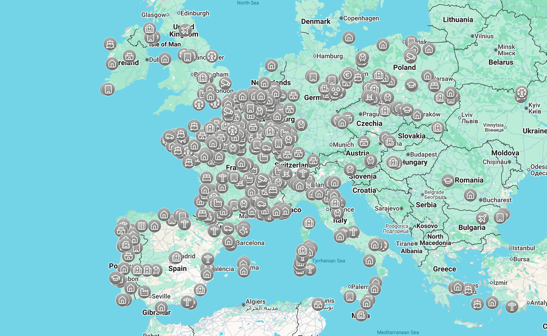
A curated map is usually the best starting point because it saves research time and filters obvious dead ends. On MapUrbex, the emphasis is on verified locations, responsible urbex, and preservation-first discovery. If you want a broad overview first, Browse all urbex maps.
After that, use satellite imagery and street-level tools to check whether the location still appears inactive. This is where many searchers avoid wasted trips. A site that looked abandoned two years ago may now be fenced for redevelopment, occupied, or demolished.
Local archives, business directories, and news articles are also useful. They help confirm closures, bankruptcies, relocations, fires, or future redevelopment plans. When several signals point in the same direction, the lead becomes much stronger.
For a map-based workflow, see How to Find Abandoned Places with Google Maps. For a practical scouting sequence, see How to Find Abandoned Places Near Me: A Step-by-Step Urbex Method.
How do you use maps and satellite imagery effectively?
You use maps effectively by looking for patterns, not isolated details. One broken roof means little. Several vacancy signals in the same place mean more.
Start by scanning areas with older industrial zones, rail corridors, edge-of-town commercial strips, or rural institutional buildings. Then zoom in and check for common markers:
- overgrown lots
- empty parking areas
- roof collapse or patch failure
- faded lot markings
- unused loading bays
- no visible recent maintenance
- disconnected site circulation
Street View adds another layer. Look for boarded windows, unreadable signage, chained gates, broken glass that has not been repaired, or long-term neglect. If the imagery is old, compare it with recent user photos or local references before deciding anything.
If you are new to the research side of exploration, How to Start Urbex: A Beginner's Guide to Urban Exploration explains the basics.
What signs suggest a place is actually abandoned?
A place is more likely to be abandoned when multiple signs of long-term vacancy appear together. One sign alone is not enough.
The strongest indicators usually include:
- sealed or boarded access points
- visible weather damage with no repair activity
- vegetation growth across paths, lots, or entrances
- absent utilities or removed fixtures
- closure notices, old branding, or obsolete operating information
- repeated local references describing the site as closed or disused
Be careful with assumptions. A building can look empty and still be private, monitored, or temporarily unused. Hospitals, schools, warehouses, farms, and military-related sites require extra caution because appearance often misleads.
How do you check whether a site is legal and safe to approach?
You check legality and safety by treating them as two separate questions. A place can be physically accessible but illegal to enter. It can also be legal to view from public space but unsafe to get close to.
Before any visit, verify at least these points:
- Is the land private, restricted, or clearly signed against entry?
- Is there evidence of active use, security patrols, or redevelopment work?
- Can the site be observed from public space without crossing barriers?
- Are there structural risks such as collapse, water damage, exposed shafts, or contamination?
- Is the area sensitive from a preservation or community standpoint?
Responsible urbex never means forced access, trespassing, vandalism, or bypassing security. If entry is prohibited, the correct decision is not to enter.
What is a practical urbex scouting workflow for 2026?
A practical workflow is simple: collect leads, verify them, filter them, then decide whether the site deserves more research.
A solid process looks like this:
- Start with a verified map or trusted lead source.
- Check satellite view and street-level imagery.
- Search the location name with terms like closed, demolition, redevelopment, or fire.
- Review public records or local planning references if available.
- Confirm whether the site can be viewed legally from public space.
- Drop the lead if access, legality, or safety is unclear.
- Keep notes with dates, status changes, and source quality.
This approach is slower than guessing, but it produces better results and fewer risky decisions. If you want a starting point, Access the free urbex map gives you a practical first layer of verified discovery.
Why does a curated urbex map save so much time?
A curated urbex map saves time because it reduces the biggest problem in scouting: false positives. Most beginners waste hours checking places that are active, demolished, or never abandoned at all.
A good map does not replace verification. It improves the quality of the first lead. That matters because every later step becomes easier when the original signal is strong.
MapUrbex is built around verified locations, responsible exploration, and preservation-first research. That positioning matters if you want a tool that supports careful scouting instead of reckless trend chasing.
FAQ
Is it legal to visit abandoned places near me?
Sometimes, but not automatically. Abandoned does not mean public. Many sites remain private property, restricted land, or active redevelopment zones. Always check local rules, posted signs, and access status before going.
Can Google Maps help find abandoned places?
Yes. Google Maps, satellite view, and Street View can reveal vacancy clues, site layout, and change over time. They work best when combined with local records and verified leads rather than used alone.
Are all abandoned buildings dangerous?
Not all of them, but many carry hidden risks such as unstable floors, water damage, asbestos, exposed metal, or unsafe surrounding terrain. Risk assessment should be conservative, especially if you only know the site from online research.
What is the best way to avoid false positives?
Use at least three source types: a curated lead, a visual map check, and a current context check such as local news or public records. If the signals conflict, treat the location as unconfirmed.
What is the best urbex map for beginners in 2026?
The best beginner-friendly option is a curated map that emphasizes verified locations and responsible use. It should help you find leads faster while still reminding you to verify legality, safety, and current status.
Conclusion
If you want to find abandoned places near you in 2026, the key is not secret knowledge. It is a repeatable method. Start with better leads, confirm them with multiple sources, and reject anything unclear on access or safety.
That is the difference between random searching and responsible urbex research. Good scouting protects your time, improves accuracy, and supports preservation-first exploration.
Access the free urbex map