A practical guide to using a Georgia urbex map to research abandoned places across the southern United States, with regional tips, common site types, and responsible exploration advice.
Georgia Urbex Map: Abandoned Locations in the Southern United States
Georgia is one of the most varied states for urban exploration in the American South. The state combines old industry, rural decline, military history, transport infrastructure, and fast-changing metro areas.
In this guide, Georgia refers to the U.S. state, not the country. The goal is simple: explain how a Georgia urbex map helps you research abandoned places more efficiently, more safely, and with a preservation-first mindset.
Where can you find a Georgia urbex map?
You can find a Georgia urbex map by using a curated resource that organizes abandoned locations by region, site type, and research value instead of relying on random social media pins. For responsible planning, start with verified map collections such as Browse all urbex maps, then combine them with local research, ownership checks, and legal access rules.
Quick summary
- Georgia is a strong urbex state because it mixes industrial ruins, rural abandonment, coastal remnants, and former institutions.
- The main research zones include the Atlanta metro fringe, Savannah and the coast, north Georgia mill towns, central Georgia corridors, and rural south Georgia.
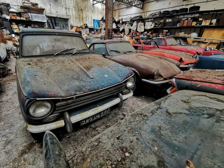
- Common abandoned places in Georgia include mills, warehouses, schools, hospitals, rail structures, motels, and agricultural complexes.
- A curated map is more reliable than scattered coordinates because ownership, demolition, and redevelopment change quickly.
- Georgia exploration requires extra attention to heat, storms, vegetation, insects, and structural decay.
- Responsible urbex means no trespassing, no forced entry, no theft, and no damage to historic sites.
Quick facts
- Location: Georgia, southeastern United States
- Region: Southern U.S. / Deep South
- Primary urban anchor: Atlanta metro
- Common abandoned site types: mills, factories, schools, hospitals, warehouses, rail depots, motels, farm infrastructure
- Research challenge: private ownership and rapid redevelopment in growing corridors
- Best workflow: curated map, satellite review, historical context, and legal verification
What makes Georgia a strong state for urbex in the southern United States?
Georgia is a strong state for urbex because it has several layers of abandonment at once: old textile industry, rail infrastructure, shrinking rural properties, closed institutions, and coastal military history. Few southern states combine this much geographic variety inside one map area.
The Atlanta region adds former industrial and commercial buildings. North Georgia contributes old mill and manufacturing landscapes. Savannah and the coast add warehouses, defense-related structures, and maritime infrastructure. Central and south Georgia often reveal schools, motels, agricultural buildings, and small-town commercial decline.
That variety matters for research. A good Georgia urbex map is not only about finding one spot. It helps you compare different parts of the state and understand which type of abandoned place is most likely in each area.
Which abandoned places are most common in Georgia?
The most common abandoned places in Georgia are former industrial buildings, institutional sites, transport-related structures, and rural commercial properties. The exact mix changes by region, but those four categories appear again and again across the state.
- Textile and light industry: Old mills, brick factories, machine shops, and warehouse buildings are especially relevant in older industrial corridors.
- Schools and hospitals: Closed campuses, former clinics, and institutional complexes appear more often in smaller cities and older county seats.
- Rail and roadside infrastructure: Depots, freight buildings, motels, garages, and service properties are common near historic transport routes.
- Agricultural and rural sites: Barn complexes, storage facilities, abandoned farm outbuildings, and small processing structures appear throughout south Georgia.
- Coastal and military remnants: Some coastal zones contain defense-related remains or maritime structures, although many are protected, unstable, or legally restricted.
If you are new to research, it helps to study patterns instead of chasing exact coordinates. The article How to Find Abandoned Places with Google Maps is useful for learning how map-based research works before you focus on one Georgia county.
Where are the main urbex zones in Georgia?
The main urbex zones in Georgia are the Atlanta metro fringe, the Savannah coastal area, north Georgia mill regions, central Georgia urban corridors, and rural south Georgia. Each zone has a different history of abandonment, which is why a statewide map is useful.
| Region | Common site types | Why it matters | Main caution |
|---|---|---|---|
| Atlanta metro fringe | Warehouses, commercial buildings, industrial shells | Fast turnover and large building stock | Redevelopment and private security |
| Savannah and the coast | Port-related structures, warehouses, military remnants | Strong maritime and defense history | Flooding, protection status, unstable materials |
| North Georgia | Mills, factories, small-town commercial sites | Old manufacturing landscapes | Steep terrain and structural decay |
| Central Georgia | Schools, hospitals, depots, industrial leftovers | Mix of institutional and industrial abandonment | Ownership complexity |
| South Georgia | Motels, farm buildings, rural businesses, rail sites | Broad rural decline patterns | Isolation, wildlife, and poor cell coverage |
This regional view is one reason curated mapping matters. A random point on a map tells you little. A mapped pattern tells you what kind of place you are researching and what risks or legal issues are likely around it.
What are 5 useful Georgia urbex areas to research?
The five most useful Georgia urbex areas to research are the Atlanta industrial edge, the Savannah coastal belt, the north Georgia mill towns, the central Georgia institutional corridor, and the rural south Georgia agricultural belt. These areas consistently reflect the state’s major abandonment patterns.
1. Atlanta metro industrial edge
The Atlanta metro fringe is one of the most productive research areas in Georgia because it combines older industrial stock with constant redevelopment pressure. That creates a large number of former warehouses, light manufacturing sites, utility buildings, and roadside commercial structures.
The challenge is that the window of abandonment can be short. A building may be empty for a year, then fenced, repurposed, or demolished. This is where a curated map and recent verification are more useful than old forum posts or recycled coordinates.
2. Savannah port and coastal belt
The Savannah area is valuable because it layers maritime history, industrial storage, transport infrastructure, and coastal defense landscapes. In practice, that means researchers may encounter old warehouses, utility structures, and scattered historic remnants tied to the port economy.
Coastal exploration needs extra caution. Humidity, corrosion, flooding, and unstable flooring are common problems. Some coastal structures are also protected, monitored, or historically sensitive, so this is not an area for casual entry or guesswork.
3. North Georgia mill towns
North Georgia is one of the most distinctive regions for abandoned industrial architecture. Former textile and manufacturing towns often leave behind brick mills, workshop buildings, water-related infrastructure, and small commercial strips shaped by the same industrial economy.
These places can be visually striking, but they also age badly. Roof failure, rotten floors, and vegetation intrusion are common. A map is useful here because it lets you compare multiple town patterns rather than assuming every old mill district is accessible or even still standing.
4. Central Georgia institutional corridor
Central Georgia is useful for researchers looking beyond factories. The region often includes former schools, hospitals, civic buildings, depots, and mixed-use commercial properties that reflect long-term demographic and economic change.
This part of the state rewards patient background research. Many properties have changed owners, sit near active neighborhoods, or remain partially used. Responsible urbex starts with context, not entry. If you are still learning the basics, read How to Start Urbex: A Beginner's Guide to Urban Exploration before planning a field visit.
5. Rural south Georgia agricultural and rail belt
South Georgia often produces the broadest range of small abandoned sites. Instead of one dramatic ruin, you may find closed motels, grain-related structures, farm outbuildings, service stations, and rail-side buildings spread across long distances.
That makes map reading especially important. Rural abandonment is harder to research from memory because sites are dispersed and often undocumented. It also adds practical risks such as heat, insects, mud, poor reception, and long emergency response times.
How should you prepare for urbex in Georgia?
You should prepare for urbex in Georgia by verifying ownership, planning for climate and terrain, and treating preservation as more important than access. Georgia can look easy on a map, but conditions on the ground change quickly.
A responsible checklist includes:
- Check whether the property is private, active, restricted, or protected.
- Never trespass, force entry, cut fences, or bypass locks.
- Wear sturdy boots and plan for heat, humidity, and sudden storms.
- Expect insects, overgrowth, sharp debris, and unstable floors.
- Avoid isolated sites without daylight, backup communication, and a clear exit plan.
- Leave everything untouched and never remove objects from historic places.
If you need a method for building experience gradually, start with How to Start Urbex: A Beginner's Guide to Urban Exploration. It explains how to approach research, risk, and etiquette before you focus on larger southern states.
How can you find abandoned places in Georgia without relying on random coordinates?
You can find abandoned places in Georgia without relying on random coordinates by combining a curated map with satellite imagery, historical context, and legal checks. That method is slower than scrolling social media, but it is more accurate and far safer.
Begin with a broad map view so you can compare counties, transport corridors, and older industrial zones. Then narrow your research using historical imagery, land-use clues, and public context. The guide How to Find Abandoned Places Near Me: A Step-by-Step Urbex Method is useful if you want a repeatable workflow.
For map-based research, How to Find Abandoned Places with Google Maps explains how to read satellite patterns, road access, and signs of vacancy. After that, use Browse all urbex maps to compare Georgia with other regions in the southern United States.
Access the free urbex map
FAQ
Is Georgia a good state for urbex beginners?
Georgia can work for beginners, but only if they focus on research and legality first. The state offers a wide range of site types, which is helpful for learning patterns. However, rapid redevelopment, private ownership, and climate hazards mean beginners should stay cautious.
What types of abandoned places are easiest to research in Georgia?
Former warehouses, roadside businesses, small industrial properties, and visible rural structures are often the easiest to research from maps. They tend to leave clear visual clues in satellite imagery. Large institutional sites may be easier to notice, but they can be more sensitive legally and structurally.
Is it legal to explore abandoned places in Georgia?
Legality depends on ownership, access status, and local rules. An abandoned building is not automatically legal to enter. If a site is private, fenced, posted, active, or restricted, do not enter without permission.
Are coastal abandoned places in Georgia more dangerous?
Coastal sites can be more dangerous because moisture, corrosion, flooding, and storm damage weaken structures faster. Access conditions also change with weather and tides. Some sites may be environmentally protected or historically regulated.
Why use a curated map instead of coordinates from social media?
A curated map gives context, not just a pin. That matters because many coordinates are outdated, fake, demolished, or posted without legal or safety information. Verified mapping supports responsible planning and reduces pressure on fragile sites.
Conclusion
A Georgia urbex map is most useful when it helps you understand patterns, not just chase locations. The state stands out because it combines southern industry, rural decline, transport history, and coastal infrastructure within one research area.
For better results, use verified mapping, study regions instead of rumors, and keep preservation first. The goal is to document and understand abandoned places responsibly, never to damage them or enter illegally.
Access the free urbex map