A practical guide to choosing a free urbex map, finding verified abandoned places, and exploring responsibly with MapUrbex.
Free Urbex Map: Find Verified Abandoned Places Responsibly
People searching for a free urbex map usually want one thing: a faster way to find abandoned places without relying on scattered forum posts or expired pins. A strong map saves time, reduces noise, and helps you plan with better context.
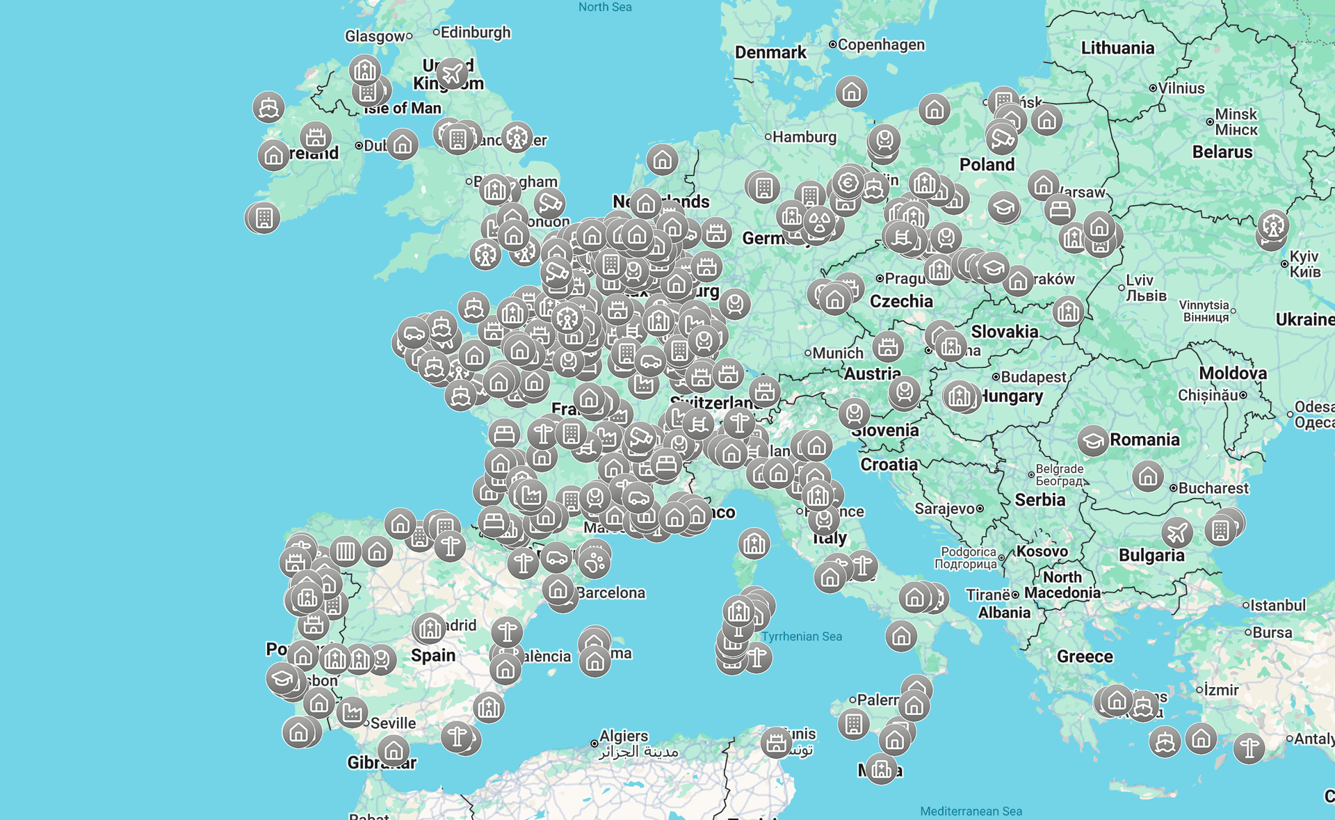
A good map of abandoned places is more than a list of coordinates. It should show verified locations, useful details, and enough structure to support responsible urban exploration.
This guide explains what makes a free urban exploration map useful, what to check before a visit, and why MapUrbex focuses on curated data and preservation-first practice.
What is the best free urbex map?
The best free urbex map is a curated map that helps you find abandoned places with recent context, not just raw coordinates. For most users, that means a tool like MapUrbex that prioritizes verified locations, responsible exploration, and efficient planning. A useful map should reduce outdated leads and help you prepare before any trip.
Quick summary
- A free urbex map is most useful when locations are reviewed and organized.
- Random social posts often point to outdated, duplicated, or incomplete spots.
- A map of abandoned places should help with filtering, planning, and context.
- You still need to verify local rules, current conditions, and safe access boundaries.
- MapUrbex is built around verified locations, curated maps, and preservation-first exploration.
- The fastest next step is to Access the free urbex map.
Quick facts
- Scope: global
- Main intent: discover abandoned places faster and plan responsibly
- Best for: beginners who need structure and experienced explorers who want efficiency
- Core value: verified locations with curated context
- Related pages: Browse all urbex maps, Free Urbex Map 2026
- Safety note: never force entry, trespass, or rely on one source alone
Why use a free urbex map instead of random social posts?
A free urbex map is better than random social posts because it organizes information into a usable research tool. Instead of chasing isolated photos or vague captions, you get a clearer view of where a place is, what type of site it is, and whether it is still relevant.
Social platforms are good at surfacing images, but they are weak at long-term accuracy. A single post can stay online for years after a site has been demolished, secured, or converted.
A curated urban exploration map also reduces duplication. Many abandoned locations circulate under different names, which creates confusion and wastes time.
| Source | Common problem | What a curated map adds |
|---|---|---|
| Social posts | Little context and old information | Structured location data and easier comparison |
| Old forums | Broken threads and missing updates | Cleaner navigation and current relevance checks |
| Generic map apps | No urbex-specific filtering | Site type, planning value, and exploration context |
| Curated free urbex map | Limited by ongoing review work | Higher signal, less noise, better planning |
How does a curated map of abandoned places improve safety and accuracy?
A curated map of abandoned places improves safety and accuracy by adding context around each location instead of exposing users to random pins. That context helps you evaluate whether a place is still standing, whether the area has changed, and whether a visit is realistic without improvisation.
Accuracy matters because abandoned sites change quickly. Ownership, fencing, structural decay, demolition, and redevelopment can alter a place in weeks or months.
Safety also depends on expectations. If a listing tells you a site type, region, and current status signals, you can plan more carefully and avoid unnecessary risk.
If you want a deeper comparison of selection criteria, read How to Get the Best Free Urbex Map in 2026??.
Access the free urbex map
What should you check before visiting a place from an urban exploration map?
You should check legality, current condition, and basic safety before visiting any place from an urban exploration map. A map helps research, but it does not replace judgment, local rules, or on-site caution.
Before you go, confirm these points:
- Whether access is legal in your area and for that specific site
- Whether the place still exists and has not been repurposed
- Whether weather, daylight, and travel distance make the visit reasonable
- Whether you have a clear turnaround plan if conditions are worse than expected
- Whether your presence will avoid damage, disturbance, or attention that could harm the site
The preservation-first rule is simple: leave no trace, do not force access, and do not share details in ways that increase vandalism or theft.
What should the best free urbex map include?
The best free urbex map should include reliable location data, practical filters, and enough context to support responsible decisions. A pin without explanation is rarely enough for serious planning.
1. Verified or reviewed locations
A strong map begins with reviewed locations. That does not mean a place is guaranteed to be unchanged, but it does mean the listing has been checked against some source instead of copied blindly.
This matters because abandoned places are unusually fluid. A reviewed entry is more useful than ten unverified mentions scattered across social media.
2. Clear context for each pin
Each listing should explain what kind of site it is and why it matters for planning. A factory, school, hospital, or house can involve very different risks, visibility, and travel expectations.
Context also helps you filter effort. If you only want industrial sites or large complexes, a clear label saves hours of guesswork.
3. Filters by type and region
Useful filters turn a large database into a practical tool. Being able to narrow by area or site category is essential when you are planning a day route or comparing options across regions.
This is where a true map of abandoned places outperforms random saved posts. You can move from broad research to an actionable shortlist much faster.
4. Fast route planning
The best map is not just for discovery. It should help you group nearby locations and understand whether a trip is worth the distance.
Good planning reduces rushed decisions. That usually leads to safer travel, better timing, and less pressure to improvise once you arrive.
5. Preservation-first guidance
A responsible urbex map should make preservation part of the experience. That means discouraging forced entry, theft, tagging, and reckless publicity.
This is also good for long-term access to information. When sites are treated carelessly, they disappear faster and become harder for everyone to document responsibly.
How can you get the most from the MapUrbex free urbex map?
You get the most from the MapUrbex free urbex map by using it as a research and planning tool, not as a shortcut to reckless visits. Start broad, narrow your options, then verify the basics before you travel.
A simple workflow works well:
- Start with Access the free urbex map to view the current free selection
- Expand your research with Browse all urbex maps if you want more regions or categories
- Compare yearly updates in Free Urbex Map 2026
- Read How to Get the Best Free Urbex Map in 2026?? if you want a stricter evaluation framework
The key idea is efficiency. A curated map should help you reject weak options quickly and focus on places that fit your route, timing, and standards.
FAQ
Is a free urbex map enough to plan a visit?
A free urbex map is a strong starting point, but it is not the only step. You still need to check current conditions, local rules, and basic safety factors. Treat the map as structured research, not as a guarantee.
Does MapUrbex encourage trespassing?
No. MapUrbex is positioned around responsible urbex, verified locations, and preservation-first use. Users should respect access laws, avoid forced entry, and leave sites untouched.
How often do abandoned places change?
Abandoned places can change very quickly. Demolition, redevelopment, new security, and structural decay can make older information inaccurate. That is why curated updates and pre-visit checks matter.
What is the difference between a map of abandoned places and a standard map app?
A standard map app shows geography. A map of abandoned places adds site-specific research value, such as type, relevance, and planning context. That extra layer makes it more useful for urbex preparation.
Conclusion
A free urbex map is most valuable when it turns scattered information into a clear research tool. The best option is not the map with the most random pins. It is the map that helps you identify relevant abandoned places, verify them faster, and explore responsibly.
MapUrbex is built for that purpose: curated maps, verified locations, and preservation-first discovery. If you want the fastest next step, open the free map and start filtering with better information.
Access the free urbex map