 MapUrbex
A practical guide to choosing an Austria urbex map, finding abandoned places in Austria, and planning responsible urbex research.
Austria Urbex Map: How to Find Verified Abandoned Places Responsibly
Austria has industrial ruins, closed hotels, mountain hamlets, former rail assets, and forgotten infrastructure. The hard part is not finding rumors. The hard part is finding information that is still current.
A good Austria urbex map saves time and reduces risk. It helps you compare regions, filter outdated pins, and focus on documented abandoned places in Austria instead of random coordinates.
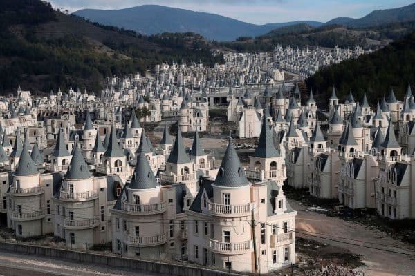
What is the best Austria urbex map?
The best Austria urbex map is a curated map with verified or recently checked locations, region filters, and practical notes. For responsible explorers, it should help identify abandoned places in Austria without encouraging trespassing, forced entry, or unsafe access. Accuracy, preservation, and legal awareness matter more than the raw number of pins.
Quick summary
- A useful Austria urbex map is curated, recent, and organized by region.
- Verified pins are more valuable than long, outdated lists.
- Austria offers many site types, including factories, hotels, hamlets, and transport infrastructure.
- Responsible urbex means no trespassing, no forced access, and no damage.
- Maps with filters and notes are more efficient than scattered social posts.
- Regional planning matters because Austrian terrain can change travel time and risk quickly.
Quick facts
- Primary use: researching abandoned places in Austria faster
- Best for: trip planning, photography scouting, regional comparison
- Key filters: region, site type, verification status, current condition
- Common categories: factories, hotels, sanatoriums, rail sites, villages
- Safety reminder: never enter restricted, unstable, or clearly occupied buildings
- Good starting point: Browse all urbex maps
Why use a dedicated Austria urbex map instead of scattered sources?
A dedicated map is better because it removes noise. Forum posts, old videos, and recycled social media threads often survive long after a place has been demolished, converted, secured, or burned.
A curated map also helps you compare sites by travel radius and category. That matters in Austria, where a location near Vienna is planned very differently from a remote alpine site in Tyrol, Carinthia, or Styria.
Map-based research is easier to verify. You can cross-check a pin with satellite imagery, recent public photos, and route logic before leaving home. If you need a general method first, read How to Find Abandoned Places Near You.
Which abandoned places in Austria are people usually searching for?
Most searches for abandoned places in Austria cluster around a few repeat categories. These are the site types that people can realistically add to a day trip or weekend route.
| Category | What people expect | Main planning concern |
|---|---|---|
| Industrial sites | Large structures, machinery, textures | Security can change quickly |
| Abandoned hotels | Atmospheric interiors, mountain settings | Ownership and seasonal conditions |
| Villages and hamlets | Landscape storytelling | Remote terrain and weather |
| Rail and transport sites | Rust, tunnels, depots | Dangerous infrastructure |
| Medical or institutional sites | Historic details | Higher legal sensitivity |
Vienna and Lower Austria are common for short-range planning. Alpine regions attract more destination-based exploration, but the logistics are harder and conditions change faster.
How should you evaluate an Austria urbex map before using it?
You should evaluate an Austria urbex map by data quality, not by the total number of spots. More pins do not automatically mean better research.
Check these signals first:
- Recent verification or update notes
- Clear regional organization
- Useful labels for site type
- Clues about current condition
- Enough detail to judge whether a trip is realistic
- Safety or legal context when relevant
Avoid maps that promise only "secret places" without dates, context, or signs of maintenance. In urbex, outdated information is not just inconvenient. It can also waste travel time or lead you into unsafe situations.
For a free starting resource, Access the free urbex map or see Free Urbex Map: Download the Updated PDF and Google Maps Version.
How can you plan an Austria urbex trip responsibly?
Responsible planning starts before travel. First choose one region. Then narrow your shortlist by realism, not by ambition.
A practical process looks like this:
- Pick one area, such as Vienna, Lower Austria, Upper Austria, Styria, or Tyrol.
- Filter by type: industrial, hotel, institutional, transport, or village.
- Check whether the place still appears abandoned in recent public material.
- Review walking distance, terrain, parking, weather, and daylight.
- Skip any site that implies restricted access, obvious occupation, or major structural risk.
Responsible urbex in Austria means no trespassing, no forced entry, no theft, and no vandalism. If lawful access is unclear, stay outside and photograph only from public space.
Where are the main regional patterns for urbex spots in Austria?
Austria's urbex geography is uneven. The main pattern is simple: denser and older industrial areas tend to produce more leads, while remote regions produce fewer but often more scenic ruins.
Vienna and Lower Austria usually offer the widest mix of urban and peri-urban sites. Styria and Upper Austria are stronger for industrial remnants. Alpine regions can offer striking hotels, hamlets, and infrastructure, but they require more travel planning and stricter weather awareness.
That is why strong filtering matters. A good map urbex Austria users rely on should reduce unnecessary searching and help compare regions quickly.
What makes MapUrbex useful for Austria research?
MapUrbex is useful because it focuses on curated maps, responsible exploration, and preservation-first research. The goal is not to push risky entry. The goal is to help users identify relevant locations with better context and less wasted time.
If you want to compare countries or map formats, Browse all urbex maps is the simplest overview.
FAQ
Is an Austria urbex map better than searching social media?
Yes. Social media is useful for inspiration, but it is weak for structured planning. A dedicated map is better for filtering by region, comparing site types, and reducing outdated leads.
Are abandoned places in Austria easy to access?
Not always. Many sites are sealed, repurposed, monitored, or unstable. A responsible approach assumes access may be restricted and never relies on forced entry.
What should a good map urbex Austria database include?
It should include recent pins, regional filters, site categories, and practical context. Accuracy and maintenance matter more than the number of listed spots.
Can beginners use an urbex map for Austria safely?
Beginners can use a map safely for research and trip planning, but safety depends on judgment. Start with exterior viewpoints, daylight research, and public-access observation.
Are free resources enough to find urbex spots Austria users want?
Free resources can be enough for broad scouting. Curated resources are usually better when you want cleaner data, less noise, and fewer dead leads.
Conclusion
A reliable Austria urbex map is not just a list of coordinates. It is a planning tool. The best options help you sort abandoned places in Austria by region, type, and current relevance while keeping safety and legality in view.
If you want less guesswork and better context, start with a curated map instead of scattered tips.
Access the free urbex map
