A practical guide to an Occitanie urbex map focused on abandoned castles and ghost villages near Toulouse and Montpellier, with safety, legal context, and responsible exploration tips.
Occitanie Urbex Map: 6 Abandoned Castles and Ghost Villages Near Toulouse and Montpellier
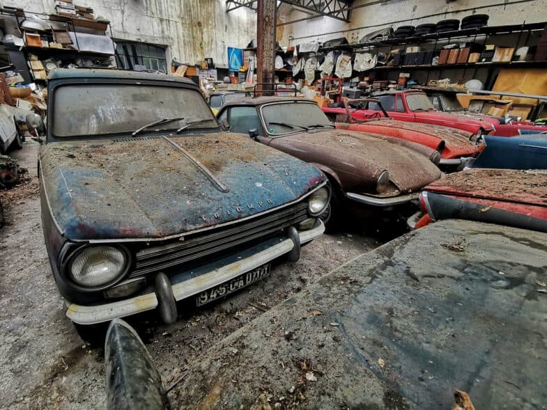
An Occitanie urbex map is useful because the region combines medieval ruins, depopulated hamlets, and rural heritage scattered between plains, foothills, and mountain roads. Around Toulouse and Montpellier, abandoned castles and ghost villages are among the most searched site types.
This guide does not publish sensitive coordinates. Instead, it explains the six place profiles most often worth tracking on a curated map, how the two urban hubs differ, and how to research these sites responsibly.
What does an Occitanie urbex map show for castles and ghost villages?
A good Occitanie urbex map shows more than pins. For abandoned castles and ghost villages, it should identify verified site types, note legal or access uncertainty when known, and give enough regional context around Toulouse and Montpellier to support careful planning without promoting trespassing, forced entry, or reckless behavior.
Quick summary
- Occitanie is one of the strongest French regions for ruined castles, abandoned hamlets, and rural heritage sites.
- Around Toulouse, visitors usually find more fortified farm buildings, manor houses, and village remains across western inland areas.
- Around Montpellier, inland sectors tend to offer more stone ruins, hilltop defensive sites, and dry upland villages.
- A curated map is more useful than random coordinates because it helps compare condition, site type, and preservation risk.
- Ghost villages and castles are not automatically legal or safe to enter.
- Responsible urbex means preservation first, no vandalism, no forced access, and no public sharing of fragile locations.
Quick facts
- Region: Occitanie, southern France
- Primary hubs: Toulouse and Montpellier
- Most relevant site types: abandoned castles, fortified manors, ghost villages, rural estates, small hamlets
- Best use of a map: planning, filtering, research, and heritage context
- Main risk factors: private property, unstable floors, collapsed roofs, vegetation cover, fire season, remote terrain
- Best approach: verified locations, daytime exterior-first visits, preservation-first behavior
Why does Occitanie contain so many abandoned castles and ghost villages?
Occitanie contains many abandoned castles and ghost villages because its landscape preserves long layers of rural and defensive history. Medieval frontier systems, isolated farming settlements, hilltop construction, and later rural depopulation all left visible ruins across the region.
In practical terms, several forces overlap here. Old defensive routes created castles, watch sites, and fortified residences. Agricultural change then weakened many small settlements. Some villages were partially emptied by migration to larger towns. Others declined after transport patterns changed or local economic activity disappeared.
This is why a regional map matters. The ruins are not concentrated in one single department. They appear in recurring patterns across inland Hérault, Aude, Ariège, Aveyron, Lozère, Tarn, and other parts of Occitanie.
Which 6 site profiles are most useful to track on an Occitanie urbex map?
The most useful map entries are usually not the most famous ruins. They are the places with enough remaining structure to be historically interesting, enough regional context to be researched, and enough legal clarity to be approached carefully from public space when access is restricted.
| Site profile | Typical area | Why it matters | Main caution |
|---|---|---|---|
| Hilltop ruined castle | Inland from Montpellier | Strong views, defensive history, stone remains | Exposure, loose masonry, steep approach |
| Fortified rural manor | Around the Toulouse hinterland | Mix of noble and agricultural history | Often private property |
| Small ghost hamlet | Dry uplands or foothills | Clear reading of rural abandonment | Fragile walls and hidden pits |
| Former farming village cluster | Secondary valleys | Several empty structures in one zone | Ownership can vary house by house |
| Priory or estate with defensive elements | Old rural corridors | Religious and domestic architecture together | Partial collapse and fencing |
| Semi-abandoned village edge | Remote communes | Useful for exterior observation and photography | Some buildings may still be occupied |
1. Hilltop ruined castles
These are among the most recognizable entries on a carte-style Occitanie urbex search. They usually offer the clearest link between landscape and history. In the Montpellier orbit, inland ridges and stone plateaus often produce this profile.
From a mapping perspective, they are valuable because they are easy to classify. From a safety perspective, they are deceptive. Height, missing parapets, and unstable stairs make them risky even when the ruin looks open.
2. Fortified rural manors near Toulouse
The Toulouse side of the region often mixes château, manor, and farm architecture. These sites matter because they show how defense and agriculture were once combined in one rural property.
They also require caution. Many are on active private land, even when the main building looks abandoned. A responsible map helps separate visually abandoned structures from legally accessible places.
3. Stone ghost villages in upland zones
Ghost villages are especially useful on a regional urbex map because they tell a settlement story, not just a building story. Empty streets, roofless houses, ovens, fountains, and terraces can reveal how a whole community was organized.
They are not safer than a single ruin. Vegetation hides drops, wells, and unstable interiors. Exterior observation is often the most responsible option.
4. Former farming village clusters on secondary roads
Some of the best research targets are not fully deserted villages but clusters of abandoned homes, barns, and communal remains along older road networks. These places often sit between better-known tourist corridors.
For researchers, they are useful because several structures can be compared in one stop. For explorers, they demand restraint because ownership may change from one parcel to the next.
5. Priories and estates with defensive features
Occitanie also contains hybrid sites: former religious buildings, estates, or large rural houses later altered for defense or storage. They are interesting because they do not fit the simple castle versus village distinction.
A curated map should flag them clearly. Their legal status is often unclear, and their interiors are frequently the least stable part of the site.
6. Semi-abandoned village edges
Some locations near Toulouse or Montpellier are not ghost villages in the strict sense. Instead, they are partially inhabited settlements with a visible abandoned quarter. These are often the most realistic places for lawful, low-impact observation from public ways.
They are also the places where discretion matters most. Never assume an empty-looking street is open for entry. Respect residents, farm activity, and local privacy.
How do Toulouse and Montpellier differ for urbex planning?
Toulouse and Montpellier are useful reference points, but the surrounding urbex logic is different. Toulouse tends to connect more naturally to western and southwestern rural belts, fortified estates, and dispersed village remains. Montpellier often leads searchers toward eastern inland stone ruins, dry landscapes, and defensive high points.
The difference is not absolute. Both urban areas can serve as bases for broader Occitanie research. What matters is the terrain pattern. If you are looking for abandoned castles in Occitanie, topography is often more important than city distance. If you are looking for ghost villages in Occitanie, old settlement networks and depopulated uplands matter more than famous tourist routes.
For a wider regional overview, see Occitanie Urbex Map: Abandoned Places and Exploration Guide. For source-evaluation methods, see How to Find Secret Urbex Locations: Real Methods That Work. For an example of claim verification in the region, see Abandoned Ferrari F40 in Occitanie: What Is Actually Known?.
How should you use a curated map responsibly in Occitanie?
You should use a curated map as a research tool, not as permission to enter a place. The right method is to confirm status, check whether the site is on private land, and prefer public viewpoints or explicitly authorized access.
A reliable map is helpful because it reduces random searching. That matters for safety and preservation. Fewer blind visits mean less accidental trespassing, less damage to fragile structures, and less pressure on vulnerable sites.
Before any trip, check weather, fire restrictions, road conditions, and daylight. Do not force locks, fences, shutters, or gates. Do not remove objects. Do not publish exact coordinates of fragile ruins. If a site shows signs of current ownership or occupation, leave immediately.
If you want to compare regions beyond Occitanie, you can Browse all urbex maps. If you want a starting point, you can also Access the free urbex map.
FAQ
Is urbex legal in Occitanie?
Urbex is not a legal category that overrides property law. Many abandoned castles, estates, and villages in Occitanie are on private land or in hazardous condition. Legal access depends on ownership, local rules, and explicit permission.
Are ghost villages safer than abandoned castles?
No. Ghost villages often look more open, but they can hide wells, collapsed floors, unstable walls, and vegetation-covered hazards. A spread-out site can be harder to read than a single ruin.
What should beginners near Toulouse and Montpellier prioritize?
Beginners should prioritize research, exterior viewpoints, simple terrain, daylight visits, and places with clear legal status. A preservation-first approach is more useful than chasing dramatic but unsafe ruins.
Should exact coordinates of abandoned castles be posted online?
In most cases, no. Public coordinates can increase trespassing, theft, vandalism, and pressure on unstable heritage sites. Responsible mapping gives enough context for research without exposing fragile locations unnecessarily.
What makes a verified map better than random social media pins?
A verified map is better because it filters duplicates, outdated rumors, demolished sites, and misleading labels. It also adds context on site type, region, and known access uncertainty.
Conclusion
A useful Occitanie urbex map is not just a list of dramatic ruins. It is a structured way to understand where abandoned castles and ghost villages appear, how Toulouse and Montpellier connect to different site patterns, and why responsible planning matters. The best results come from verified information, careful research, and preservation-first behavior.
Access the free urbex map