Discover a verified Normandy urbex map and 10 types of abandoned places around Rouen and Caen where access can be legal, visible, or authorized.
Normandy Urbex Map: 10 Abandoned Places with Legal Access in Rouen and Caen
Normandy is one of France's most searched regions for abandoned places. Rouen and Caen attract explorers because the region combines industrial remains, military history, manor houses, farm buildings, and coastal sites.
The problem is not finding rumors. The problem is finding accurate access information. A responsible Normandy urbex map should distinguish between public viewpoints, official openings, owner-authorized visits, and places that must not be entered.
Is there a reliable Normandy urbex map for legal abandoned places?
Yes. A reliable Normandy urbex map exists when it filters locations by current access status, public visibility, or owner authorization instead of sharing random coordinates. Around Rouen and Caen, the safest method is a curated map that shows whether a place can be seen legally from public space, visited during an official opening, or entered only with permission.
Quick summary
- Normandy has a dense mix of industrial, military, rural, and seaside abandoned heritage.
- The safest way to plan urbex in Rouen or Caen is to use a verified map, not copied coordinates.
- Legal access usually means public exterior views, heritage events, guided visits, or explicit owner approval.
- Access status changes often after sales, fencing, demolition, or security incidents.
- MapUrbex focuses on verified locations, responsible urbex, and preservation-first mapping.
Quick facts
- Region: Normandy, France
- Main search hubs: Rouen, Caen, Le Havre, Dieppe, Cherbourg
- Best use case: planning a responsible photo route
- Common site types: mills, bunkers, villas, schools, farm buildings, factories
- Legal baseline: no trespassing, no forced entry, no vandalism
- Best tool: a curated map updated for current conditions
Why use a verified Normandy urbex map instead of random coordinates?
A verified map reduces two common problems: outdated access information and unsafe assumptions. An abandoned place can be demolished, secured, sold, or reopened for legal visits in a short period.
MapUrbex is built for that gap. It prioritizes verified locations, current notes, and preservation-first decisions. If you want a broader overview first, Browse all urbex maps. For regional context, see Normandy Urbex Map: Explore Abandoned Places in Normandy Responsibly and How to Find Secret Urbex Spots Responsibly.
Which 10 kinds of abandoned places can you find around Rouen and Caen?
Around Rouen and Caen, the most common legally viewable or sometimes legally visitable abandoned places fall into ten recurring categories. Exact pins are best handled through a verified map because status changes quickly, but the patterns below are consistent across Normandy.
-
Closed mills and warehouses Often found near rivers and older transport corridors. Legal access is usually limited to exterior views from public roads unless permission is granted.
-
Disused farm buildings Normandy has many rural properties with barns, sheds, and empty houses. These are sensitive because they are often still private even when unused.
-
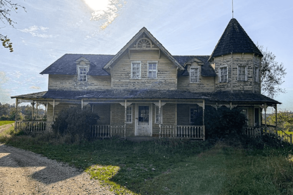
Abandoned manor houses and small châteaux These sites are visually striking but frequently fragile. Some are visible from public paths; entry requires clear authorization.
-
Former coastal hotels and holiday buildings Seaside decline created many empty hospitality properties. Public promenades can offer legal photography without entry.
-
Military remains and bunkers Normandy's history makes this a major category. Access rules vary sharply because some areas are protected, unstable, or environmentally restricted.
-
Closed schools and public institutions These buildings appear in many searches for urbex Rouen and urbex Caen. They can move quickly from empty to secured or redeveloped.
-
Small industrial plants Old workshops, depots, and processing buildings are common in secondary towns. They are among the places most affected by fencing and surveillance.
-
Disused stations and rail-side structures Rail heritage is attractive, but railway property is especially sensitive. Track access is never acceptable; only public viewpoints are safe and legal.
-
Empty villas and suburban houses These are widely searched but often the least suitable for public sharing because of ownership privacy and vandalism risk.
-
Religious or medical heritage in transition Former clinics, chapels, or care facilities sometimes sit empty during redevelopment. They require extra caution because they may contain hazards or protected materials.
Legal access does not mean abandoned equals open. It means the place can be viewed from public space, entered during an official opening, or visited with explicit authorization.
Where are the main urbex zones in Normandy?
The strongest Normandy urbex interest clusters around Rouen, Caen, Le Havre, the coast, and rural inland corridors. Each zone has a different mix of building types and a different access profile.
| Area | Typical place types | Usual legal access pattern | Main note |
|---|---|---|---|
| Rouen | mills, warehouses, schools, villas | public viewpoints or owner permission | dense urban fabric changes fast |
| Caen | military remains, institutions, industrial buildings | public exteriors, heritage openings, permission | many sites are in redevelopment corridors |
| Le Havre | port-side industry, depots, concrete structures | mostly exterior only | security can be strict |
| Dieppe and coast | hotels, villas, bunkers | promenade viewpoints, occasional authorized entry | weather and erosion matter |
| Cherbourg area | military and maritime remains | restricted depending on site | protected zones are common |
| Inland Normandy | farms, manors, workshops | mostly private land, permission needed | access data ages quickly |
What does legal urbex access mean in Normandy?
In Normandy, legal urbex access usually means one of four things: a view from public space, an official guided visit, a heritage event, or explicit owner permission. It does not mean that an open gate, broken fence, or abandoned appearance gives a right to enter.
That distinction matters for both law and preservation. Responsible exploration protects sites from theft, fire, graffiti, and structural damage. It also protects explorers from injury and conflict.
How should you prepare an urbex trip around Rouen or Caen responsibly?
The best way to prepare is to treat access as temporary and verify everything shortly before the trip. A good route starts with legal status, not with photography ideas.
- Check whether the site is visible from a public road or path.
- Look for current owner information, event announcements, or closure notices.
- Avoid night entry, forced access, climbing, or solo visits.
- Bring basic safety gear for lawful exterior exploration, such as sturdy shoes and a charged phone.
- Leave immediately if signage, security, or local residents indicate no access.
- Never publish sensitive entry details that could increase trespass or vandalism.
FAQ
Can I enter an abandoned building if a door is already open?
No. An open door is not consent. Without a public opening or explicit permission, entry can still be illegal and unsafe.
Are all spots on a Normandy urbex map safe?
No. A map helps with planning, but safety still depends on current structural condition, weather, contamination risks, and access rules.
Is photographing an abandoned place from the street legal?
In many cases, yes, because you remain in public space. Local restrictions, privacy concerns, or military sensitivity can still apply.
Why are some exact coordinates not published publicly?
Because unrestricted sharing often leads to trespassing, vandalism, stripping, and rapid site loss. Preservation-first mapping protects both places and people.
Conclusion
A useful Normandy urbex map is not just a list of rumors. It is a filtered tool that helps you distinguish between abandoned places that are publicly viewable, officially visitable, or accessible only with permission.
For urbex Rouen, urbex Caen, and the wider region, the safest method is the same: use verified information, respect property rights, and choose preservation over access at any cost.
Access the free urbex map