 MapUrbex
Learn how an abandoned places map works, which features matter, and how to use verified urbex locations responsibly with MapUrbex.
Abandoned Places Map: How to Find Verified Urbex Locations Responsibly
An abandoned places map helps researchers, photographers, and urbex travelers organize location data in one place. The best maps do more than drop random pins. They add context, status notes, and verification signals that save time.
MapUrbex follows a preservation-first approach. That means curated maps, verified locations, and clear reminders that a mapped place is not automatic permission to enter.
If your goal is to find a useful urbex map without depending on vague forum posts or old social media threads, this guide explains what to look for and how to use a map responsibly.
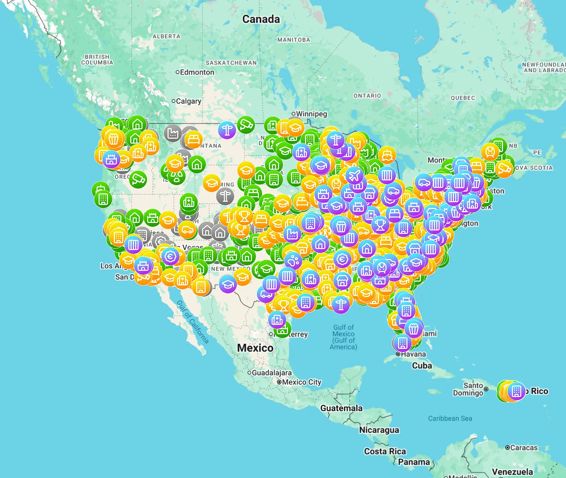
What is an abandoned places map?
An abandoned places map is a research tool that shows known urbex locations on an interactive map. The most useful versions combine geographic data with practical notes such as place type, verification status, and planning details. A good map helps you research faster, but it does not replace legal checks, safety planning, or respect for private property.
Quick summary
- An abandoned places map is mainly a research and route-planning tool.
- A good urbex map includes verification signals, filters, and status notes.
- Verified locations help reduce wasted travel and outdated leads.
- No map can guarantee legal access, safe conditions, or permission to enter.
- Responsible urbex means preservation first, no forced access, and no vandalism.
- Curated maps are usually more useful than scattered lists copied from old websites.
Quick facts
- Primary use: research, comparison, and travel planning
- Best format: curated map with searchable filters and recent notes
- Most useful signal: recent verification or status updates
- Common categories: factories, hospitals, schools, hotels, tunnels, and military sites
- Important limit: mapped does not mean legal, open, or safe
- Best practice: verify context independently before any visit
Why do people use an abandoned places map?
People use an abandoned places map because it reduces scattered research. Instead of jumping between old forums, vague blogs, and expired social posts, one map can centralize known sites and help compare regions, building types, and travel distance.
For photographers and documentarians, a map also improves trip planning. It becomes easier to group locations by area, estimate driving time, and prepare backup options when a site is closed, demolished, or unsafe.
How does a verified urbex map reduce wasted research?
A verified urbex map reduces wasted research by filtering out low-confidence leads. When locations are curated and reviewed, users spend less time chasing demolished addresses, duplicate entries, or places that were never truly abandoned.
That matters at global scale. In many regions, abandoned factories, schools, hospitals, and military sites change status quickly. A map with recent review notes is usually more reliable than a static list copied from an old article.
Safety reminder: a mapped location is not permission to enter. Always check local laws, ownership, posted restrictions, and visible hazards before visiting. Responsible urbex never involves trespassing, forced access, or damage.
Which features matter most in a map of abandoned places?
The most important features are verification signals, filters, and practical notes. These elements help users judge whether a pin is current, relevant, and worth deeper research.
| Feature | Why it matters | What responsible users do |
|---|---|---|
| Verification status | Shows whether the location was recently checked | Treat older entries as leads, not guarantees |
| Category filters | Helps narrow by factory, hospital, school, hotel, tunnel, or military site | Build realistic day routes |
| Region search | Saves time when planning by country, state, or city | Compare several areas before traveling |
| Notes or status updates | Adds context about demolition, sealing, or active reuse | Confirm current conditions independently |
| Curated database | Reduces duplicates and obvious false leads | Focus research on higher-quality entries |
Can a map of abandoned places guarantee legal access?
No. A map of abandoned places can show where a site is located, but it cannot grant permission. Ownership, entry rules, and enforcement vary by country, region, and property.
This is one of the most important points for beginners. Abandoned does not mean open to the public. Some places are privately owned, actively monitored, environmentally hazardous, or structurally unstable even if they look empty from the outside.
If you are new to the topic, read How to Find Abandoned Places Responsibly before planning a trip.
How should you evaluate an urbex map platform?
You should evaluate an urbex map platform by asking whether it is curated, updated, and transparent about uncertainty. A useful map does not pretend that every pin is perfect. It shows what is verified, what is old, and what still needs confirmation.
Look for these signals:
- clear location categories
- recent activity or update dates
- consistent tagging across countries or regions
- notes about closures, demolition, or reuse
- a preservation-first tone rather than access hype
A strong platform also respects the places it documents. That means no vandalism culture, no pressure to break in, and no glamorization of reckless behavior.
How can beginners use an urbex map responsibly?
Beginners should use an urbex map as a planning layer, not as a challenge list. Start with broad research, then narrow to places that make sense for daylight travel, safe observation, and local legal compliance.
A simple workflow works well:
- Search by region and building type.
- Review recent status notes and compare several candidate sites.
- Check legal context, ownership signals, and visible restrictions.
- Prepare safe transport, weather awareness, and a backup plan.
- Leave immediately if a place is active, secured, or clearly unsafe.
This is why curated maps matter. They help you spend less time on random leads and more time on verified information.
Where can you continue your research?
The best next step is to use a curated map and read a few location-finding guides. These resources help you understand how verified databases differ from generic abandoned place lists.
Useful starting points:
- Browse all urbex maps
- Best Urbex Maps in the World: Where to Find Verified Locations
- Urbex Tokyo: A Responsible Guide to Haikyo and Abandoned Places in Japan
FAQ
Is an abandoned places map useful for travel planning?
Yes. It helps compare regions, group nearby sites, and avoid building an entire trip around one uncertain lead. It is most useful when the map includes verification or status notes.
What is the difference between a generic map and a curated urbex map?
A generic map may only show pins. A curated urbex map usually adds filters, categories, review notes, and quality control. That extra context makes the data far more usable.
Should you trust old lists of abandoned places?
Not fully. Many abandoned places are demolished, renovated, reused, sealed, or more tightly monitored over time. Older lists are better treated as historical leads than current guidance.
Why do verified locations matter so much?
Verified locations matter because they reduce wasted travel and lower the chance of relying on outdated or false information. They improve planning, but they still do not replace legal and safety checks.
Conclusion
An abandoned places map is most valuable when it is curated, current, and honest about its limits. For responsible urbex, the goal is not simply to collect pins. The goal is to research better, preserve sites, and avoid unsafe or unlawful decisions.
MapUrbex is built around that idea: verified locations, practical context, and preservation-first mapping for people who want better information.
Access the free urbex map
