 MapUrbex
Learn how to find abandoned mines near you using responsible research methods, curated maps, and safety-first planning without relying on risky rumors.
Abandoned Mines Near Me: How to Find Them Responsibly
If you are searching for abandoned mines near me, the most useful approach is not random exploration. It is careful research, legal checks, and strict safety limits.
Abandoned mines attract photographers, historians, and urbex readers because they combine industrial heritage with dramatic landscapes. They also rank among the most hazardous abandoned places in the world.
MapUrbex recommends a preservation-first approach. That means verified information, respect for property, and no forced entry.
Where can I find abandoned mines near me?
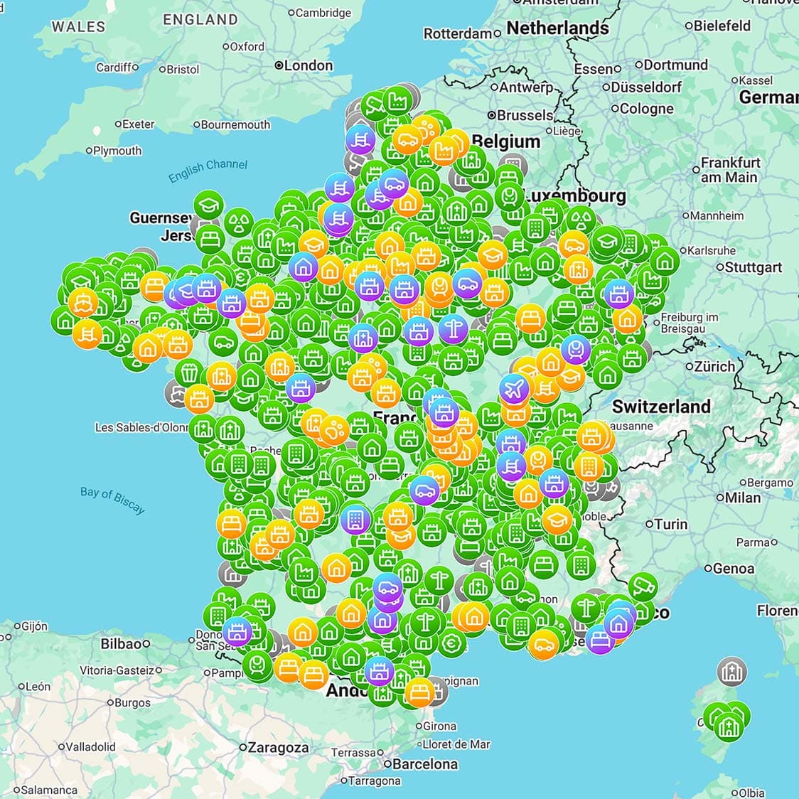
You can find abandoned mines near you by combining historical mining records, geological survey data, old topographic maps, local archives, and curated urbex maps. The safest approach is to identify documented sites first, then verify land status and whether public access is allowed. Do not rely on rumors, hidden entrance tips, or instructions that encourage trespassing or underground entry.
Quick summary
- Abandoned mines are best researched through public records, mining history sources, and curated maps.
- A mine abandoned decades ago can still be legally restricted, unstable, or actively monitored.
- Mine urbex is far riskier than many other abandoned sites because of shafts, collapses, gases, and flooding.
- The most responsible visits focus on legal viewpoints, surface remains, and documentation from safe distances.
- A reliable abandoned mine map saves time by filtering weak or misleading location data.
- Never enter underground workings unless you are authorized, trained, and properly equipped for that environment.
Quick facts
- Typical features: headframes, spoil heaps, adits, tramways, processing ruins, ventilation structures.
- Common risks: vertical drops, rotten timber, toxic air, water-filled voids, unstable rock, remote terrain.
- Legal reality: many sites are on private, industrial, protected, or hazardous land.
- Best use case for maps: historical research, route planning, and finding legal observation points.
- Best practice: document, do not disturb; preserve, do not collect.
What counts as an abandoned mine?
An abandoned mine is a former extraction site that is no longer operating as an active mine. In practice, the term can describe much more than a single tunnel or shaft.
It may include surface buildings, ore processing remains, rail links, waste piles, worker housing, or sealed entrances. Some places are fully derelict. Others are partially reused, fenced, or under environmental monitoring.
This matters because a site that looks deserted may still have an owner, a leaseholder, or a public safety restriction. For research purposes, treat every mine abandoned site as legally active until proven otherwise.
How can you find abandoned mines without relying on unsafe rumors?
The most reliable way to find abandoned mines is to cross-check several sources. One source rarely gives enough context.
Start with mining history databases, state or national geological surveys, historical topographic maps, and archive material. Then compare that information with current satellite imagery and land ownership data. Satellite images can confirm landscape traces, but they do not prove access rights or safety.
A curated resource is often faster than open rumor networks. Browse all urbex maps if you want a structured starting point, and read How to Find Abandoned Places Responsibly for a wider method that applies beyond mines.
If your goal is an abandoned mine map rather than random coordinates, focus on sources that provide context: date of operation, site type, access notes, and nearby hazards. That is more useful than a dropped pin with no explanation.
Which research methods are most useful?
The best method depends on whether you want historical context, visual confirmation, or trip planning. In most cases, combining methods works best.
| Method | Best for | Limits | Responsible use |
|---|---|---|---|
| Geological survey records | Confirming real mining areas | Often technical or incomplete | Use to identify districts and mine names |
| Historical maps | Finding former shafts and workings | Old names may differ from modern ones | Compare with modern maps before any trip |
| Local archives and museums | Context and dates | Not always searchable online | Use for site history and ownership clues |
| Satellite imagery | Spotting spoil heaps and ruins | Cannot confirm legality or hidden hazards | Use only as a secondary check |
| Curated urbex maps | Saving time and filtering bad tips | Coverage varies by region | Use to shortlist documented sites |
For a broader overview of mapping tools, Best Urbex Maps in the World: Where to Find Verified Locations is a useful companion article.
Why is mine urbex especially risky?
Mine urbex is especially risky because mining structures fail in ways that are hard to predict. A surface ruin may look stable while the ground below is hollow.
Major hazards include concealed shafts, collapsing stopes, rotten ladders, poor air quality, flooding, bad rock, explosive remnants, and sudden vertical drops. Even experienced explorers often avoid underground mine entry unless they have specialist training and authorization.
Remote mine districts also create rescue problems. A simple ankle injury can become serious if the site is isolated and communication is poor.
For most readers, the responsible standard is clear: study the site, photograph only legal exterior remains, and do not enter underground workings.
Can you legally visit an abandoned mine?
Sometimes, but many abandoned mines cannot be legally visited beyond public roads or designated trails. Ownership and access rules vary widely by country and even by parcel.
A closed mine may sit on private land, protected heritage land, active concession land, or a dangerous area managed by local authorities. Fences, warning signs, sealed portals, and no-entry notices must be respected.
If you are unsure, assume access is not permitted. Responsible urbex means checking land status first and leaving if access is unclear.
How does a curated map help when searching for abandoned mines near me?
A curated map helps by replacing vague hearsay with structured information. That is especially important for mines, where bad information can be dangerous.
MapUrbex focuses on verified locations, responsible discovery, and preservation-first planning. A good map can help you identify documented sites, compare regions, and plan legal viewpoints without publishing reckless entry advice.
If you want to compare categories and regions, Browse all urbex maps. If you want an easy starting point, use the free tool below.
Access the free urbex map
What should you check before planning any mine-related trip?
You should check legality, terrain, weather, distance, and your own objective before leaving home. That short checklist prevents many avoidable mistakes.
Use this sequence:
- Confirm whether the location is actually a mine site and not an active industrial area.
- Check ownership, local restrictions, closures, and heritage protection status.
- Plan for daylight and surface observation only unless you have explicit authorization.
- Review terrain hazards such as unstable spoil heaps, cliffs, and remote access roads.
- Tell someone your route and return time if you are visiting a remote area.
- Bring basic safety gear for hiking conditions, not underground penetration.
- Do not move barriers, open covers, or test sealed entrances.
A simple rule works well: if the only way to document the site is to bypass a barrier or enter underground, the trip is not responsible.
Are surface remains usually the best option?
Yes. For most people, surface remains are the best option because they offer historical interest with far lower risk.
Headframes, engine houses, ore bins, tailings landscapes, and transport ruins can often be studied from public paths or legal viewpoints. This approach also reduces damage to fragile sites and avoids spreading sensitive entry details.
In practical terms, the best abandoned mine experience is often a research-led landscape visit, not an underground mission.
FAQ
Are abandoned mines always on private land?
No, not always. Some are near public land, trails, or heritage areas. But many are privately owned or controlled by agencies, so you should never assume access rights from appearance alone.
Is it safe to go inside an abandoned mine?
In most cases, no. Abandoned mines can contain hidden shafts, bad air, collapse zones, and water hazards. Without authorization, specialist training, and proper equipment, underground entry is not a responsible choice.
Can I use satellite imagery to find mine entrances?
You can use satellite imagery to understand the landscape, but it should not be used as a guide for entry. Images do not reveal legal status, internal conditions, or concealed hazards.
What is the safest way to document a mine site?
The safest way is to stay on legal public access routes, focus on exterior remains, carry standard outdoor gear, and avoid all underground spaces and unstable structures.
Are there better alternatives to entering a mine?
Yes. Historical research, landscape photography, museum visits, archival work, and legal observation points usually provide a better balance of access, ethics, and safety.
Conclusion
Searching for abandoned mines near me is really a research problem before it is an exploration problem. The best results come from verified sources, legal awareness, and strict safety boundaries.
If you want to find a mine abandoned site responsibly, use records, maps, and context. Avoid rumor-based coordinates, respect closures, and treat underground workings as specialist environments rather than casual urbex targets.
Start with a safer map-based approach
MapUrbex is built for responsible discovery: verified locations, curated maps, and preservation-first planning.
Access the free urbex map
