Use the Belgium urbex map to research abandoned bunkers and factories around Brussels and Liège with a responsible, verification-first approach.
Belgium Urbex Map: Interactive Guide to Abandoned Bunkers and Factories
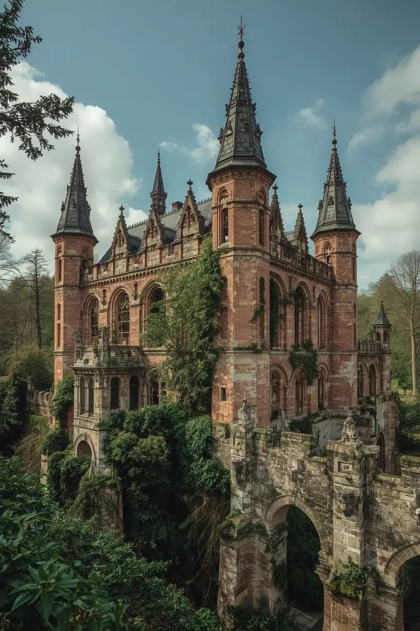
Belgium is one of the most researched urbex countries in Western Europe because industrial decline, military heritage, and dense cities overlap in a relatively small area. People searching for a Belgium urbex map usually want a practical way to compare abandoned bunkers, factories, and urban ruins around Brussels, Liège, and former industrial corridors.
This guide explains what an interactive map should show, where the main research zones are, and how to use verified locations responsibly. MapUrbex takes a preservation-first approach: curated maps, verification notes, and no encouragement of trespassing or forced access.
What does the Belgium urbex map show?
A good Belgium urbex map shows where abandoned bunkers, factories, forts, and disused buildings are concentrated by region, then adds context about verification, current condition, and legal risk. The goal is not to drop reckless coordinates. It is to help researchers compare Brussels, Liège, Wallonia, and other zones with a safer, more reliable method.
For a broader starting point, see Browse all urbex maps or the dedicated guide Belgium Urbex Map: Best Abandoned Places and Responsible Exploration Guide.
Quick summary
- A Belgium urbex map is most useful when it separates industrial, military, institutional, and transport-related sites.
- Liège and the wider Walloon industrial belt are stronger for abandoned factories than central Brussels.
- Abandoned bunkers in Belgium are more scattered, so regional filtering matters.
- Verified maps are more reliable than random social posts because sites change, get reused, or become sealed.
- Responsible urbex means no trespassing, no forced entry, no vandalism, and no publication of sensitive access details.
Quick facts
- Country: Belgium
- Primary themes: abandoned factories, bunkers, forts, warehouses, rail and logistics sites
- Main research cities: Brussels and Liège
- Best broader zone for industry: Wallonia
- Best tool: an interactive map with filters and verification notes
- Legal baseline: private property rules still apply, even when a place looks empty
Which regions are most useful for finding abandoned bunkers and factories in Belgium?
The most useful Belgian regions for urbex research are usually Liège, Charleroi, the Sambre-Meuse industrial belt, and selected areas around Brussels. Factory sites cluster around former heavy industry. Bunkers and military remains are more fragmented, which is why a country map with regional filters is more useful than a simple list.
| Region | Typical abandoned sites | Why it matters for research |
|---|---|---|
| Brussels | smaller urban sites, depots, institutional buildings, peripheral military remnants | Good for compact urban research, but large industrial ruins are less common |
| Liège | factories, workshops, warehouses, mining-related remains | One of the strongest areas for industrial urbex in Belgium |
| Charleroi and nearby Wallonia | heavy industry, power-related infrastructure, logistics ruins | Dense post-industrial landscape with multiple site types |
| Coastal and border areas | bunkers, defense structures, scattered military remains | Better for targeted bunker research than broad city exploration |
| Rural Belgium | farms, chapels, manors, smaller industrial remnants | More variable and often harder to verify remotely |
Belgium's industrial geography explains why "abandoned factories Belgium" is such a strong search theme. Heavy industry left durable building stock, especially in Wallonia, while "abandoned bunkers Belgium" often requires narrower local research because military sites are less evenly distributed.
What kinds of abandoned sites can you research around Brussels and Liège?
Brussels and Liège are both relevant for urbex, but they are not similar. Brussels research usually focuses on smaller urban ruins, institutional sites, depots, and peripheral military structures. Liège is better known for a broader industrial landscape, including factories, workshops, warehouses, and infrastructure linked to the region's manufacturing history.
For "urbex Brussels," the map is helpful because the city changes quickly. Redevelopment, demolition, and temporary security measures can make older lists unreliable. For "urbex Liège," the value of a map is scale: the wider metropolitan and valley areas offer more industrial variety than a single neighborhood search.
If you are researching beyond Belgium, Urbex Map of Europe: The Most Complete List of Abandoned Places gives a wider regional overview, and Abandoned Castles in Europe: 8 Ruined Sites Every Urbex Researcher Should Know is useful for heritage-focused exploration.
How should you use an interactive urbex map in Belgium responsibly?
Use an interactive urbex map in Belgium as a research and planning tool, not as permission to enter any site. The correct workflow is to identify patterns, verify whether a place still exists, check ownership or restrictions, and decide whether observation from public space is the only lawful option.
A responsible process usually looks like this:
- start with map filters by region and site type
- compare recent satellite and street-level context when available
- check for signs of active reuse, redevelopment, or restricted status
- avoid military or sealed underground structures unless access is lawful and safe
- never force doors, fences, panels, or barriers
- do not remove objects or disclose vulnerable entry details publicly
- prefer daylight, stable weather, and basic safety equipment
This matters in Belgium because many locations are close to active neighborhoods, transport corridors, and private land. A map is most valuable when it reduces uncertainty rather than encouraging risky behavior.
Why use MapUrbex instead of random lists or social posts?
MapUrbex is useful because abandoned places change fast, and random lists often ignore verification, access context, or current condition. A responsible Belgium urbex map should help users understand whether a site is still standing, whether the category is accurate, and whether the location should be treated as sensitive.
That verification-first method is especially important for bunkers and factories. A bunker may be sealed, flooded, protected, or located on restricted land. A factory may be partially reused, under demolition, or structurally unstable. Curated mapping does not eliminate risk, but it improves research quality.
What are the main legal and safety rules for urbex in Belgium?
The main rules are simple: being abandoned does not make a site legal to enter, safe to explore, or acceptable to damage. Belgian urbex research should always start from property rights, public safety, and preservation.
Key reminders:
- do not trespass on private or restricted land
- do not enter through broken openings or create new access points
- do not damage buildings, remove artifacts, or tag walls
- treat bunkers, shafts, roofs, and basements as high-risk environments
- avoid solo visits in isolated areas
- leave immediately if a place is occupied, monitored, or clearly secured
FAQ
Is urbex legal in Belgium?
Urbex is not automatically legal in Belgium. Many abandoned sites are still private property or fall under restricted use. Lawful access depends on ownership, permission, and local conditions.
Are abandoned bunkers in Belgium safe to visit?
Not automatically. Bunkers can be flooded, sealed, contaminated, unstable, or subject to military or environmental restrictions. They should never be treated as easy sites.
Where are the best areas for abandoned factory research in Belgium?
Liège, Charleroi, and the broader Walloon industrial belt are usually stronger than central Brussels for factory-related urbex research.
Does Brussels still have good urbex locations?
Yes, but they are often smaller, more temporary, and more exposed to redevelopment than classic Walloon industrial sites.
What makes an urbex map reliable?
A reliable map uses verification, recent updates, category accuracy, and clear notes about legal or safety context. That is more useful than a raw coordinate dump.
Conclusion
Belgium remains one of the most important urbex research countries in Europe because it combines industrial heritage, military remnants, and dense urban history in a compact geography. The right Belgium urbex map helps you compare Brussels, Liège, and Wallonia more intelligently while keeping verification, legality, and preservation at the center.
If you want a broader overview, start with Browse all urbex maps and the country guide Belgium Urbex Map: Best Abandoned Places and Responsible Exploration Guide.
Access the free urbex map