 MapUrbex
Plan urbex in Brittany with a regional, verified approach. Discover the main types of abandoned places, department differences, and responsible route planning.
Urbex Brittany: Regional Guide to Abandoned Places and Verified Maps
Brittany is one of the most varied French regions for urban exploration. Across Finistère, Côtes-d'Armor, Morbihan, and Ille-et-Vilaine, explorers encounter abandoned manors, farm buildings, chapels, military remains, schools, and small industrial sites.
That variety is exactly why urbex Brittany works best as a regional guide, not as a random list of pins. Distances are real, conditions change quickly, and many abandoned places in Brittany are private, fragile, or unsafe. A verified map helps you filter better and plan more responsibly.
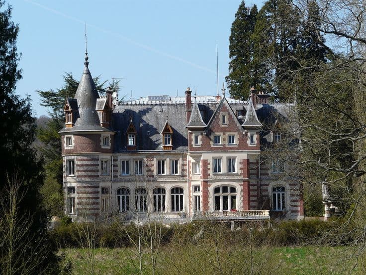
What is the best way to do urbex in Brittany?
The best way to do urbex in Brittany is to use a verified regional map, sort places by department and site type, and prioritize locations with clear access context or permission. Brittany is broad and varied, so a curated guide saves time, reduces wasted travel, and supports responsible, preservation-first exploration.
Quick summary
- Brittany offers a strong mix of manor houses, farms, chapels, military structures, schools, and industrial ruins.
- A verified Brittany urbex guide is more useful than scattered social media spot lists.
- Each department has a different travel logic, landscape, and site profile.
- Many abandoned places in Brittany are on private land or are structurally unstable.
- Responsible urbex means no forced entry, no trespassing, and no damage.
- Curated maps make route planning faster, safer, and more consistent.
Quick facts
- Region: Brittany, north-west France
- Main departments: Finistère, Côtes-d'Armor, Morbihan, Ille-et-Vilaine
- Typical site families: manor houses, farms, chapels, schools, hospitals, workshops, military remains
- Best planning method: build a route by department instead of chasing isolated spots
- Legal baseline: abandoned does not mean legal to enter
- Best tool type: verified maps and curated regional guides
Why is Brittany such a strong region for urbex?
Brittany is a strong region for urbex because it combines rural abandonment, coastal military history, older religious heritage, and scattered industrial remnants. The result is a wide range of atmospheres within one region.
In practice, abandoned places in Brittany are often more dispersed than in heavily industrial regions. That makes route-building important. A good Brittany urbex guide helps you compare areas, reduce blind driving, and focus on places that match your interests.
Which abandoned places can you expect in Brittany?
The most common abandoned places in Brittany are manor houses, agricultural buildings, chapels, schools, institutional sites, workshops, and coastal military remains. The region is known less for giant factory complexes and more for varied heritage landscapes.
That difference matters for planning. Many spots are rural or semi-rural, which affects parking, approach times, weather exposure, and phone coverage. A site that looks simple on a map may be fenced, occupied nearby, or too unstable to approach.
Typical categories include:
- Abandoned manors and old residences
- Farms and agricultural compounds
- Chapels, schools, and religious properties
- Coastal bunkers and military relics
- Small factories and workshops
- Medical or institutional ruins
How should you plan an urbex Brittany route?
The smartest way to plan an urbex Brittany route is to cluster places by department, road time, and backup value. Brittany is large enough that poor planning can turn a promising day into long drives and disappointing dead ends.
A practical route method is simple:
- Choose one department or one travel corridor for the day.
- Start with one priority site and add two backup options nearby.
- Check weather, daylight, and coastal conditions before leaving.
- Avoid relying on one single pin.
- Leave immediately if access is unclear, private, or unsafe.
If you want a starting point before building a route, Browse all urbex maps or Access the free urbex map.
How do the Breton departments differ for urbex?
The Breton departments differ mainly in landscape, density, and travel rhythm. Knowing those differences helps you search more efficiently and choose the right kind of day trip.
| Department | Typical urbex profile | Planning note |
|---|---|---|
| Finistère | Coastal military remains, isolated rural sites, weathered buildings | Longer driving segments and stronger exposure to wind and rain |
| Côtes-d'Armor | Manor houses, chapels, farms, smaller institutions | Good for mixed rural itineraries |
| Morbihan | Farms, estates, shoreline structures, small industrial remnants | Useful for combining inland and coastal stops |
| Ille-et-Vilaine | Manor properties, schools, workshops, peri-urban sites | Often easier for shorter day routes |
This table is a planning tool, not an access guarantee. Site status can change quickly, and every spot should be approached with caution.
How can you explore responsibly and legally?
Responsible urbex in Brittany starts with a basic rule: abandoned does not mean accessible. Many sites are private property, protected heritage, or structurally dangerous. Some are monitored, partially occupied, or closed for safety reasons.
MapUrbex follows a preservation-first approach. That means:
- never force entry
- never trespass
- never damage locks, windows, doors, or interiors
- never remove objects
- avoid sharing sensitive access details publicly
- leave if a place is occupied, secured, or unstable
This approach protects both people and places. It also makes verified maps far more valuable than viral spot lists with outdated information.
Which MapUrbex resources help you find verified places in Brittany?
The most useful MapUrbex resources for Brittany are the regional map, the free map entry point, and curated articles that organize places into usable categories. These tools help turn search intent into real trip planning.
Useful starting points:
- Brittany Urbex Map: Hidden Abandoned Places Across Brittany
- Top 50 Abandoned Places in Brittany: Verified Urbex Guide
- Brittany Urbex Map: 15 Mysterious Places to Spot in Cotes-d'Armor and Finistere
- Browse all urbex maps
FAQ
Is urbex legal in Brittany?
Urbex is not automatically legal in Brittany. Most abandoned sites are still private property, and access without permission can be unlawful. Always respect barriers, signage, and ownership.
What are the best types of abandoned places in Brittany?
Brittany is especially strong for manor houses, farms, chapels, military remains, and scattered institutional sites. Its strength is diversity rather than one single site type.
Is a regional guide better than searching for single spots?
Yes. A regional guide is more efficient because Brittany is geographically spread out. Grouping verified places by area reduces wasted driving and gives you backup options if one location is inaccessible.
What should you check before visiting an abandoned place in Brittany?
Check legal access, road time, weather, structural risk, daylight, and whether the site is near active property or exposed coastline. Never rely on an old pin alone.
Why use a verified urbex map?
A verified urbex map improves planning quality. It helps you compare areas, filter site types, and avoid misleading or outdated spot lists.
Conclusion
The best urbex Brittany strategy is regional, verified, and responsible. Brittany offers a rich mix of abandoned places, but the region rewards careful route planning far more than impulsive searching.
If you want a better overview of abandoned places in Brittany, start with curated maps and guides, then narrow your trip by department, travel time, and site type.
Access the free urbex map
