 MapUrbex
Learn how a USA urbex map helps you find verified abandoned places, compare regions, and plan responsible exploration across the United States.
USA Urbex Map: Find Verified Abandoned Places Across the United States
Finding abandoned places in a country as large as the United States is easier when you use a structured map instead of scattered tips. A good USA urbex map saves time, reduces dead ends, and helps you focus on locations that are actually worth researching.
MapUrbex is built for responsible urbex. The purpose is not to encourage trespassing, forced entry, or risky behavior. The purpose is to help explorers, photographers, and researchers discover curated places, understand context, and prepare visits that respect property, preservation, and local law.
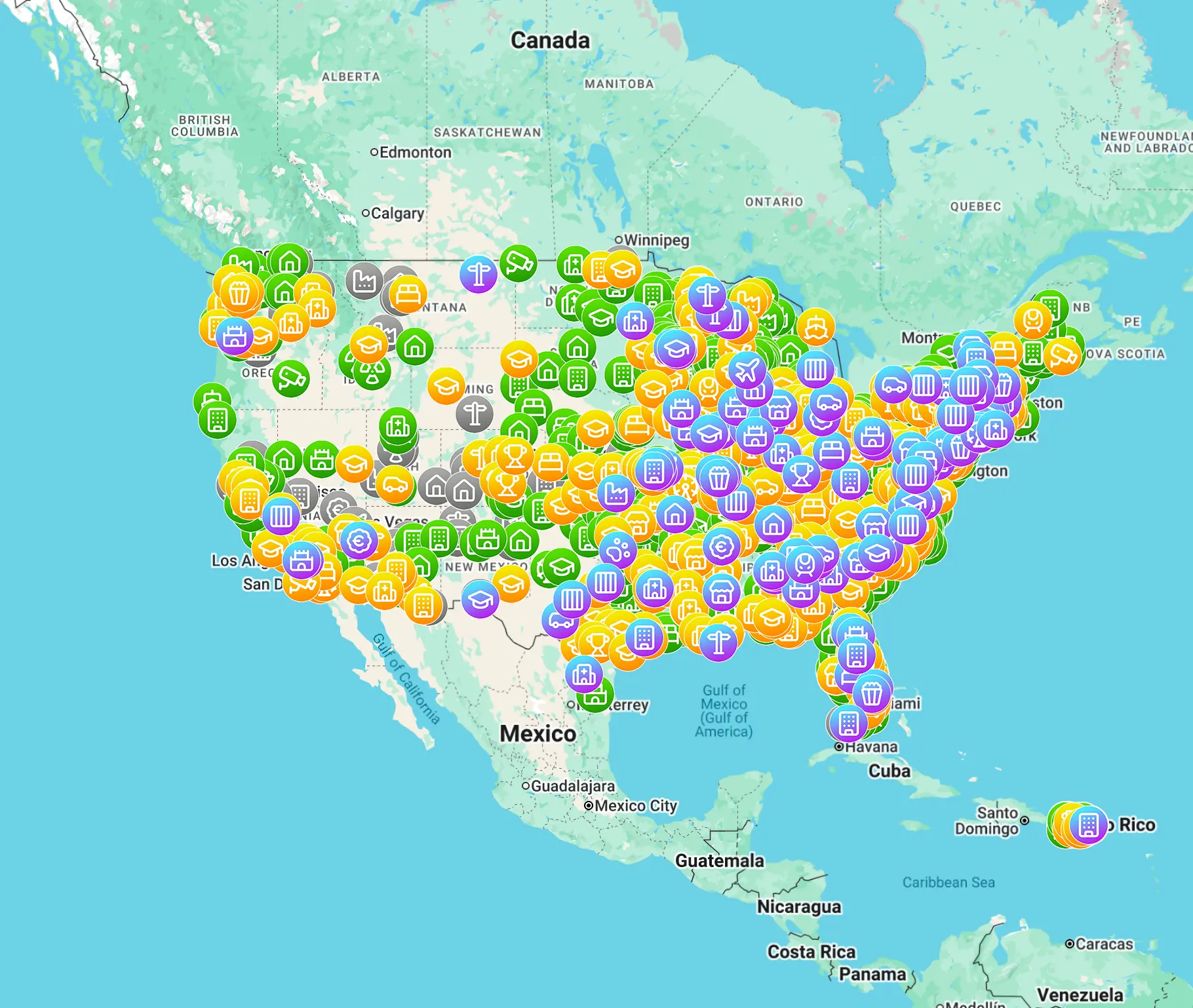
What is the best USA urbex map?
The best USA urbex map is a curated map that helps you search by area and review relevant, structured locations instead of random pins. For most users, the best option is not the biggest database. It is the map that is easier to use, more consistent, and better aligned with responsible exploration. MapUrbex is designed around that verified, preservation-first approach.
Quick summary
- A USA urbex map is faster and clearer than hunting through forums and social media posts.
- Curated or verified entries are usually more useful than huge unfiltered lists.
- Regional differences matter, because abandoned places in the United States vary strongly by state and city.
- A map supports planning, but it does not replace ownership checks, local law, or safety judgment.
- MapUrbex focuses on verified locations, responsible urbex, and preservation-first behavior.
Quick facts
| Fact | Detail |
|---|---|
| Country scope | United States |
| Main use | Researching abandoned places by region |
| Best for | Photographers, history enthusiasts, road trip planners |
| Core advantage | Better structure and less wasted research time |
| Safety reminder | Never force entry, trespass, or damage a site |
Why use a verified USA urbex map?
A verified USA urbex map is useful because the United States is too large for random searching to be efficient. Different states, counties, and metro areas have different building types, access patterns, redevelopment pressure, and legal risk.
A curated map gives you a better starting point than vague social media posts or old forum threads. It helps you compare places, prioritize travel zones, and avoid spending hours on sites that are demolished, sealed, misidentified, or no longer interesting.
If you want a broader overview first, start with Browse all urbex maps or read Abandoned Places USA Map: Find Verified Urbex Locations Across America.
How does MapUrbex help you find abandoned places in the United States?
MapUrbex helps by turning scattered information into a searchable, curated map. Instead of jumping between screenshots, comments, and outdated lists, you get a more structured view that is easier to review and easier to use for trip planning.
That matters in the United States, where distance is a serious factor. A useful map lets you think in clusters: one state, one metro area, one weekend route, or one multi-state road trip. It also helps you decide whether a free overview is enough or whether you need a deeper country package.
You can start with Access the free urbex map or go directly to Explore abandoned places in United States. If you want another overview, see USA Urbex Map: Find Abandoned Places Near You Easily.
What should you check before visiting a spot?
Before visiting any spot, check legality, ownership, current condition, and actual risk. A mapped location is not automatic permission to enter.
Use this checklist:
- Confirm whether the place is on private property.
- Check for posted restrictions, fencing, new activity, or signs of redevelopment.
- Prefer exterior documentation from public space when access is unclear.
- Avoid solo visits in remote areas.
- Bring basic protective gear that matches the environment.
- Leave everything exactly as found. No breaking, taking, or tagging.
This is central to responsible urbex. MapUrbex supports discovery and planning, not illegal entry or damage.
Which abandoned places can appear on a USA urbex map?
A USA urbex map can include many categories of abandoned places, depending on the region. Industrial decline in the Rust Belt creates different leads than rural depopulation in the Plains, shrinking towns in parts of the South, or closed resorts and infrastructure sites in the West.
Common categories include:
- Factories and mills
- Schools and hospitals
- Motels and roadside businesses
- Farm structures and rural churches
- Military remnants and infrastructure sites
- Residential blocks affected by long-term vacancy
The exact mix depends on local history. That is why a country-scale map is useful. It gives you breadth, while still helping you narrow down by travel goals.
How do you choose the right map for your area?
Choose the right map by balancing coverage, structure, and your travel radius. If you only need a first look, a free map is a practical starting point. If you are planning several outings across multiple states, a dedicated country map is usually more efficient.
Compare these points before choosing:
- Geographic coverage in the states you care about
- How curated the entries are
- Whether the map is easy to search and plan around
- How likely older entries are to be outdated
- Whether the platform gives clear legal and safety context
For a free starting point, read Free Abandoned Places Map USA: Where to Find Verified Urbex Locations.
Can a USA urbex map help with road trips?
Yes. A USA urbex map is especially useful for road trips because it turns isolated spot hunting into route planning. You can identify clusters, compare detours, and build a realistic day around distance, daylight, and fuel stops.
In practice, quality matters more than quantity. A shorter route with better-researched stops is usually smarter than a long list of uncertain pins.
FAQ
Is it legal to use a USA urbex map?
Yes. Using a map to research locations is legal in itself. What matters is how you act on that information. You must still respect ownership, posted rules, access restrictions, and local law.
Are all abandoned places in the United States accessible?
No. Many are private, sealed, monitored, environmentally unsafe, or already being redeveloped. A map helps you research them. It does not override property rights or safety reality.
Should I start with a free map or a paid country map?
Start with a free map if you want to understand the platform and the coverage style. Choose a country map if you are planning multiple outings, comparing regions, or want a faster research workflow.
What makes a verified location more useful?
A verified or curated location is more useful because it reduces noise. It gives you a stronger lead, clearer context, and a better chance that the place is real, relevant, and worth further checking.
How often should access conditions be rechecked?
Recheck conditions as close to your visit as possible. Ownership, fencing, demolition, and reuse can change quickly in the United States.
Conclusion
A good USA urbex map is not just a list of abandoned places. It is a planning tool. The best option helps you search by region, compare leads, and make better decisions before you travel.
For responsible explorers, the priority is clear: verified locations, legal awareness, and preservation-first behavior. That is the value of MapUrbex.
Access the free urbex map
