Find a free urbex map USA, compare reliable sources, and locate real abandoned places across America with a verified, responsible approach.
Free Urbex Map USA: Where to Find Real Abandoned Places
A free urbex map USA can save hours of research if you want a structured way to locate abandoned places across the country. The key is not volume. The key is finding a map built from real location work, consistent categorization, and regular checks.
MapUrbex focuses on verified locations, responsible exploration, and preservation-first research. That means the goal is not to push risky entry. It is to help users identify potential sites, understand what type of place they are looking at, and plan responsibly.
This guide explains where to find a free urbex map in the United States, what it should include, and how to use it without relying on random lists or outdated social posts.
Where can you find a free urbex map in the USA?
You can find a free urbex map USA through curated platforms that organize abandoned places by region and category instead of relying on scattered posts. A useful free map should show real locations, basic context, and a consistent structure. The easiest starting point is to Access the free urbex map and compare it with Browse all urbex maps.
Quick summary
- A good free urbex map USA helps you find abandoned places faster than social media searches.
- Curated maps are more useful than random lists because they group sites by area and type.
- Verified location databases reduce wasted time on demolished, converted, or duplicate places.
- A map should support responsible urbex, not trespassing, forced access, or vandalism.
- Free access is ideal for discovery, while broader map access can help with deeper trip planning.
- In the United States, legality varies by property status, ownership, and local enforcement.
Quick facts
- Country covered: United States
- Best for: Finding abandoned places by area with a structured map
- Primary use case: Discovery, trip planning, and location research
- What a free map should include: categories, geographic coverage, basic status clues, and usable navigation
- What it should not promise: guaranteed access or legal permission
- Safety reminder: abandoned does not mean public, safe, or open to entry
Why is a curated map better than random lists?
A curated map is better because it turns scattered information into a usable research tool. Random lists often mix demolished sites, private property, duplicate entries, and vague descriptions.
A strong map gives you context. You can sort by region, recognize patterns, and avoid spending time on places that are no longer relevant. That is why many readers start with Abandoned Places USA Map: Find Verified Urbex Locations Across America and then use USA Urbex Map: Find Abandoned Places Near You Easily to narrow down nearby options.
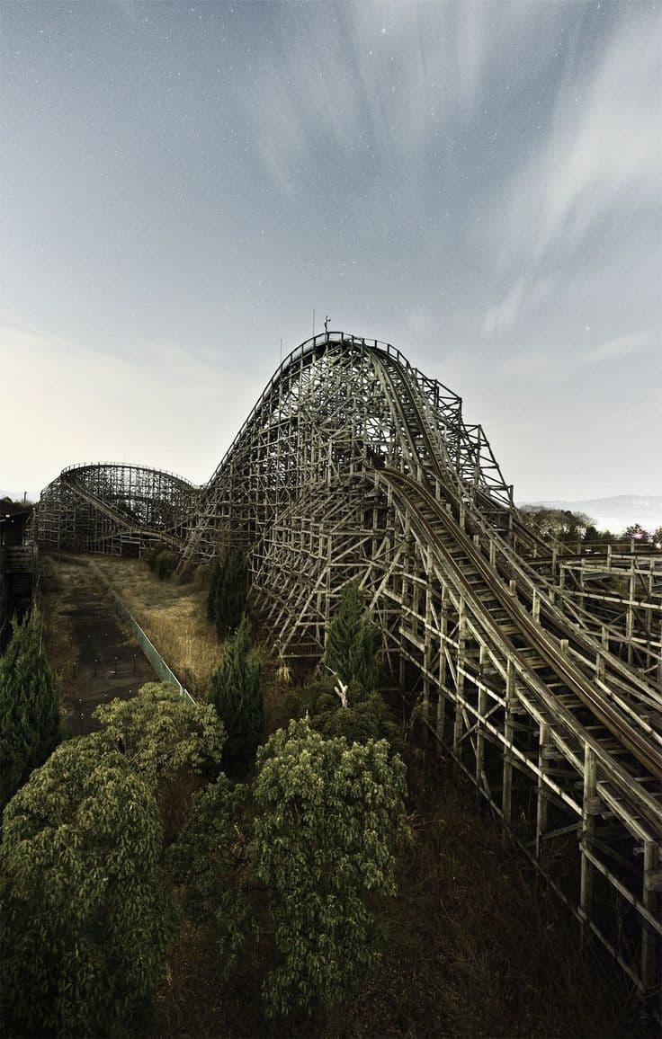
Another advantage is consistency. A curated map uses the same structure across states. That makes comparison easier when you are looking at abandoned hospitals, factories, schools, theme parks, or military sites.
What should a good free urbex map USA include?
A good free urbex map USA should include usable location coverage, clear categories, and enough context to help you decide whether a place is worth researching further. It should not be just a pin dump.
The table below shows the practical difference between common source types.
| Source type | Best use | What you get | Main limitation |
|---|---|---|---|
| Curated free urbex map | Fast discovery | Structured places by area and category | Less depth than broader paid research layers |
| Social media posts | Visual inspiration | Recent photos and clips | Poor searchability and weak verification |
| Generic abandoned place list | Broad reading | Names and stories | Often outdated and not map-first |
| Open crowd spreadsheets | Large volume | Many submissions | Mixed quality and inconsistent accuracy |
At minimum, a useful free map should help you answer five questions quickly:
- What kind of abandoned place is this?
- In which part of the USA is it located?
- Is the listing specific enough to research further?
- Does it look current or likely outdated?
- Is it worth adding to a responsible trip plan?
If a map cannot answer those basics, it is not saving you time.
How can you find real abandoned places without wasting time?
The fastest way is to start with a structured map, then validate each site before you travel. That workflow is more efficient than starting with hashtags, videos, or old forum threads.
A practical method looks like this:
- Open a map with national coverage.
- Filter by region or travel radius.
- Note the site type that interests you most.
- Cross-check recent public signals such as visible activity changes or redevelopment clues.
- Remove anything that looks demolished, converted, or clearly active.
- Keep only locations that fit a legal and realistic plan.
This is where a curated map matters. It gives you a strong first pass. You still need judgment, but you waste less time on noise.
If you want broader coverage beyond the starter layer, Browse all urbex maps is the easiest next step. If you are comparing free access with current paid options, the overview in Urbex Map USA 2026 (Flash Sale) can also help.
How should you use a free urbex map responsibly in the United States?
You should use a free urbex map as a research tool, not as permission to enter a property. In the United States, property law, fencing, signage, security, and local enforcement all matter.
MapUrbex follows a preservation-first approach. That means:
- do not trespass
- do not force entry
- do not break locks, windows, or barriers
- do not remove objects
- do not publish information in a way that encourages vandalism
- leave sites exactly as found
A simple rule is worth repeating: an abandoned place can still be privately owned, monitored, hazardous, and legally off-limits. Responsible urbex starts with verification, caution, and respect for the site.
When does a free map make sense, and when should you upgrade?
A free map makes sense when you are exploring the category, building a shortlist, or checking whether a region has enough abandoned places to justify a trip. It is the best entry point for discovery.
A broader map makes more sense when you want denser coverage, more trip-planning efficiency, or a better research workflow across multiple states. That is usually relevant for regular explorers, photographers, road-trip planners, and content researchers.
In short:
- use free access for discovery
- use broader map access for depth
- use both responsibly
FAQ
What is the best free way to find abandoned places in the USA?
The best free way is to start with a curated urbex map instead of random search results. A structured map reduces duplicate research and makes it easier to compare sites by area and type.
Is the free urbex map really free?
Yes, a free layer is useful for discovery and initial research. What matters is whether the map is organized well enough to help you act on the information responsibly.
Are all abandoned places legal to visit?
No. Abandoned does not mean legal to enter. Many sites are private property, restricted, unsafe, or monitored. Always respect ownership, signage, and local law.
Can I find abandoned places near me with a USA map?
Yes. That is one of the main advantages. A national map helps you narrow results by state, city area, or travel radius instead of searching blindly.
How often do abandoned place maps change?
They change often because sites can be demolished, renovated, sold, secured, or reopened. That is why curated and regularly maintained maps are more useful than static lists.
Conclusion
A free urbex map USA is the most practical starting point if you want to find real abandoned places across the country without drowning in low-quality search results. The best maps save time, improve trip planning, and support responsible exploration.
Use a curated source, verify before you go, and treat every site with caution and respect.
Access the free urbex map